Well, friends, it’s been a long time since I posted anything here. I don’t even know if this will get through to anyone, but in case it does I wanted to let you know that my book about the trip has finally been published on Amazon. It’s called Crashing the World, available on Amazon as either a real book or ebook. Check it out, and be happy and safe!
Author Archives: ruffinontheroad
Thank You
Dear Friends,
I’ve been home for several days now and it’s a bit strange not having another plane to catch, another adventure to look forward to, but the adjustment is nothing unexpected. The best part has been seeing friends again, and in the process of doing so I’ve learned how many people have been following along via Ruffin on the Road.
This blog turned out to be very valuable to me. It rekindled my passion for both writing and photography. It also helped me stay disciplined toward my goal of approaching this trip more as a student than a tourist; knowing I had to do a post at the end of a trip segment kept me focused on taking notes, asking questions and doing research.
Most importantly, the blog enabled me to stay connected to you. The encouragement and support I received from so many of you kept me going in so many ways, kept me motivated and strong and very often from feeling alone. I can’t begin to tell you how grateful I am for that. And through the blog I’ve reconnected with many old friends and made new ones as well, an unexpected and truly wonderful benefit.
Thank you all so much for riding along on this journey … it’s meant a great deal to me.
Peace and love always.
Ruffin
(Here’s one final pretty picture … taken just outside Salzburg.)

Categories: Uncategorized
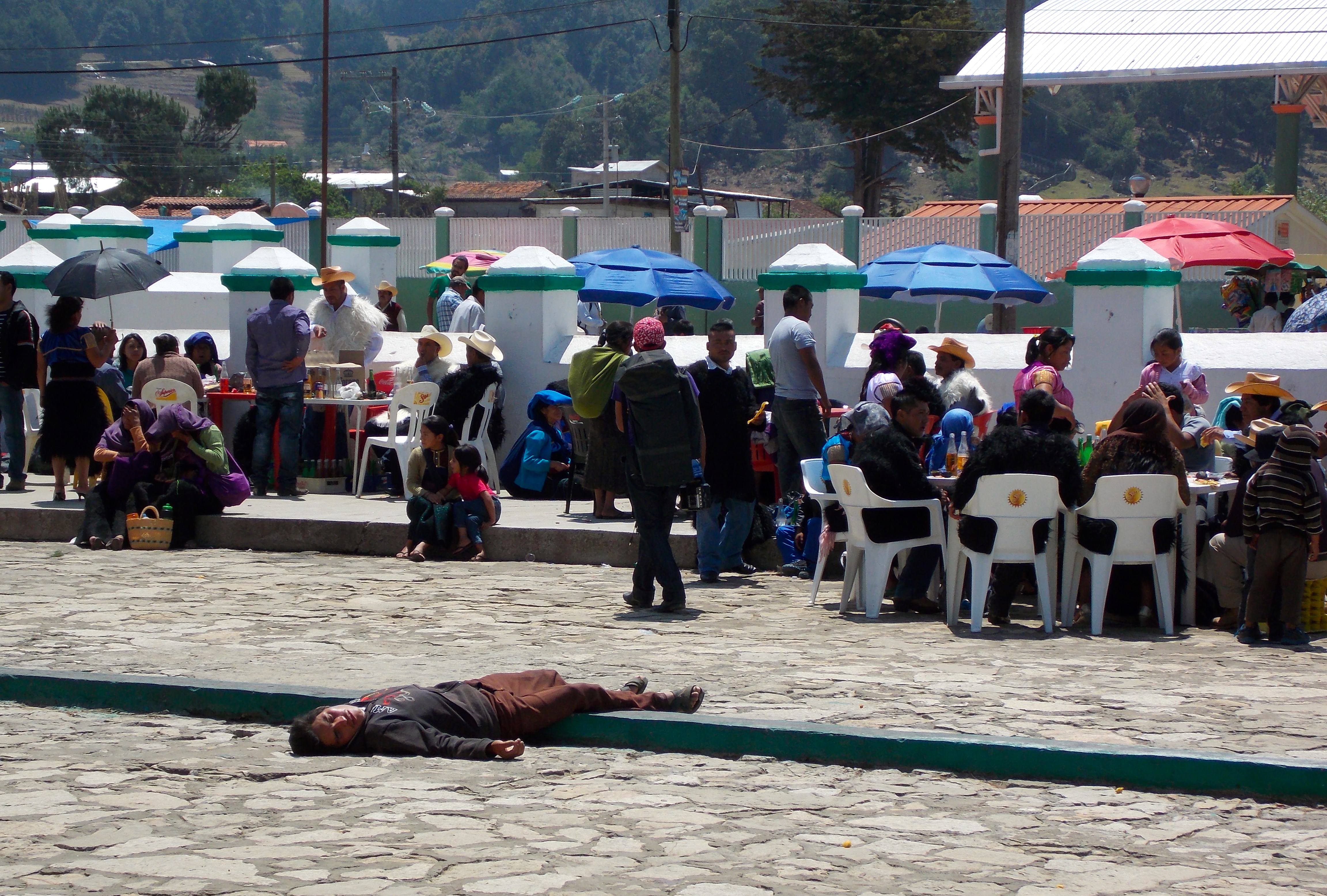
Guatemala: The Final Adventure
I had every intention of spending the last two weeks of this trip sitting on a beach somewhere, continuing the Cuban rum-and-cigar tradition and getting ready to head home. But when my Mexican tour of Mayan ruins ignited an interest in that culture and I learned that Guatemala had some special sites of its own, I booked a trip there instead.
Through a website called Tours By Locals I found three wonderful young people who have a passion for nature and for Mayan history. Sofia and Dulce have been friends since childhood and Sofia is currently the Coordinator

Sofia Anzueto and Alfred Denfeld.
for Public Use at three national parks, working for the Guatemalan ministry of culture and sports. Her boyfriend Alfred is German but on the brink of becoming a Guatemalan citizen; he is likely the most upbeat and positive person I have run into on this trip, and he possesses considerable knowledge in the areas that interested me.
Their experience in guiding to date was limited to a one-day tour with a couple from Australia to Tikal, the largest Mayan tourist site in Guatemala. Not much of a challenge. I told them they had 10 days and I wanted to see the best sites that no one else gets to see. And they pulled it off masterfully, taking me deeper into the jungle with each phase of the journey.
Prior to that, though, I had flown from Cuba to Panama City, and there took a boat ride through the Panama Canal, which was mildly interesting. The “Canal Zone” started in 1850s with a train from the Caribbean Coast on the north to the Pacific coast on the south. The Canal is located where the train tracks once were, and a McDonalds now occupies the old train station at the Pacific end. There is a long history of the U.S. having a military presence in the Zone, and a university now resides in the former barracks.
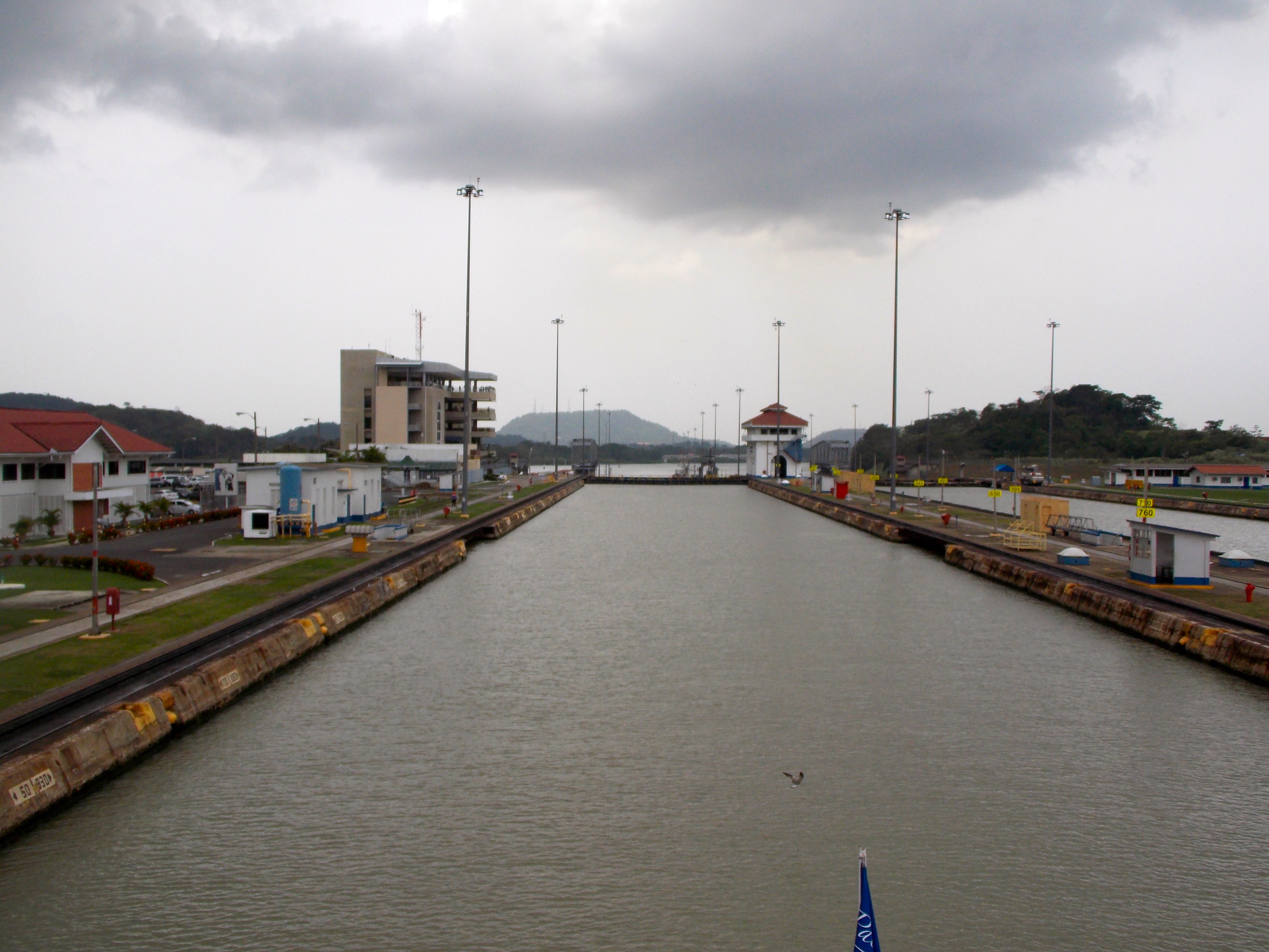
Heading through the Panama Canal, toward the Pacific Ocean.
Since the installation of lights in 1965 the Canal has operated every minute of every day; the demand is that great. We saw several dozen huge vessels queued up out in the Pacific in what they call the “anchor line”, awaiting confirmation that payment had been transacted before they entered the Canal and were boarded by a Canal captain, who guides the ship for the entire 50 miles of the passage. The Panama Canal is the only place in the world where a ship’s captain is required to turn his command over to another pilot.

An interesting museum and the Panama City skyline, as seen from the Canal.
The next day I flew to Guatemala City and then north to Flores/Santa Elena, where the girls picked me up at the airport and we met Alfred for dinner at his restaurant. I spent the next day around Flores, a small, charming
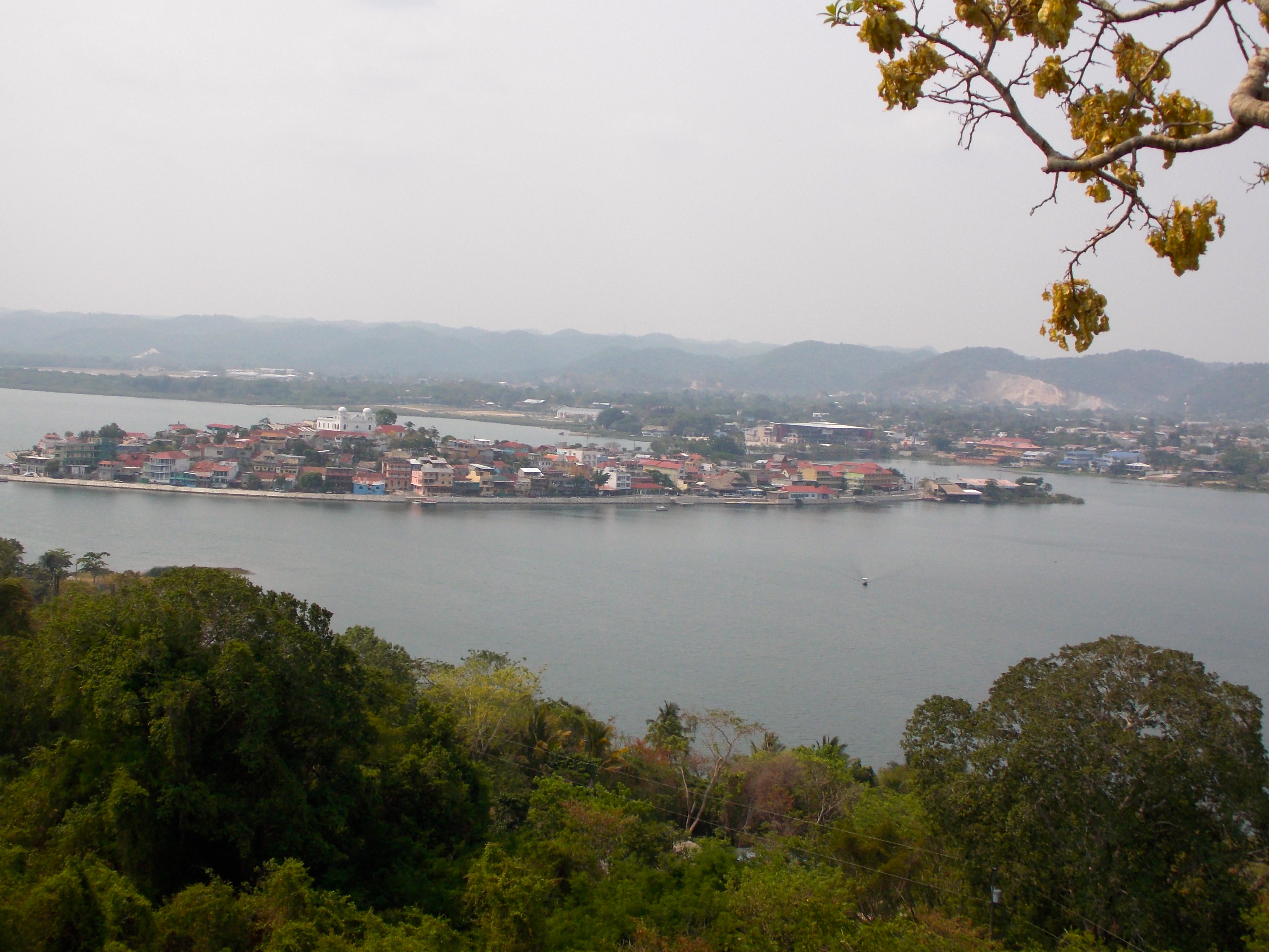
The lovely island community of Flores.
island connected by causeway to Santa Elena. Alfred and I hiked up to a “mirador”, a wooden overlook platform, on a hillside across the water in San Miguel. Beneath it and the ridge to which it connects lie some of the oldest of Mayan ruins in Guatemala, and later in the day we visited some archeologists, ensconced in a secret location as they chart the specific plan to excavate the area; many cartons in their limited space contain itemized artifacts, pottery, glyphs and bones which would have great value to the black market. We examined a package containing the spine and feet of a small Mayan man more than 1000 years old. It was a privilege seeing these dedicated people at work and the precision they bring to it.
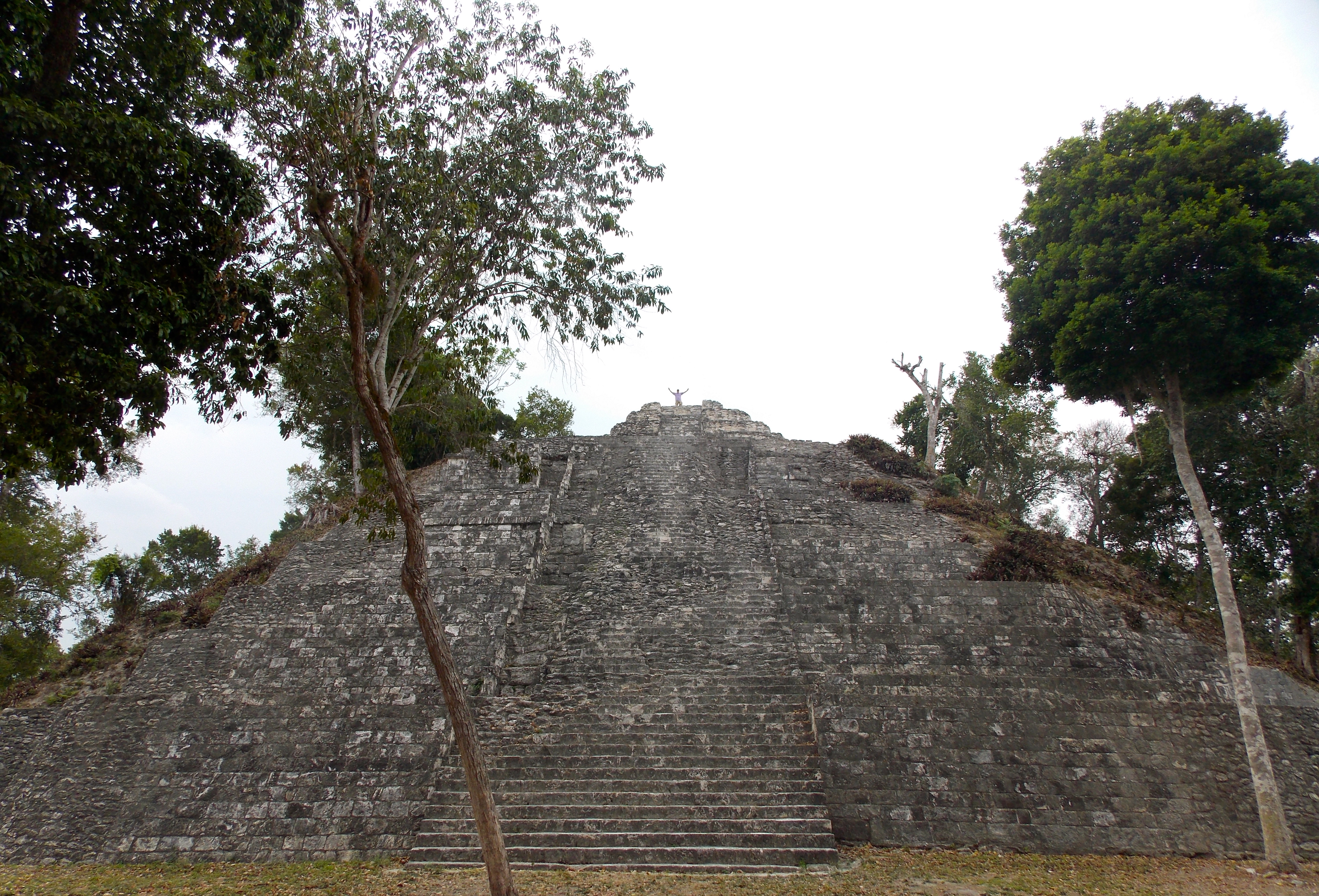
TIKAL
The following day Dulce and I went to Tikal with a loquacious local expect named Juan. Tikal is the best-known Mayan site in Guatemala, the one place all tourists and scholars feel they need to visit. It’s in the lowlands, very close to my home base in the lakeside community of El Remate, but we left at six a.m. to beat the heat and crowds.

Dulce Del Cid checks out a Mayan refrigerator.
On the surface Tikal is less impressive than a place like Chitchen Itza in Mexico, which has many more buildings excavated and clearly a larger maintenance budget. But Tikal feels more authentic somehow. A total of 4,028 structures have been identified at Tikal and only 3% of them are visible, the remainder covered by mounds and hillsides, foliage and trees. The city is about 16 square kilometers and at one point 150,000 people lived there. It thrived from about 900 BC to 900 AD.
Tikal’s iconic monument is Temple One, built in 734 by King Ah Kakaw – also known as Lord Chocolate – and excavated by archeologists from the University of Pennsylvania between 1956 and 1969. It’s part of the Gran Plaza that includes Temple Two, which Lord Chocolate’s son built as tribute to him, a vast necropolis where kings and nobles are buried and a residential area facing it.

Temple One at Tikal, from the main acropolis.
Temple Three is currently under repair after being hit by lightning. We climbed Temple Four, the highest point in Tikal; you can see the crowns of the other big structures over the top of the jungle, and you can’t help but visualize what it must have been like in its glory: treeless, majestic, thriving.
LA BLANCA & YAXHA
Alfred and I went to a small site at La Blanca, where excavation started in 2004 and only archeologists visit three months a year. It features the highest palace in Guatemala.
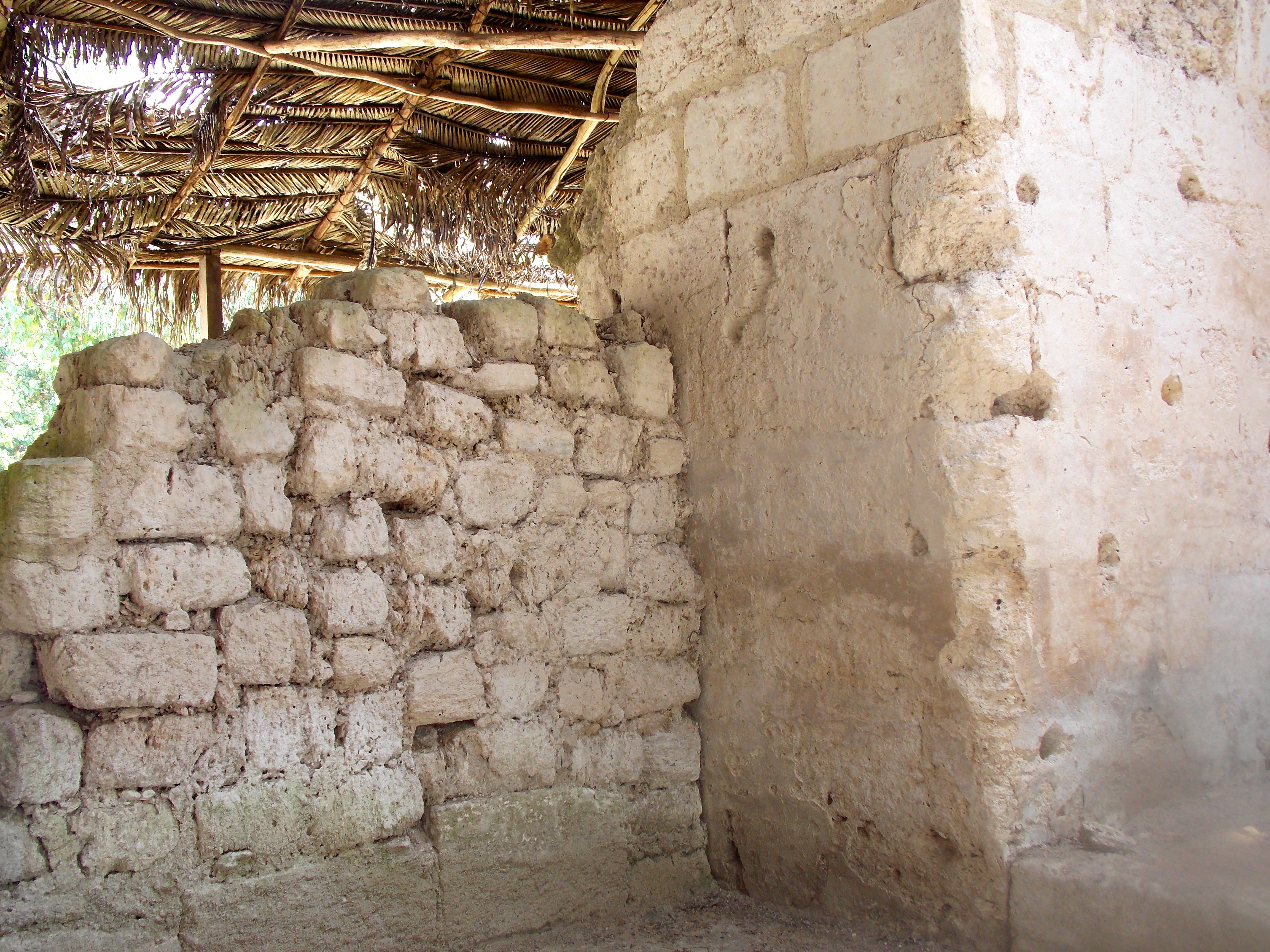
Old wall and rapidly constructed new wall.
The day before Juan had given me his theory of the end of the Mayan civilization, which included draught, famine, disease, internal war and eventually being overcome by other civilizations. Alfred wasn’t buying it. He believes the Mayan ruling class used the fear of the gods to keep the working class in line, but over time that became less and less effective. The working class got smarter, questioning, rebelling. He pointed out a wall in a palace that was built poorly and quickly, indicating a threat from within. Some of the working class migrated to cities that were less punitive. His theory is that a broad rebellion led to the civilization’s demise after almost 2,000 years. (Interestingly, very little is known about the life of the workers. They did not live in these stone cities of the rulers and their servants, but outside the walls, in wooden structures that have long since rotted away.)

The ball court at Yaxha.
In the afternoon Sofia joined us at the main site under her purview and my favorite site of the trip, Yaxha (YAH-sha). They refer to it as “the Manhattan of the Mayan world” because of the number of buildings in such close proximity. Again, a very small percentage have been excavated and exposed but as you walk among the tree-covered mounds it’s easy to imagine a bustling city of 40,000 people. We checked out an administrative building at the top of a long path leading up from a lake that was once connected via river to the Caribbean; the building contained the tax office where those coming to trade stopped to make a payment. We also saw two or three contemporary altars where Mayan descendants are permitted to enact occasional ceremonies; that would be something to see, but no gringos are permitted.
Communing with the gods at Yaxha. Too bad there wasn’t a zipline down.
NAKUN & TOPOXTE
There is a reason so few people visit Nakun, another of the parks Sofia helps manage; it’s just very challenging to get to. The ruts and holes in the dirt road are so formidable we averaged about 7.5 miles per hour in a Ford Expedition; an elite marathoner averages about 12. So most of the 200 or so people who visit each year are there professionally.
A temple at Nakun.
Nakun is unique because it has massive walls, like a fortress, different from all other Guatemalan sites. Mayan cities were generally within 35 kilometers from other cities so they could communicate with smoke, fire or mirrors (shiny rocks), and thus maintain peaceful relations. The walls indicate that Nakun didn’t have the necessary alliances to trust they wouldn’t be attacked.
The weather during my visit to this point had been unseasonably dry, with many fires creating a very smoky environment. We were exploring a palace at Nakun with 48 rooms, probably an administrative area, each room an office, when the dry season in Guatemala ended with a vengeance. The temperature dropped appreciably, the smell was in the air, we could hear the storm like an engine, making its way across the jungle, and then it was upon us. It was a powerful experience to be the only ones there as this torrential rain returned the lushness to the jungle. “Imagine the party”, said Alfred, referring to how the Mayans must have reacted when the rainy season finally returned.

The rain brought much-needed relief to the jungle.
In the afternoon, after a tough ride back, we took a short boat ride to Topoxte Island, actually a peninsula this time of year. We were again the only people at the ruins, and walking up the hill toward the site amid the guttural, angry wail of the howler monkeys was a wonderfully foreboding and mysterious moment. The ruins at Topoxte are mysterious as well because everything is so small. The short narrow steps, the doorways, the tiny beds; everything indicates that Mayans who lived there were much smaller than at any other location, and no one knows why.
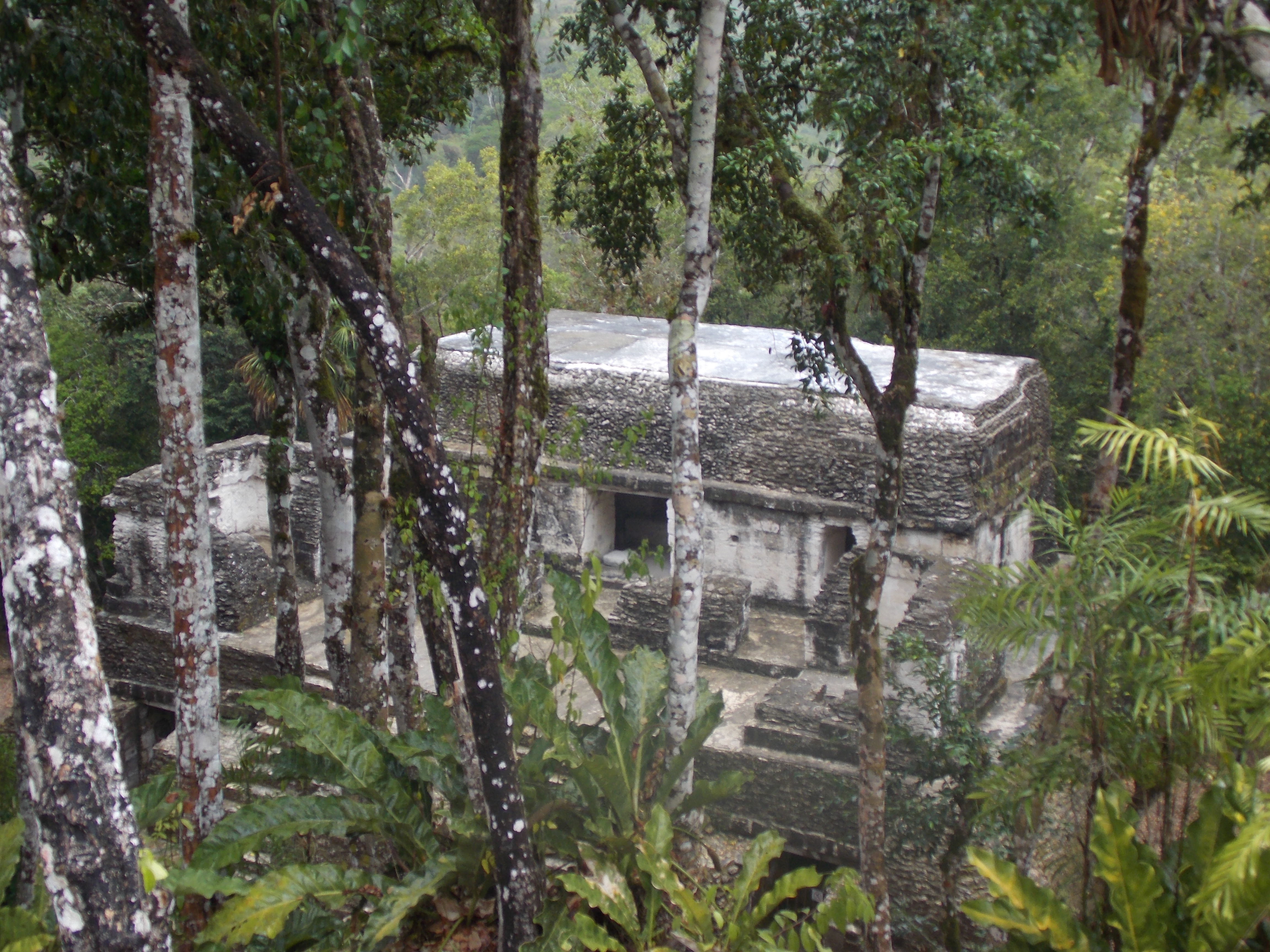
AGUATECA
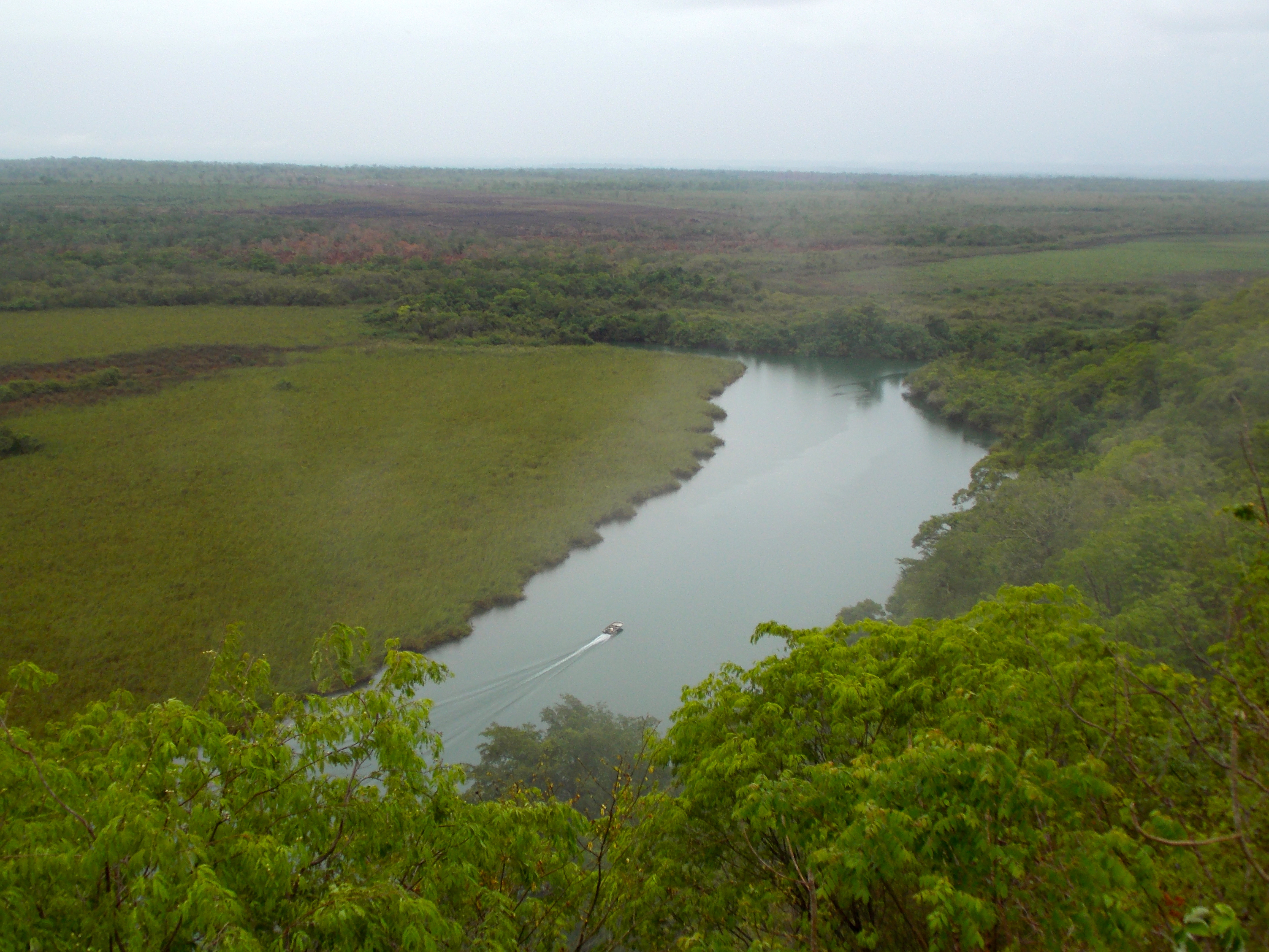
The remainder of the Guatemalan visit consisted of two road trips that continued the progression of going deeper into the jungle, starting with a two-day journey to ruins at Aguateca. Sofia, Alfred and I took a long boat trip down the Petexbatun River, cruising comfortably in the narrow sections, having to pole through the shallower, wider sections. We ended up at the wonderful Hostal de Isla Chiminos, went for a kayak ride, had a terrific dinner of whitefish that were caught a hour earlier and slept soundly until the howler monkey alarm went off around dawn.
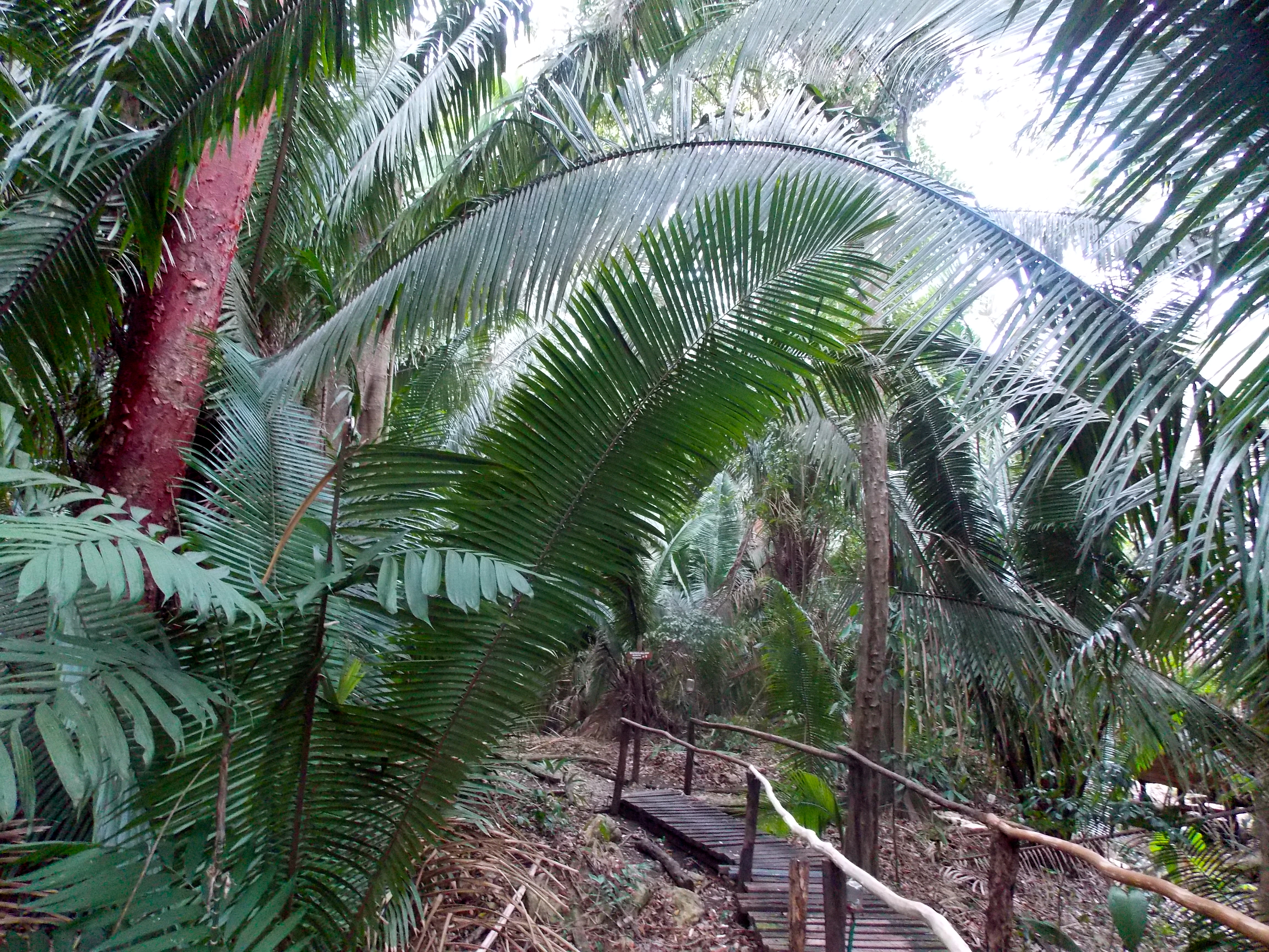
The huge Corozo Palms dominate the jungle at the Chiminos Island Lodge.
After another boat ride further into the jungle led us to the entrance to Aguateca, ruins that are surrounded by a natural canyon more than 100 feet deep. This city apparently had a lot of enemies and was always under attack. It was occupied briefly around 100 AD and then abandoned, and then repopulated in 600-800. Some upper class hotshots from Tikal came to live in Aguateca about 761 but were gone by 810, fed up with the attacks from the locals. “The people from the big city came and pissed off the rednecks,” said Alfred.
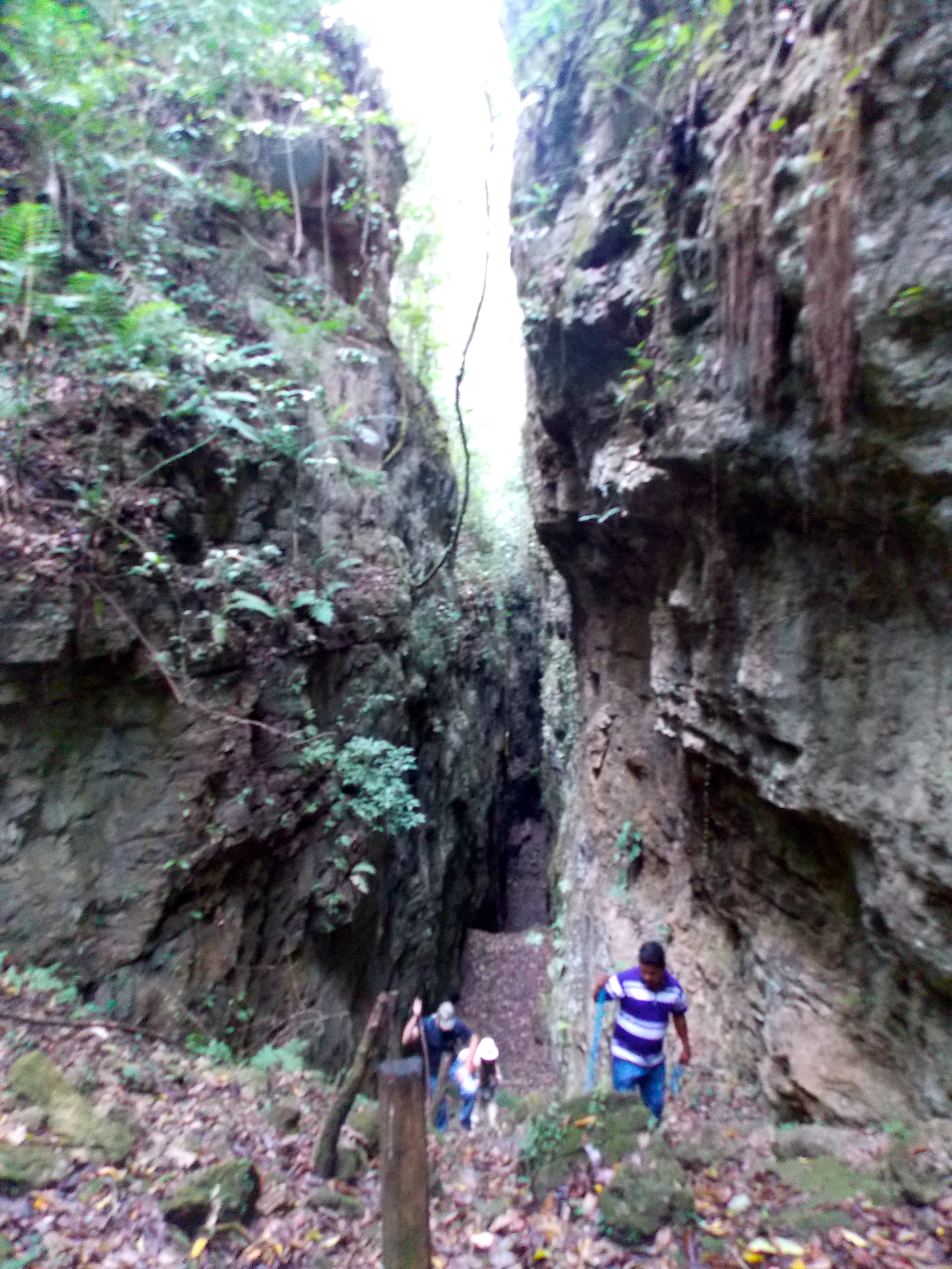
Emerging from the massive canyons surrounding the ruins at Aguateca.
We ventured down into the canyon, the walls were so steep and unassailable; it was dark and ominous and fascinating. We found a deep cavern where archeologists rappelled down and found many bones, the remains of those who had been sacrificed.
WAKA
Alfred and I and an American naturalist named Lou made the final journey, a three-day trip to an archeological site called Waka. Truthfully we knew there wasn’t much to see there; this was all about the trek, the jungle, the birds and wildlife.
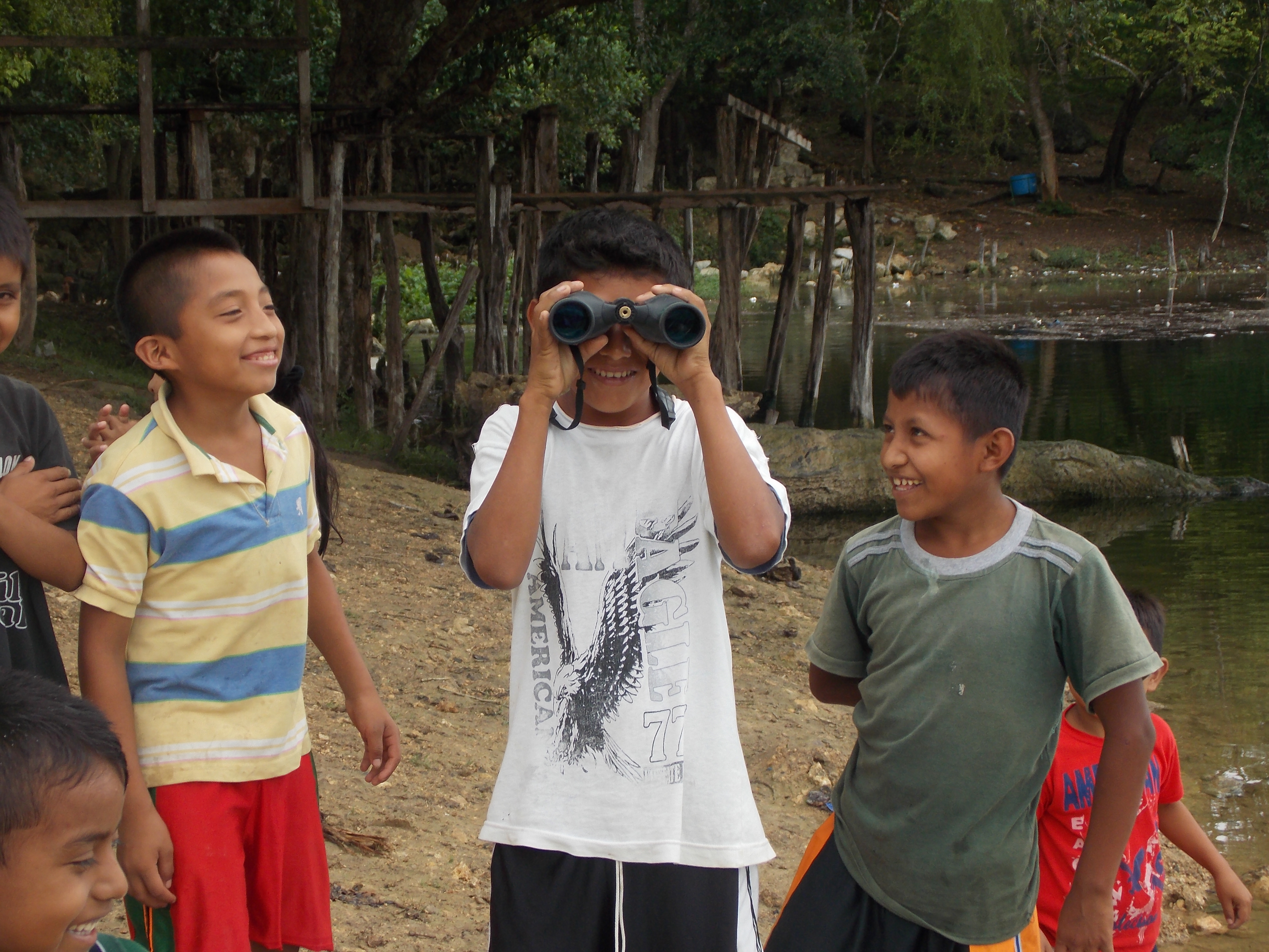
The indigenous kids got a kick out of the binoculars.
We started with a tough two-hour drive over a rocky road to the edge of the San Pedro River. Nearby, women did laundry on the rocks, and some of their children came over to check out our canoe and kayak and binoculars. These kids didn’t speak Spanish; they spoke a Mayan language called Qeqchi. We loaded up the boats and headed south on the river, and several hours later arrived at Las Guacamayas Biological Station.
We had a late lunch and met seven Brits who were there to study snakes and lizards. The leader of the group, a guy named Rowland from England, had been bitten by a snake previously thought to be safe to handle; the middle finger on his right hand was three times normal size and surrounded by a massive blood blister that extended onto his hand. The swelling had initially gone halfway up his forearm. It got our attention.
The view from the Mirador.
After an intense rain shower Alfred, Lou and I went for a walk in the jungle and climbed a wooden tower overlooking the river. There was a very Apocalypse Now moment as a small boat made its way around a bend in the river and into the heart of darkness, the protected jungle on one side and uninhabitable wetlands on the other. The next morning we made the same trip by canoe and kayak, with Lou, whose specialty is birds, pointing out the wide variety of herons and egrets, kingfishers and hawks. We pulled into shore at the remains of an old dock, hid the paddles in the woods and started out on the long trek to Waka.
Spider monkey, deep in thought.
Thirty minutes in we heard the unmistakable sound of a chain saw in the distance. “Maybe Mafia, illegally cutting trees,” said Alfred. Apparently there is organized crime that extracts cedar, mahogany and other valuable wood from the jungle canopy. This part of Guatemala is also heavy with drug traffic, as trucks bring the product up here from Colombia and Peru before it gets flown to northern Mexico. But the sound was nothing so exotic, just workers at a ranger station.
Another hour or so in and we heard the rumbling of a vehicle coming toward us on the muddy road, and in advance of it a couple of guys with AK-47s. It was an uncomfortable moment until we realized they were army, maybe 25 young guys in all, armed and on patrol looking for bad guys.

One of the many steles at Waka.
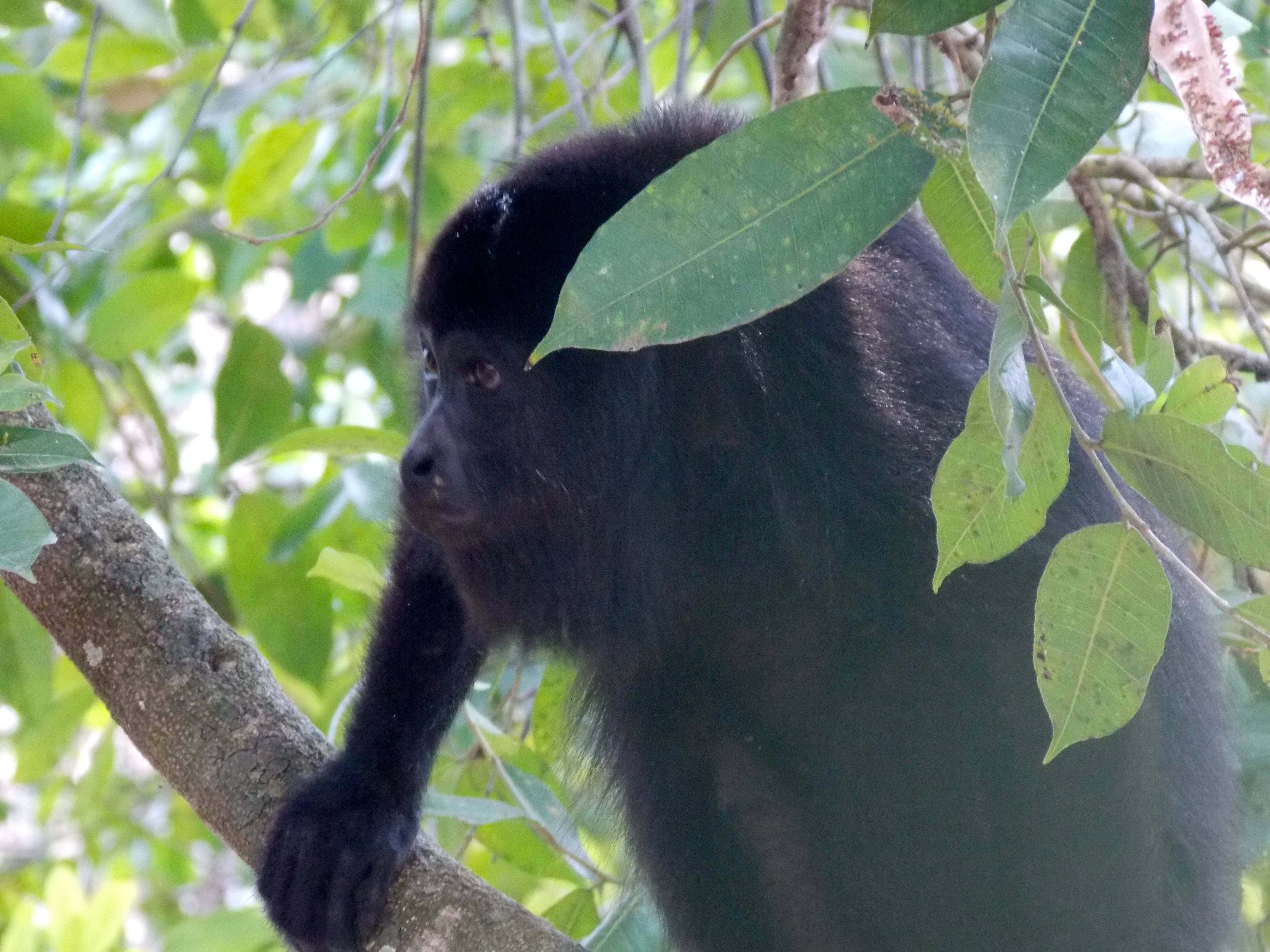
We finally got to the archeological site and as expected it wasn’t much. There are three plazas at Waka, each with a number of steles – large stones carved to tell a story – in various states of decay. There was a cave that had been plastered up to make it harder for looters, who are every bit as knowledgeable and capable as the archeologists; there is always a market for Mayan artifacts. The highlight of the walk back was an encounter with a couple of families of angry spider monkeys offended by our presence. From far above their screeches echoed as they broke off branches and shook the trees until the branches rained down upon us. It was hysterical.
We worked hard that day in the Guatemalan heat and humidity, and upon return to the biological station drank a cold beer and shared a sense of satisfaction from the day’s effort. At that moment I was especially glad I hadn’t just mailed in the last two weeks, that I’d found Sofia, Alfred and Dulce, these extraordinary young people who guided me to remote Mayan cities, to the serenity of the river, the mystery of the jungle, and the incredible variety of wildlife that you are fortunate to see once in your lifetime.
* * * * * * * *
During the brief trip yesterday from Flores to Guatemala City I pulled a muscle in my back and my left knee swelled up with no help from a snake bite, very inconsequential things, but after dragging a 45-pound backpack around for a year I feel like my body is telling me: enough is enough, it’s time to go home.
And indeed it is.
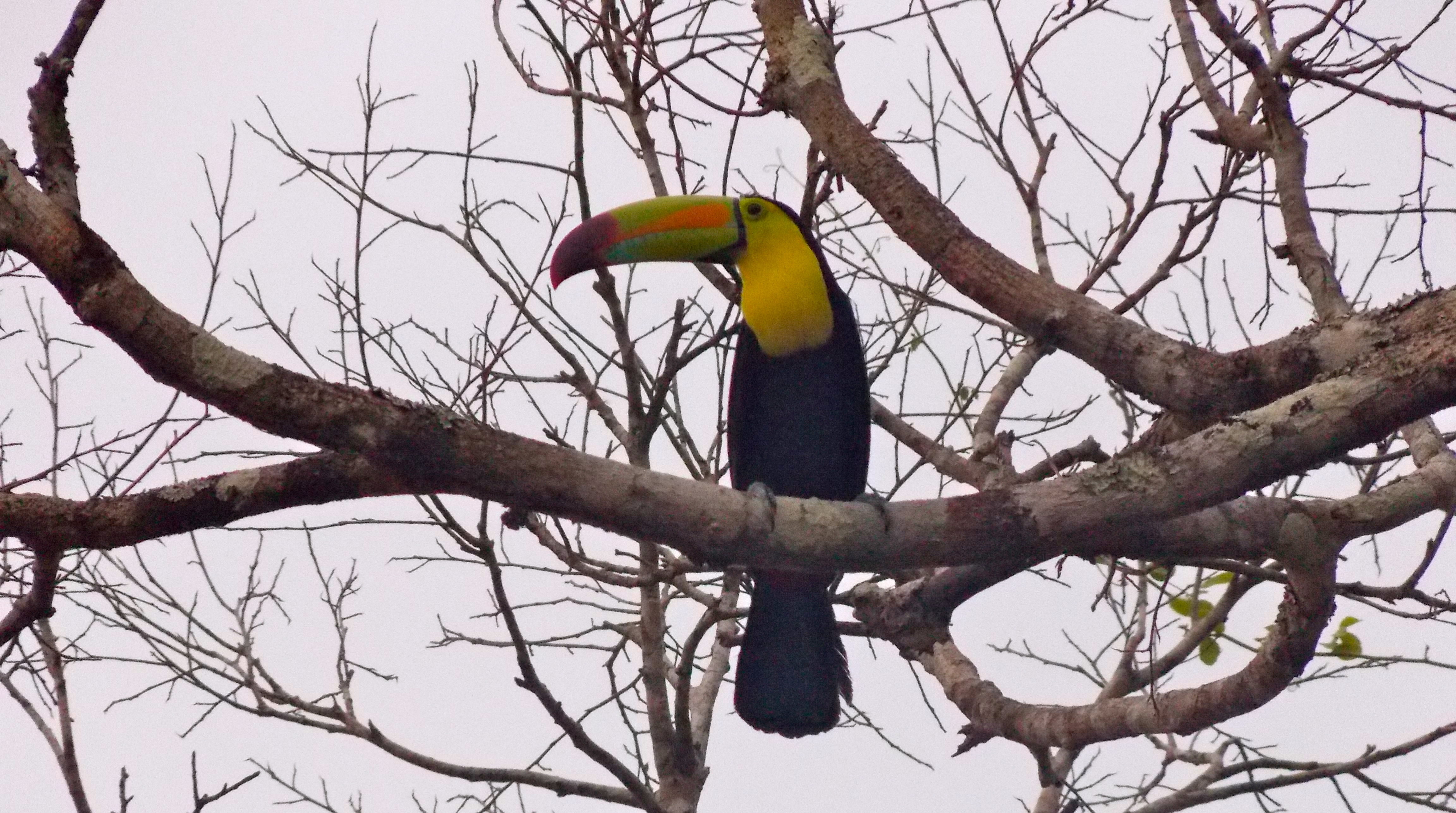
Who can? You can, Toucan.
Categories: Uncategorized
Thirteen Days in Cuba
NOTE: My friends, this post is ridiculously long. I should break it into two or three but just don’t have the motivation or the time, and as a result it’s kind of all over the place, divided into chapters, with a historical timeline in italics that is broken up by trip notes and photos relevant to specific historic moments. Frankly, it’s a bit of a mess.
Also, I generally try to confirm significant facts by using various on-line resources. In Cuba, with no Internet access, I wasn’t able to do that, so what’s written here comes directly from people I spoke to or from the one book I had with me, without corroboration. So please, take things at face value.
Since the beginning of this trip I had hoped to find a way to get to Cuba. In December I was introduced to a company from Portland, Oregon called Ya’lla Tours, and a couple of months ago we worked out an opportunity for me to make a legal 13-day visit. The itinerary started with four days in Havana and then a drive across country to Santiago de Cuba in the east, and a flight back for one final night in Havana. I had no idea what to expect; I was entering legally with all the proper approvals and visas, but I suspected it wouldn’t be without some interesting dynamics.
It didn’t take long to have that confirmed. Disembarking a flight from Mexico City I was approached in the immigration area by a casually dressed young man with a badge hanging around his neck. His name was Abner and he was very polite, identifying himself as an immigration officer and indicating he would like to ask me some questions. He made notes on a form as I answered questions about why I was there, where I was going, with whom, where I was staying, how much cash I had, where I had been on my trip and what had I done there, what I was bringing with me, whether I had an iPhone or a laptop. He looked through my passport and all my papers, including my Cuban itinerary.
Finally he thanked me and let me go. I got through immigration, picked up my bag and was approached by a young policeman, who asked if he could interview me. And the interrogation began again, very respectfully, with all the same questions. After ten minutes he asked me to wait, took my passport and walked over to consult with … Abner! They huddled for a minute and finally I was free to go.
Over the next couple of days I talked about this to Armando, a guy I met in Havana. “He probably wasn’t an immigration officer,” he said, “he was Homeland Security. You attracted his attention because you’re an American, because you’re traveling alone, and because you came in through terminal three. Most Americans come from Miami, through terminal two. They’re concerned you might be a terrorist.”
It hasn’t happened in a long time but, according to Armando, Cubans believe that CIA-employed Cuban nationals in the U.S. have been responsible for bombings and fires that have killed or injured thousands of Cubans, all part of a strategy to force a regime change. It sounds outrageous, but that is the belief. Officials are evidently also on the lookout for Americans who support dissidents and political bloggers, which seems like the more likely explanation. Maybe Abner decided he needed a second opinion and signaled the cop, I don’t know, but it wouldn’t be the last time I felt that level of scrutiny.
(Thirteen days later – this morning, Saturday – I was at immigration at the Havana airport on the way out of Cuba and a guy in an Immigration officer’s uniform approached me and said: don’t I know you? It was Abner. We had a great conversation and exchanged phone numbers. Damn, it sure is a funny ol’ world.)
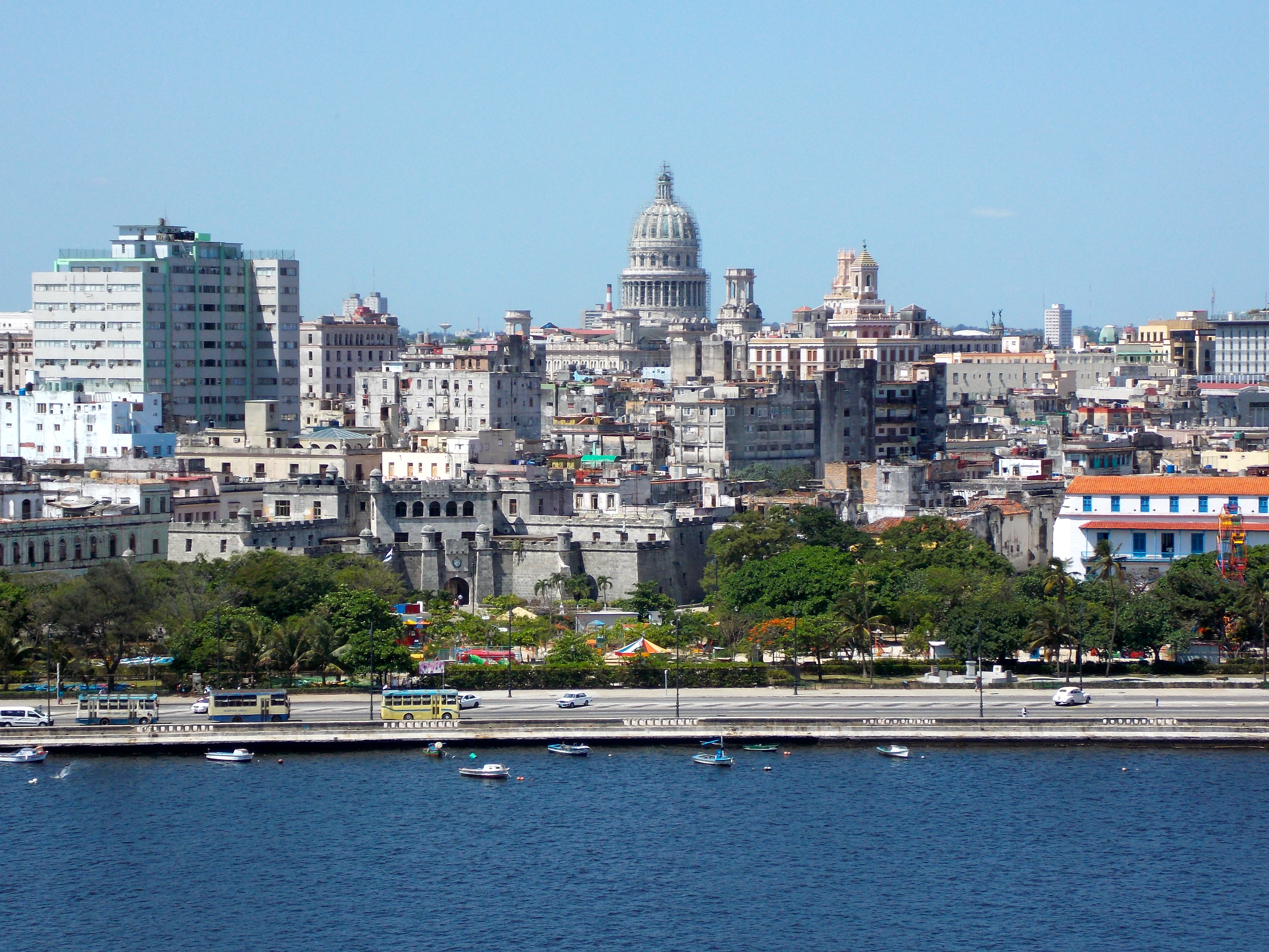
Havana, with the Capitol Building in the distance.
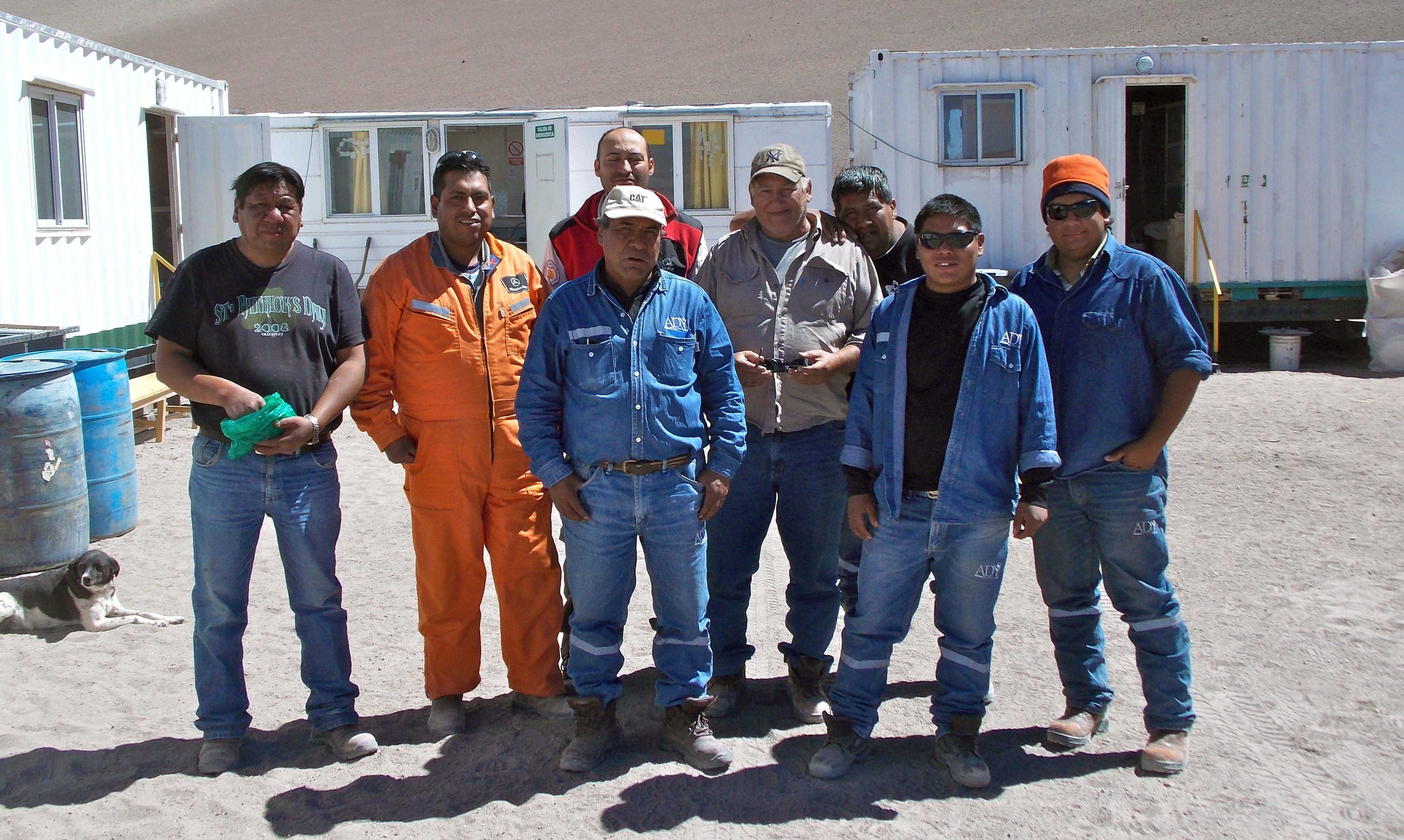
Outside the airport I met my companions for the next 13 days: Jorge Frank Alpizar, my young guide, who goes by his middle name (his father was a Sinatra fan) and Deivy Hernandez, who would be driving us. The itinerary, as I was to find out, was approved in advance by the Cuban government and could not be altered. It was heavy on history, which was great, but I would have liked the opportunity to meet more of the people. That kind of activity is apparently well monitored. So we started in …

Deivy Hernandez and Frank Alpizar
La Habana
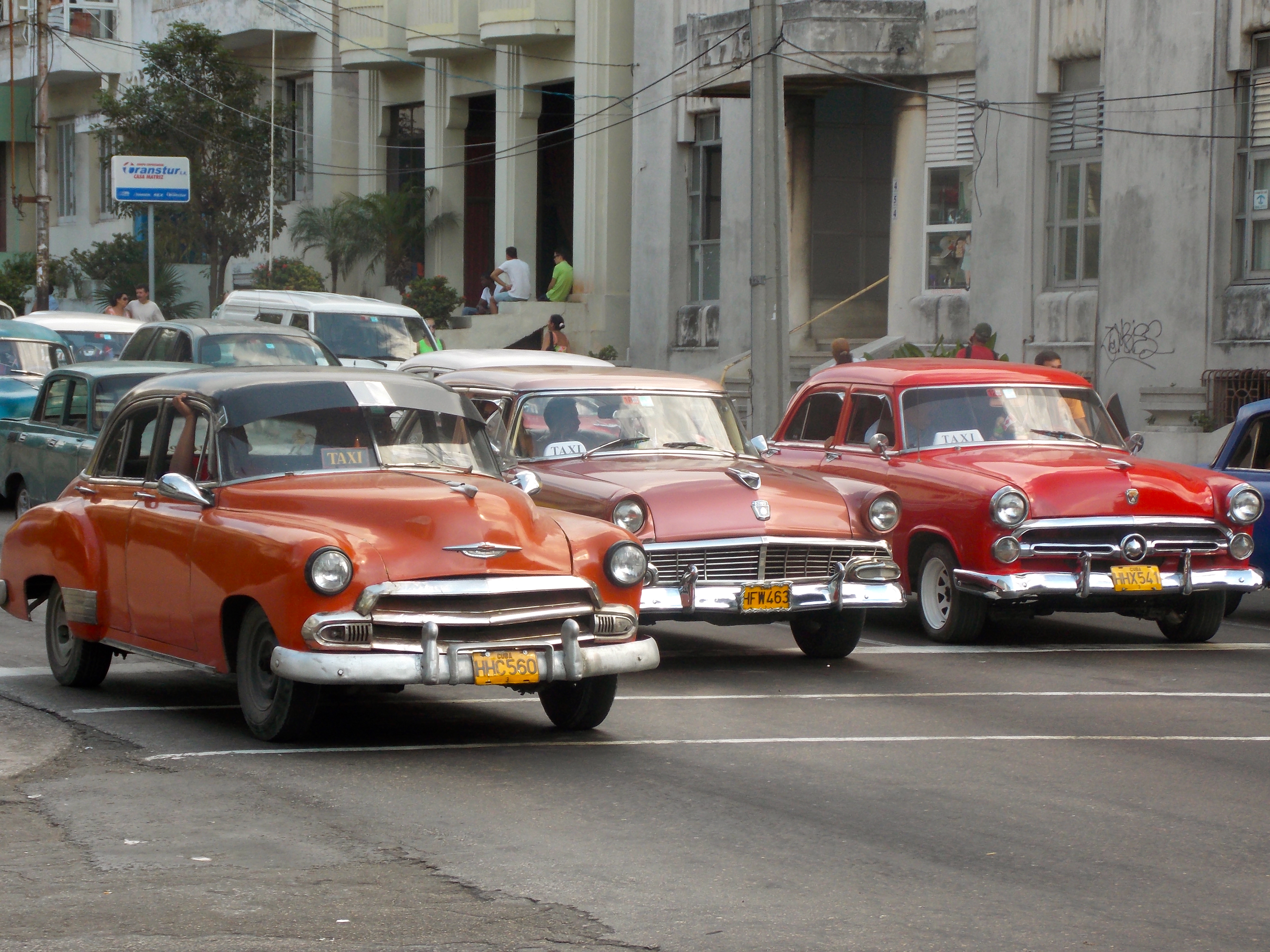
Havana is a city of about 2.5 million people, and, as I’d been told, the first thing you notice is the cars. After the revolution of 1959 Cuban citizens were not allowed to purchase new automobiles, so a majority of vehicles in Havana are old American cars from the 50s, and a few from the 40s. Chevys, Plymouths, Dodges, Oldsmobiles, Caddys, some looking rough and some looking royal, but all looking cool. Parts are hard to come by so you often see bumpers or taillights from one year on the chassis of another. In 2010 the government relaxed the policy and Cuban citizens who have the money can now buy and sell both cars and real estate. The cost of getting a car into the country, though, is half again as much as the cost of the car, so there aren’t many.
The cars are great but in truth there really aren’t that many of them, there is very little traffic in Cuba. But at all times of day the streets are full for people. In the evenings I walked from my hotel toward the Atlantic Ocean and the malecon, or the seawall (photo at the very top). It extends for miles along the shoreline and is a gathering spot for thousands of residents, and it’s the ideal place to get a sense of the people and the culture. No one has a cell phone, no one’s nose is buried in an electronic device, which is so refreshing. People are actually talking to each other, there are many guitars, but most of all there is a whole lot of romance going on. Cuba is exceptionally voluptuous … the music, the attitude, the women. The outfits are tight and revealing, the heels are high, the seductiveness is palpable, the people uninhibited.
Although it’s changing little by little as more private business licenses are granted, basically the government owns everything: the tour and transportation companies I used, the hotels I stayed in, the restaurants where we ate, the gas stations where we fueled up. People get education, health care, some food and clothes from the government, but it’s still tough to live on the very meager salaries they are paid, so they do what they have to do,

KC and the Sunshine Band? Seriously?
which is often steal from their place of employment: from the government. There is a vibrant black market, and we saw evidence of people’s ability to sell hot items while avoiding the many government cameras.
We spent a lot of time in the narrow streets of Old Havana, which was far more vibrant and updated than I expected. There is street construction and building refurbishment going on everywhere, and the blend of colors and cultures in the architecture almost give it a modern, European feel. There are many spacious plazas. Most buildings are only two stories, allowing for a lot of sunlight and a festive environment. There is music and energy everywhere; if was fun to imagine how it must have been in the golden days of the 40s and 50s.

Old Havana
If you’re in Cuba at some point you are obligated to enjoy some rum and cigar, I just didn’t expect the first time to be at 10:30 in the morning as I was serenaded by a five-piece, all-woman band. The rum was sweet and wonderful, and the Romeo y Juliet tasted deliciously illegal, which of course made it the best cigar I’ve ever had.
We visited the Museum of Fine Arts, and much of the best work had a political bent; this stuff was only recently allowed to be displayed. An artist named Antonia Eiriz had a painting called La Muerta en Pelota, holding Castro accountable for the decline of baseball in Cuba. Another large painting glorifying many Cuban heroes was once hanging in an official building until someone pointed out that it also featured Ringo Starr and Freddy Mercury. A dissident and blogger named Tania Bruguera made a Cuban flag from locks of hair from other dissidents.
Frank and I also spent a lot of time visiting places associated with a guy named …
Ernest Hemingway
Hemingway first came to Cuba in 1932 when his fishing boat broke down and he pulled in for repairs. He ended up living in Cuba for a time, introducing it to friends, writing many of his most famous novels here and finding inspiration for others. In the process he became a revered figure in Cuba. During my visit we saw:
- The Ambos Mundos hotel, where Hemingway lived between 1932 and 1939, when he was in Cuba before buying a home. The lobby has many photos of him, including one with Fidel.
- La Bodeguita del Medio (The Little Place in the Middle), another Hemingway hangout where we stopped for lunch. It’s not in a great location but the original owner let people write on walls, served good drinks and great shaved beef, and it became popular. They claim to have invented the Mojito; Jorge said that wasn’t the case, but there is no denying Hemingway had a few at this place. There was a good little band entertaining us featuring a guy playing a tres, a unique Cuban guitar with three sets of double strings.

- Hemingway’s house in San Francisco de Paola, which he bought in 1940 for $17,000. It’s a small, beautiful home on seven acres, atop a hill with a nice view of the city. On display behind the house is his boat, the 45-foot wooden fishing vessel the Pilar, out of Key West.

A room in Hemingway’s house.

The boat that broke down and brought Hemingway to Cuba.
- The fishing town of Cojimar, where Hemingway found the inspiration for the Old Man and the Sea. There is a Hemingway memorial by a fort where we met an old guitar player named Marcelino Martinez Garcia, who used to be a musician of note in a band that often played for Hemingway. Now he serenades tourists, maybe makes a few pesos in tips. He let me play his guitar, and he was visibly unimpressed.

Marcelino sings me a song.
- Finally we went to the Floridita restaurant and bar: (The Cuna del Daiquiri, it says behind the bar … The Cradle of the Daiquiri). A bronze statue of Hemingway leaning on the bar attracts tourists for photos. There was live music (there is live music everywhere, all day long) and the place was packed with drinkers at 11 in the morning.
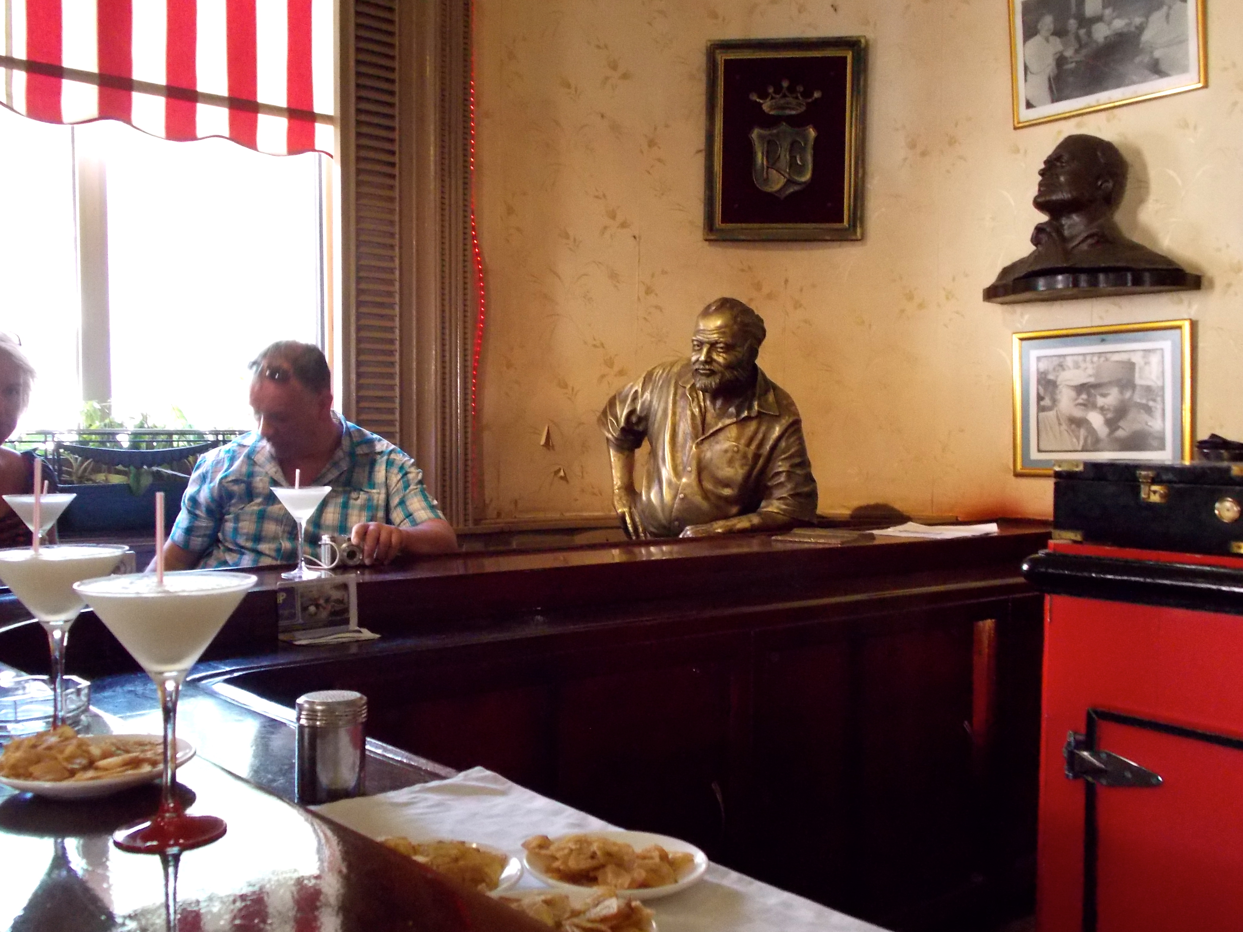
Daiquiri time at the Floridita
To understand where Cuba is now and where it might go in the future, it’s critical to know something about its …
History
Two indigenous tribes inhabited Cuba when it was discovered by Christopher Columbus in 1492. Don Diego Velazquez, a wealthy and powerful Spaniard who dreamed of conquering the New World, established the first settlement at Baracoa in 1511.
Baracoa is a lovely and peaceful place, and very hard to get to: it was 500 miles round trip from Santiago de Cuba, much of it on tough mountain roads. According to Frank: “Cubans are born hoping that one day they will see Baracoa.” The residents in this rather isolated place are an exotic blend of native Indian, Spanish, African and Asian.
On the way to Baracoa we drove through the province of Guantanamo, and close to the U.S. Base at Guantanamo Bay, which is American soil. There was a checkpoint where we spent 15 minutes waiting for my passport to be reviewed. Frank pointed out a large field that has been planted with land mines by both the U.S. and Cuban governments, America wanting to protect the base and Cuba wanting to prevent defections. According to Armando there is a blind man – a “coyote” – who knows the field and leads defectors through it.
On the return trip we passed the border at Guantanamo and I pointed a camera out the back window as we were going 45 miles an hour; there was no picture to take, so I didn’t. Two nights later Frank received a call at home from Homeland Security, asking if I had taken that picture and chastising him for not having more control over the person he was guiding. On security cameras the military had seen me point my camera, they knew the car, they knew who was in it and they were going to make certain that no photo of their building and their gate left their country. “It’s the only border we have,” said Frank, “and it’s a border with the country that’s considered our enemy. Things like this are very important to the military.”
In 1515 Velazquez built the village that 70 years later would become Havana. Understanding the city’s strategic importance, the Spanish fortified it well.
We visited several of the city’s forts including Fortaleza San Carlos de la Cabana, the largest fort in the Americas, built by the Spanish between 1763 and 1774 because of British pirates. It’s currently run by the Cuban army, which uses it for training, and it features the 12 apostles, huge cannons guarding the south.

- The 12 Apostles.
Spain massacred or enslaved the natives and eventually brought slaves from Africa and Asia. A revered figure in Cuban history is Carlos Manuel de Cespedes, who in 1868 declared war on Spain by freeing his slaves: 37 other slave owners followed, starting a civil war that lasted ten years. That war for independence failed, but slavery was abolished in 1886.
We visited the town of Bayamo, historically significant as the home of Carlos Manuel de Caspedes, who led the first fight for independence and took the town from the Spanish in 1868, the first city to fall. He was named the first president of the republic but was ousted in 1873, and that same year he was assassinated by Spanish soldiers while teaching school in the countryside. Bayamo was also where Cuba’s first newspaper – Il Cubano Libra … was published, and where the Cuban National Anthem was written and first performed.
There was a second war for independence that failed in 1879-1881, but in 1898 Cuba finally won its freedom from Spain after a three-year war known as The Necessary War. Jose Marti was the inspiration, the thinker and the fundraiser behind the war, and despite the fact he died in its first battle he is a huge hero in Cuba, with a statue in almost every town we visited; the airport in Havana bears his name. He also created the Cuban Revolutionary Party … in Key West!
We visited a synagogue in Havana that featured a small but impactful Holocaust Museum and a memorable quote from Marti: “Mankind is composed of two kinds of men – those who love and create, and those who hate and destroy.”

From one end of Cuba to the other you find statues of Jose Marti, the father of the fight for independence.
Also in 1898 the USS Maine, anchored in Havana harbor, mysteriously exploded and sank, and America blamed Spain, starting the Spanish-American War and turning Cuba into a U.S. republic. In 1902 the U.S. turned control over to an elected government, marking Cuba’s independence.
Between 1902 and 1934 U.S. companies controlled most of Cuba’s sugar plantations, banking and other industries. America controlled many economies in Latin America, resulting in a number of revolutions, and the U.S. feared a revolution in Cuba might result in a Communist regime.
In the 1930s there was a three-person leadership team in Cuba that included the American ambassador and, as head of the army, General Fulgencio Batista. Fearing that a young lawyer named Fidel Castro might win an election scheduled in 1952, Batista took control of Cuba in a coup. He was a ruthless assassin with close ties to U.S. organized crime, which ran gambling and prostitution in Cuba. His police force was brutal, and resisters were beaten or killed, but he was good for American business and thus supported by the U.S. government.
In July ’53 Castro and small group of supporters attacked the Moncada barracks housing Batista’s soldiers in Santiago de Cuba. He was caught and sentenced to 15 years in jail, but the effort helped turn him into a romantic figure with the Cuban people.
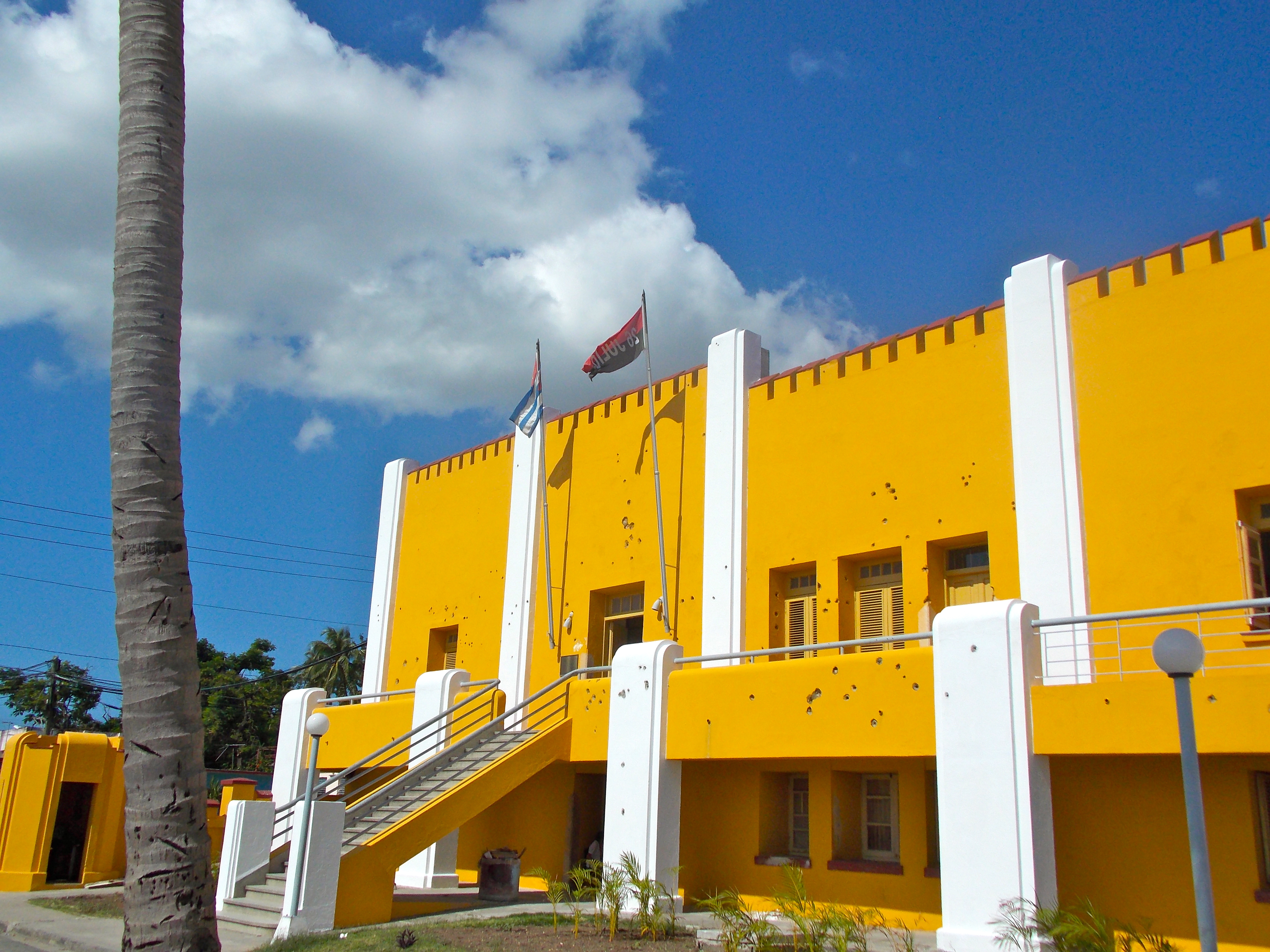
Old bullet holes in the Marcado Barracks, now a school.
Because of urging from America and a desire to appear benevolent, Batista released Castro after two years and exiled him to Mexico. There, he and his brother Raul met Che Guevara, and they started planning the revolution. In 1956 the three of them and some 80 others boarded a boat called Granma for an alleged fishing trip, and after eight days – and the loss of one man overboard – they arrived in Santiago de Cuba, and headed for the Sierra Maestra Mountains. In May 1958 they began the revolution with a series of attacks, which encouraged many of Batista’s followers to desert. At the end of the year Batista fled to the Bahamas and then the Dominican Republic, and in January ‘59 Castro entered Havana triumphant.
Che
There is likely no more compelling figure in Cuban history than an Argentinian doctor named Ernesto “Che” Guevara. In Cuba his image is everywhere: on t-shirts and billboards, buildings and hillsides. In the Mexico City airport, before boarding my flight to Havana, I saw a little kid, less than two years old, sucking on a pacifier and wearing a t-shirt with Che’s likeness and his iconic statement: Hasta la Victoria Siempre … Forward to Victory Always.
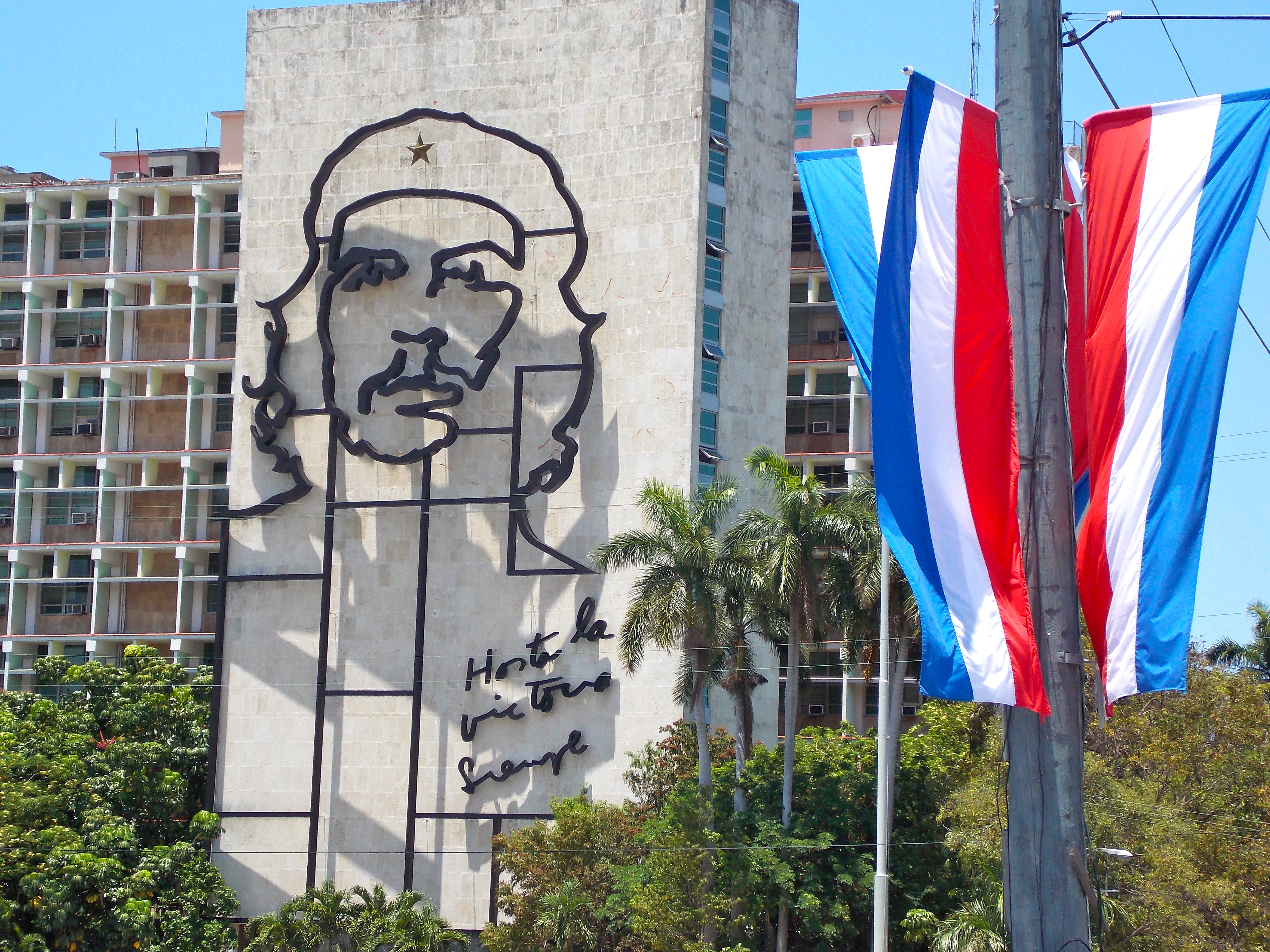
Che on the Department of the Interior building, at the Plaza of the Revolution
A successful and wealthy doctor from Buenos Aires, Che’s Marxist tendencies developed from the suffering he saw throughout South America, which he blamed on capitalism. In 1953 Che and his friend Alberto Granados drove motorcycles north through South and Central America to Mexico, where he met Raul and Fidel Castro. He immediately joined their revolutionary effort and snuck back into Cuba with them in 1956. For two years they hid out at their rebel headquarters in the Sierra Maestra Mountains, recruiting, training and planning the revolution. Che became Fidel’s second-in-command and at the age of 31 he led the final victory of the revolution, capturing the city of Santa Clara on December 31, 1958. The following week Fidel Castro entered Havana as the triumphant leader of the revolution.
Che is honored in Santa Clara, where the mausoleum containing his remains and a museum dominate a large plaza. We made the drive over the mountains from Trinidad to see it and since you can’t take photos inside, I left the camera in the car. Prior to entering Frank was asked where I was from, and he told them.

The Plaza honoring Che Guevara in Santa Clara.
The museum contains many photos and artifacts, including Che’s trademark beret with the gold star, his medical school graduation diploma, even a picture of him with a golf club. I started making some notes on my iPhone, and 20 seconds later a guard came up to me and politely asked me to put the phone away. I explained I was not taking pictures, just notes. Frank translated her response. “She says it doesn’t matter, security people told her to stop you,” he said. I looked at the ceiling, and it was covered with the small camera bubbles that you see in casinos.
After the revolution Che stayed in Cuba and trained the forces that defeated the Cuban exiles at the Bay of Pigs, and he eventually became president of Cuba’s National Bank. But in 1965 he left to look for revolutions elsewhere, and two years later he was killed in Bolivia by army forces with support from the CIA. I haven’t verified this but Frank told me that the CIA guy whose group killed Che and his small band in Bolivia went public with it 30 years after it happened, identifying the location of the bodies. Cuba then got permission to excavate the site and test the remains, and they are all now buried in the mausoleum in Santa Clara, identified by ceramic likenesses and their nicknames … Willie, Coco, Che. The mausoleum is an oddly moving place, dark and a bit ominous with the vigilant guards, casually but beautifully presented.
Following the revolution, Cuba adopted the Soviet model: equality without materialism. Castro immediately starting making good on his many promises, generating trust with the people. He had promised, for example, to eliminate illiteracy, so he marshaled a volunteer force of 100,000 students to go out into the country and teach. Today Cuba’s literacy rate is 99.8%.
Suddenly the poorest, most rural people had food, clothes and education. This coincided with the emergence of the Soviet Union as a super power, putting Cuba in a position of strength and making for a lot of discomfort in Washington D.C. So the CIA began recruiting Cuban exiles and developing a plan to invade Cuba, hoping to spark a rebellion. The paramilitary group Brigade 2506 from Mexico left from Guatemala to an area on the southern coast of Cuba called La Bahia de Cochinos, which was selected because the people were poor and supposedly susceptible to recruitment, and it was also close to both the mountains where Batista supporters lived and to Havana. The Bay of Pigs invasion began on April 15, 1961, and it was over in three days, Castro’s strength and reputation having grown exponentially.
On the way to the Bay of Pigs we went through a town called Australia, where Castro had his headquarters for the 72-hour battle in a sugar factory. After the Bay of Pigs the local towns were named for heroes of the battle or for countries that supported the revolution. Monuments by the side of the road honored those who died in the battle. As we got closer a billboard read: “The mercenaries got only to this point.” There were two points of battle: Playa Larga (Long Beach), which is now a prosperous beach and tourist town, and Playa Giron.

Giron – The first defeat of the yankee imperialists in Latin America.

In the romanticized version of the Bay of Pigs, Castro himself drove this tank.
In October 1962, the attention of the world was focused on the Cuban Missile Crisis and the possibility of a conflict with the Soviet Union terrifying to contemplate. Once that was over the U.S. focused on completing the embargo of Cuba, what Cubans call the “bloque”, the blockade; it has been going on for 51 years and Cubans believe it is the cause of all their economic woes.

Remnants of the Cuban Missile Crisis
“All most Cubans want to see right now is a dialogue,” Armando told me, “but they don’t believe it will happen because of politics. The American government pays millions of dollars to Cuban-Americans to undermine the Cuban government and try to force regime change. Maybe they smuggle in a few laptops to dissidents but mostly it goes into their pocket. They don’t want to lose that revenue stream.” Cubans are extremely suspicious of the Marco Rubios of the world, whose angry rhetoric toward the Cuban government is confusing to the average citizen.

Blockade: The Largest Genocide in History. Map of Cuba in a noose, nice touch.
When the Soviet Union was strong everything worked passably; the people of Cuba were relatively happy because they had enough to live on and didn’t know any better. But in the early 1990s the fall of the Soviet Union eliminated Cuba’s lifeline and created such economic turmoil that Cuba had to open itself up to non-American tourism. Cubans begin to learn what they were missing. And very, very slowly, things began to loosen up.
Today, Raul Castro has taken the reins because of Fidel’s declining health, and he’s announced that in 2018 he will step down, and that no successor will be able to stay in office longer than ten years. . No one seems sure of what exactly what will happen when there is no Castro in charge for the first time in 59 years, but everyone hopes for greater freedom and economic opportunity.
The Cuban people acknowledge that, for the most part, they don’t work very hard and are unmotivated. Before the revolution, under capitalism, it was different, and that’s what Communism does; it sucks the energy and creative spirit out of people who would otherwise be expressing themselves in the arts, in business, whatever. What’s the good of having a literacy rate of 99.8% when the people can’t use their intelligence and education to build something, to better their lives?
Raul Castro has made some subtle changes, most significantly by expanding the private sector, allowing more than half a million people with licenses to start small businesses and offering bank loans to entrepreneurs. He was quoted as saying that “we have to erase forever the notion that Cuba is the only country in the world where one can live without working.” And he stated he would step down in 2018.
“So, what happens then?” I asked Armando. “He’ll just be replaced by some guy he hand picks. I already saw the guy named somewhere.”
“Miguel Diaz-Canell. I wouldn’t vote for that guy, ever,” Armando said.
“Vote? You think there will be a vote?”
“I don’t know. But I don’t want that guy. You talk to anyone who is interested in politics, they wouldn’t want him.”
“So who would be your choice?” I asked him.
“The city historian in Havana. He’s smart, humble; he walks among the people. Diaz has four bodyguards! Why? Who is he to need bodyguards? Also, there is a guy in Santiago de Cuba, like a mayor; he’s a good man, I would prefer him.”
“Do you hear what you are saying?” I asked. “You’re saying that you want a choice. You want a democratic process.” He didn’t disagree.
Observations From the Road
Frank, Deivy and I drove east from Havana for a week with stops in many towns of historic importance. From one end of Cuba to the other I saw very little poverty, at least compared to so many other places I have been. Even the humblest of rural homes is clean, with enough manicured landscaping to affirm the pride of the people who live there.
“The money is distributed, so everyone has something,” said Frank. “The richest people in Cuba only have four or five million dollars, and most of them are artists. Cuban art is in demand by outside collectors. I saw one artist sell two paintings and a sculpture for $80,000 to an American collector, right in front of my nose! Can you believe that? That is more than a surgeon here makes in a lifetime.”

Live music is everywhere, including in the streets.
Frank is an intelligent and knowledgeable young man of 29 who speaks four languages (Italian and Portuguese along with English and Spanish), but he has never been outside of Cuba. I asked he would like to go to the States. “It will never happen. I’m not married, I own no property in Cuba, I am just the kind of person the U.S. government would fear would visit America and never leave. Many have done that, and some haven’t been the best people.”
He told me there are three ways for a Cuban to get to the U.S. One, you can pay $10,000 in Cuba and have a relative or friend pay another 10K in America to get a fast boat to the Florida keys. Two, you can sign a work contract in Mexico and then pay the “coyotes” to take you across the border. Also about 20K, but riskier. Three, you can become a Spanish citizen. In 2005 Spain started cracking down on immigration but if you can prove you are no more than three generations removed from your Spanish heritage you can become Spanish citizen and then go to U.S., and then become American citizen in one year. According to Frank the 1966 Cuban Adjustment Act said that if you arrived form Cuba with “dry feet” the U.S helps you get a job, a car, an apartment to rent.
You see fewer and fewer cars in the interior, and I was surprised that throughout Cuba there are so few motorcycles; you would think the inexpensive Chinese motorbikes that are so prevalent in Africa and Asia would be a big hit here, but that’s not the case. People travel in rickety old Chinese buses, or they stand by the side of the road holding out a fistful of pesos, hoping a truck driver will pick them up and take them to the next town. Attractive women, of course, get priority treatment.
The roads are spotty, but not as bad as I was led to believe. Early in the cross-country trip we were cruising along a great six-lane highway when our side of the median abruptly ended and we crossed to the other side, where there was now two-way traffic in the outer lanes and the middle lane was reserved for whomever dared to pass. A large sign on the side of the road urged caution by trumpeting the number of deaths on that road so far this year.
“Let me guess,” I said to Frank. “This highway was under construction when the Soviet Union collapsed, and the money ran out.”
“Exactly,” he said.
It’s a little hairy on the two-lane roads. Trucks, buses and a few cars are zipping along at 60 miles per hour, sharing the road with bicycles and many horse-drawn carriages; passing is definitely a creative art.
There are hundreds of billboards throughout Cuba, but none of them advertise a product or a service; they all, in one way or another, promote the ideology. The first one I saw coming in from the Havana airport said: Thank you Che, for your example. There are five Cubans in U.S. jails for alleged espionage in America and many billboards demand their release. Che’s famous quote from his final letter to Fidel Castro – Hasta la Victoria Siempre – is a favorite, as is something Castro said during the Bay of Pigs: Patria o Muerta. Homeland or Death. I asked Frank the purpose of all this propaganda. “Truthfully,” he said, “I have no idea.” At first the billboards were an interesting curiosity, but they became tiresome.
One afternoon we visited a resort area called Varadero, a peninsula of land with the ocean is on both sides with prime real estate in the middle. It gets 2.5 million visitors a year and sports 58 hotels (more than the rest of Cuba combined), four marinas and even one golf course. The beaches are wide and beautiful, the water topaz blue; easily drivable from Havana, it’s a prime area for big-time development.
I needed to get a piece of travel information from Gmail, so in the town of Camaguey Frank and I stopped at a rare establishment offering Internet access. I didn’t have my passport with me and was not allowed to use a computer; they needed to enter me into a database and track my usage. Cubans were not allowed to use the place at all, just foreigners. Frank also told me that at home he had tried to access my blog, but it was unavailable. “Certain words, even words like ‘travel’, will trigger the block,” he said. Ruffinontheroad, banned in Cuba. Cool.

The machetes at this plaza in Santiago de Cuba send a definite message.
Our final stop was Santiago de Cuba, the country’s second-largest city and one with a great deal of history. Sadly, there was evidence everywhere of the devastation caused by hurricane Sandy last year before it hit the northeast United States. Homes along the water were being rebuilt, roofs everywhere in need of repair, marble statues in the local cemetery in pieces. “After the storm it looked like Godzilla came through here,” Frank told me. We saw four or five key historic sites in town, most memorably the Moncada Barracks, where they have preserved the bullet holes on the façade from July 26, 1953, when Fidel Castro and a small band attacked several thousand of Batista’s soldiers, with predictable results.
* * * * * * *
And now I’m back for one final night in Havana, drinking a glass of twenty-two year old rum, smoking a Monte Cristo cigar, banging out these final words and trying to channel Papa Hemingway in his house on the hill. And tomorrow morning the sun will also rise and I will fly to Panama, with the bittersweet knowledge that I am just two weeks away from home.
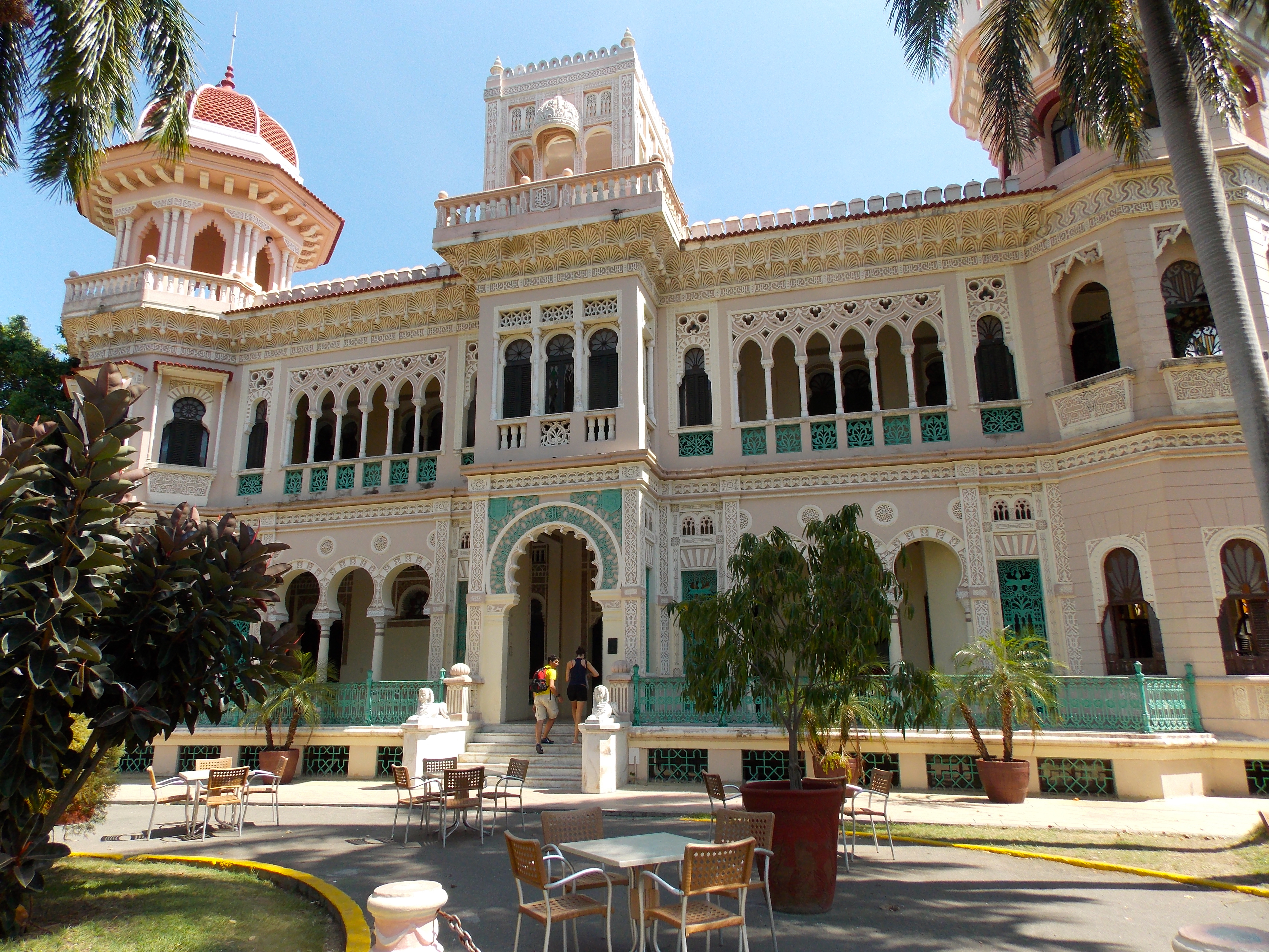
The Palacio de Valle in Cienfuegos, former home to a sugar baron, now a restaurant. So many different architectural influences working together. Beautiful.

Can’t have too many shots of old cars.

Like I said …
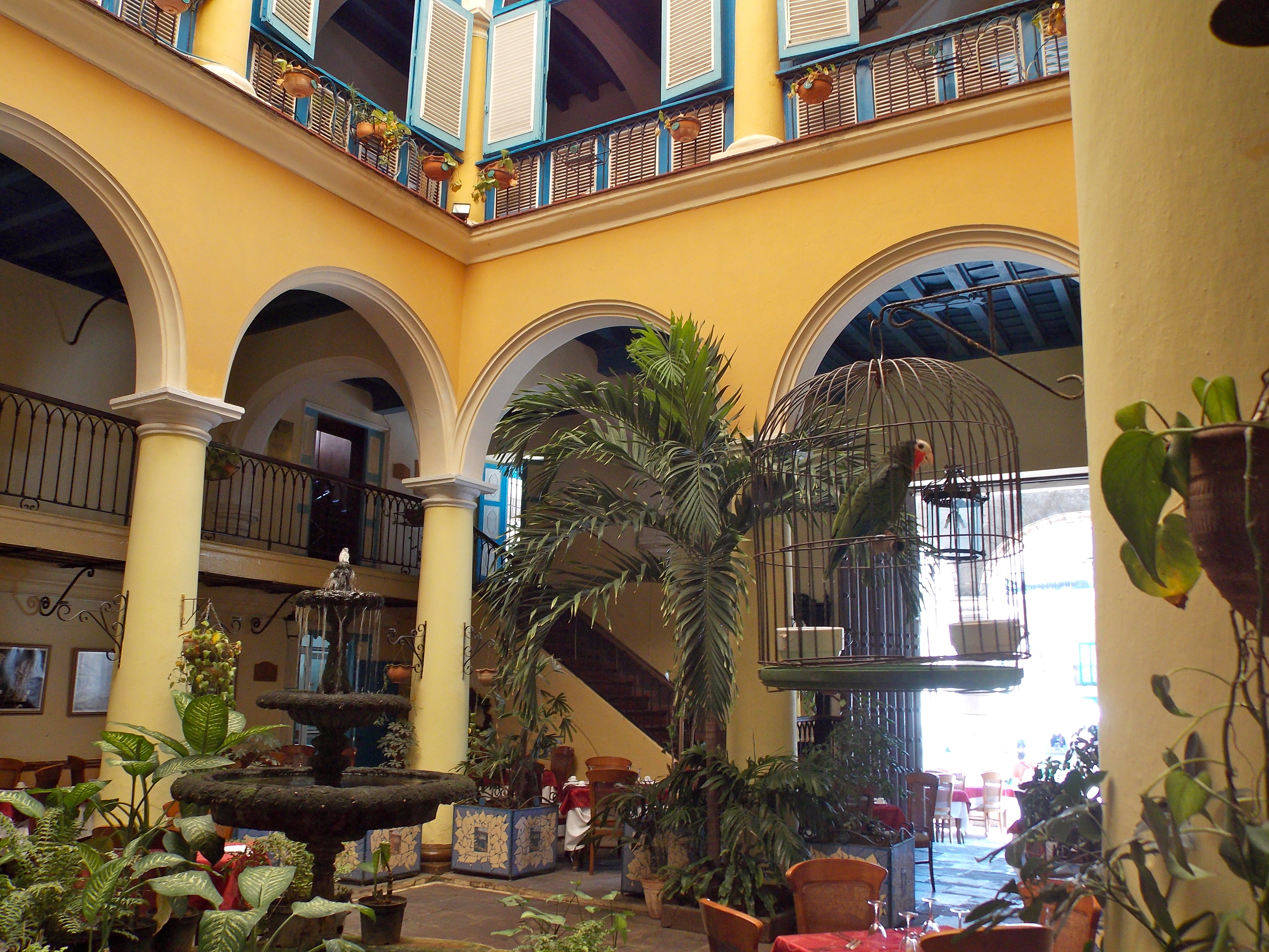
The beautiful old buildings with the open-air core are so typical of Old Havana.

This is senor Pedro Pablo Perez Perez, former TV and film actor. Cuban class.
Categories: Uncategorized
Home Stretch
For the past week I have been in Cabo san Lucas, on the southern tip of Baja California, staying with some very good friends in a luxurious villa overlooking the Sea of Cortez. The Cabo/San Jose area is beautiful, a  lot like many of the nicer resort areas of Arizona, but with beaches and water. We spent a great afternoon on a 50-foot catamaran for sun and snorkeling, had a number of amazing meals and had a special final night with a mountaintop sunset and great sipping tequila.
Most of all it was just extremely relaxing and for me a chance to actually unpack, catch up with laundry, do some reading and spend time with my friends. Truthfully, the week shouldn’t count as part of this trip, it was just so comfortable, but it gave me a chance to get motivated and organized for the final month. I’m in Mexico City tonight and leave tomorrow for Havana and 12 days in Cuba. From there it’s a couple of days in Panama and then to Guatemala for the final adventure of this trip, seeing more Mayan ruins, some of which are so deep in the jungle you can only reach them by boat. And on the first of June I fly from Guatemala City to Miami, and onto Jacksonville.
The next couple of weeks I’ll be without phone and Internet so will do the next post from Panama. I’m excited about the opportunity to make a legal trip to Cuba, meet some of its people, study its history and culture and religion, and to share some of that when I get the chance.
Until then, stay safe and healthy!
Categories: Uncategorized
The Brilliance and Brutality of the Mayans
Following my wonderful visit to northwest Argentina I had a few transition days in Costa Rica; in Jaco I went zip lining and ATV riding, and I watched the third round of the Masters in an open street bar filled with aging 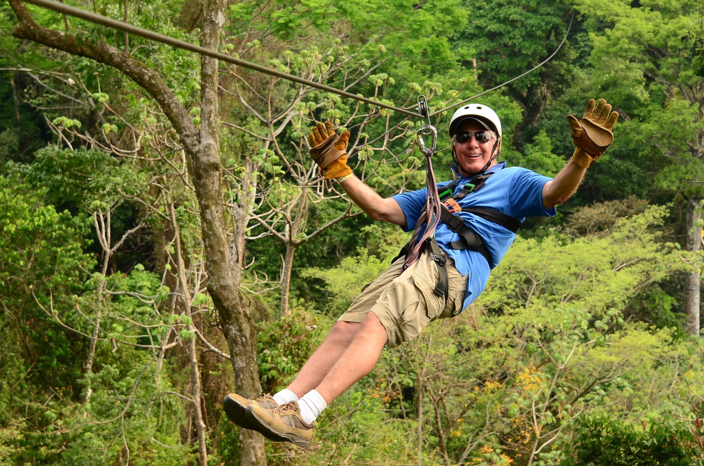 American hippies and young Costa Rican hookers, a demographic pairing that seemed to function quite well.
Then I headed to Mexico for a ten-day tour that focused on Mayan ruins. I booked this trip long ago thinking that it would be an interesting way to spend a week, but certainly not knowing that over the past four months I would develop a serious interest in once-great civilizations by visiting Ayutthaya north of Bangkok, in 1700 one of the largest and most culturally-advanced cities in the world before it was destroyed by the Burmese; the Angkor complex in Cambodia, a massive community that once included 1,500 temples before it was destroyed by Ayutthaya; Easter Island, where the Rapa Nui culture ultimately fell victim to civil war and depleted resources; and northwest Argentina, to which the Incans migrated from Peru before being overcome by the Spanish. Spending some time in the heart of the Mayan world was timely.
Regarding these ancient civilizations of South America and Mesoamerica (which extends from central Mexico south to Costa Rica), I’ve always thought in terms of the big three: Mayans, Aztecs and Incans. But in truth there were many more indigenous peoples; the Mayans and Aztecs both evolved to some extent from the Olmec, and in Mesoamerica there were also the Mixtec (from whom Mexico gets its name), Yucatecs, Zapotecs and the Toltecs,

A rare remaining example of the Mayans’ use of vivid colors.
who came down from the north to ultimately blend with the Mayans, who had come up from Guatemala and Belize in the south.
The Mayans were both brilliant and brutal. Their calendar was much more precise than the one we currently use, and they actually had three different ways of measuring time, which they considered to be a repeating cycle rather than linear. Most of their major cities had observatories, and their understanding of astronomy exceeded all of their contemporaries; they revered the planet Venus and used it in one of their calendar systems. The sophistication of their architecture, the intricacy of their art, their knowledge of mathematics and the fact that they had the only fully-developed written language in Mesoamerica all pay tribute to their superior intellect.

The MesoAmerican ballgame stadium in Palenque, where winning could cost you your head.
Yet they believed in and widely practiced human sacrifice, often with children aged eight to 12, but also with religious leaders and prisoners. It was believed to provide sustenance for the sun and was considered an honor; in the biggest athletic contests it was the winning team or winning captain who was beheaded after the victory. If it wasn’t beheading, others were sacrificed by having their hearts removed while they were conscious. When Cortez and the Spanish conquistadors overcame the Mayans they were appalled at these practices and destroyed all hieroglyphic documentation and manuscripts in the belief they contained elements of the Mayan depravity.
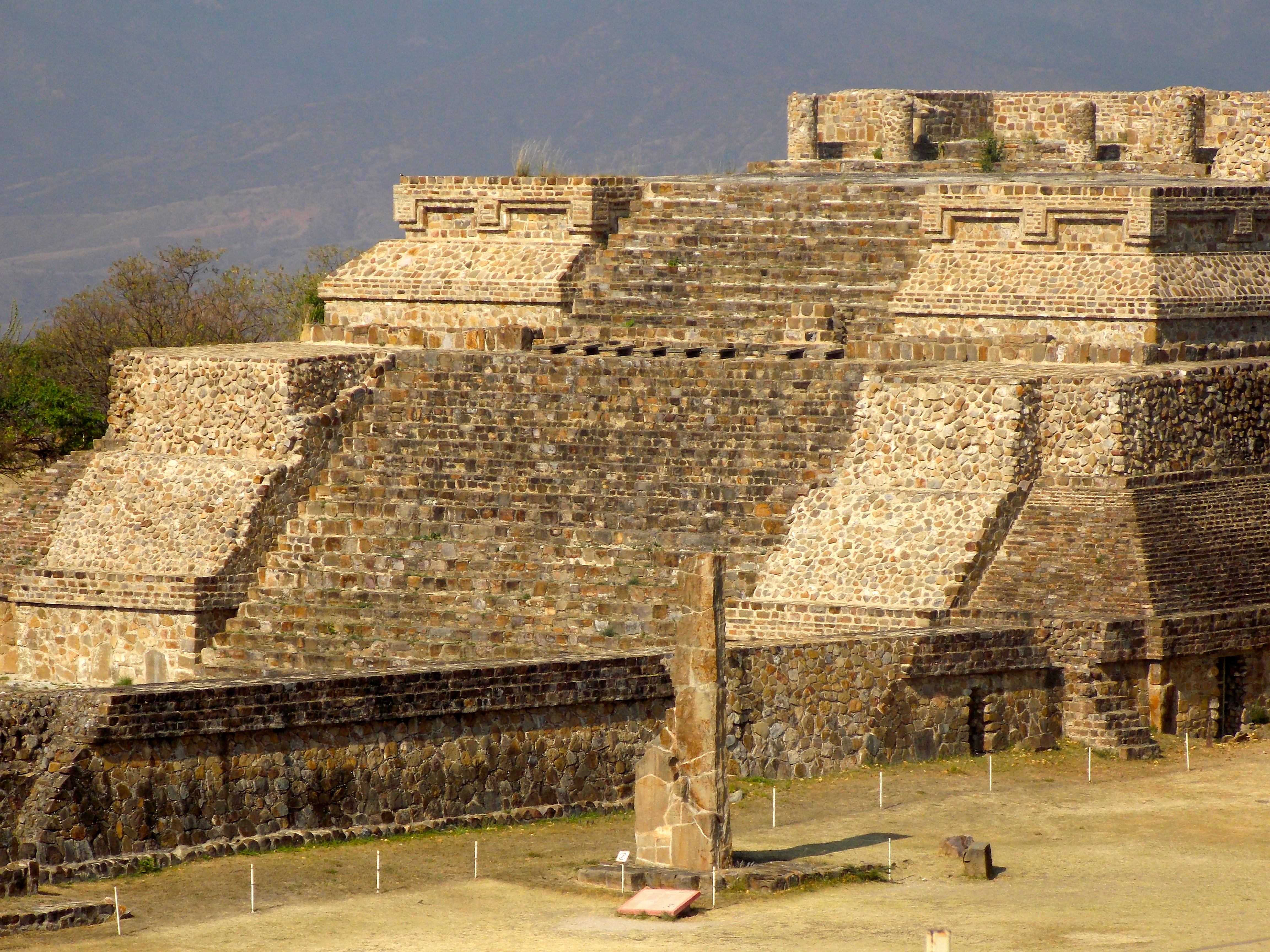
The major temple at Monte Alban
The first ruins we visited were actually Zapotec, at Monte Alban in the Valley of Oaxaca, a day’s ride from Mexico City. Monte Alban (pronounced as one word, like Ricardo’s last name) was the first urban complex in Mesoamerica and dates from 500 B.C. Prior to Monte Alban social organization had been based loosely on agricultural communities, but in a remarkable effort by the leaders of the main villages, this ceremonial center was built over three neighboring hills and became the center of religious and political activities. It was also a center for the arts and science as seen in the pottery, architecture, palace of dance and a substantial observatory.
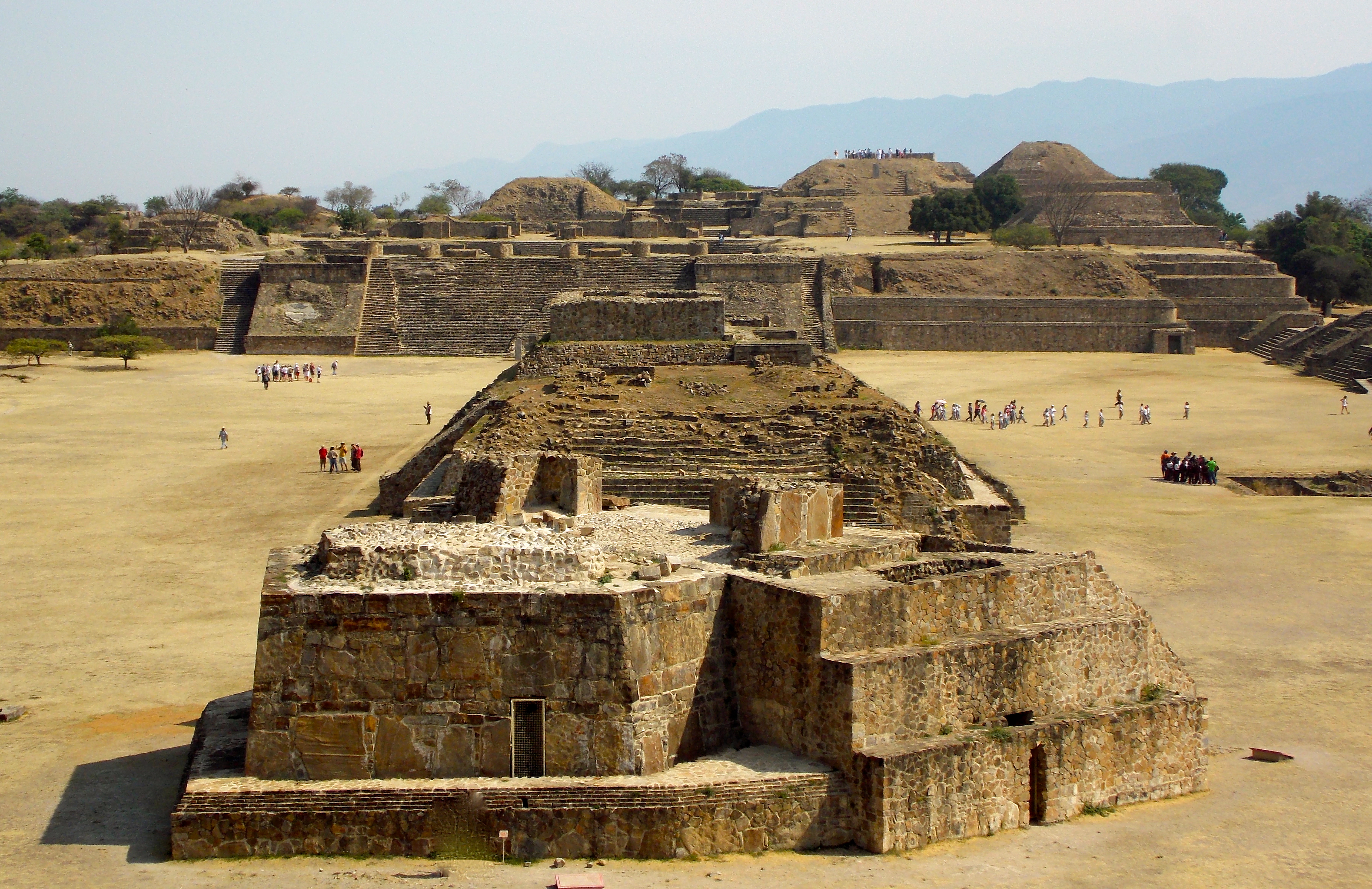
The structure in the foreground is the Monte Alban observatory.
Next stop was the Mayan city of Palenque, which features the tomb of perhaps the greatest of all Mayan kings, Pakal, who came to power in 615 A.D. as a teenager and ruled for 68 years. In 1948 an archeologist found a hidden stairway within the Temple of the Inscriptions and took four years to follow it downward, digging out the mud and breaking through barriers. Finally, in 1952, in a moment that rivaled any discovery in Egypt, he entered a chamber to find the sarcophagus that contained the remains of the great Pakal, as well as the bones of six people who were sacrificed to accompany Pakal on his journey to the underworld.

The Palenque tomb where Pakal’s remains were uncovered in 1952.
Palenque isn’t the largest of the major ruin sites but it has some of the best examples of architecture, sculpture and aqueducts in the Mayan empire. The city thrived from about 200 B.C. to 1200, when it was abandoned and consumed by the jungle. Spanish conquistadors discovered it in 1773, and scientists have since determined that Palenque once consisted of about 1,500 buildings, 90% of which are still buried.

Elevated look at Palenque, where 90% of the city’s structures are still buried.
The following day our bus pulled up at Uxmal (pronounced, as best I can figure it, “Ooshmal”), which featured a number of impressive structures including the five-level Pyramid of the Magician and the huge Governor’s Palace. Because the site is elevated and water is too deep to access, a complex system of aqueducts and cisterns was developed, including a charcoal filtration process to purify the water. There are hundreds of masks of Chaac, the rain god, with his large spout-like nose representing the rays of the storms. Uxmal also features many carvings of serpents, which, along with the jaguar, figured prominently into all levels of Mayan mythology.

The Pyramid of the Magician at Uxmal.
Between 600 and 900 A.D. Uxmal was the most important and powerful site in Yucatan, an influential ally to Chichen Itza, but the last construction took place in 1050 and while there were still inhabitants there in the mid 1500s no Spanish community was ever built there and by 1600 it was completely abandoned.

The steam baths were usually placed near the ball court.
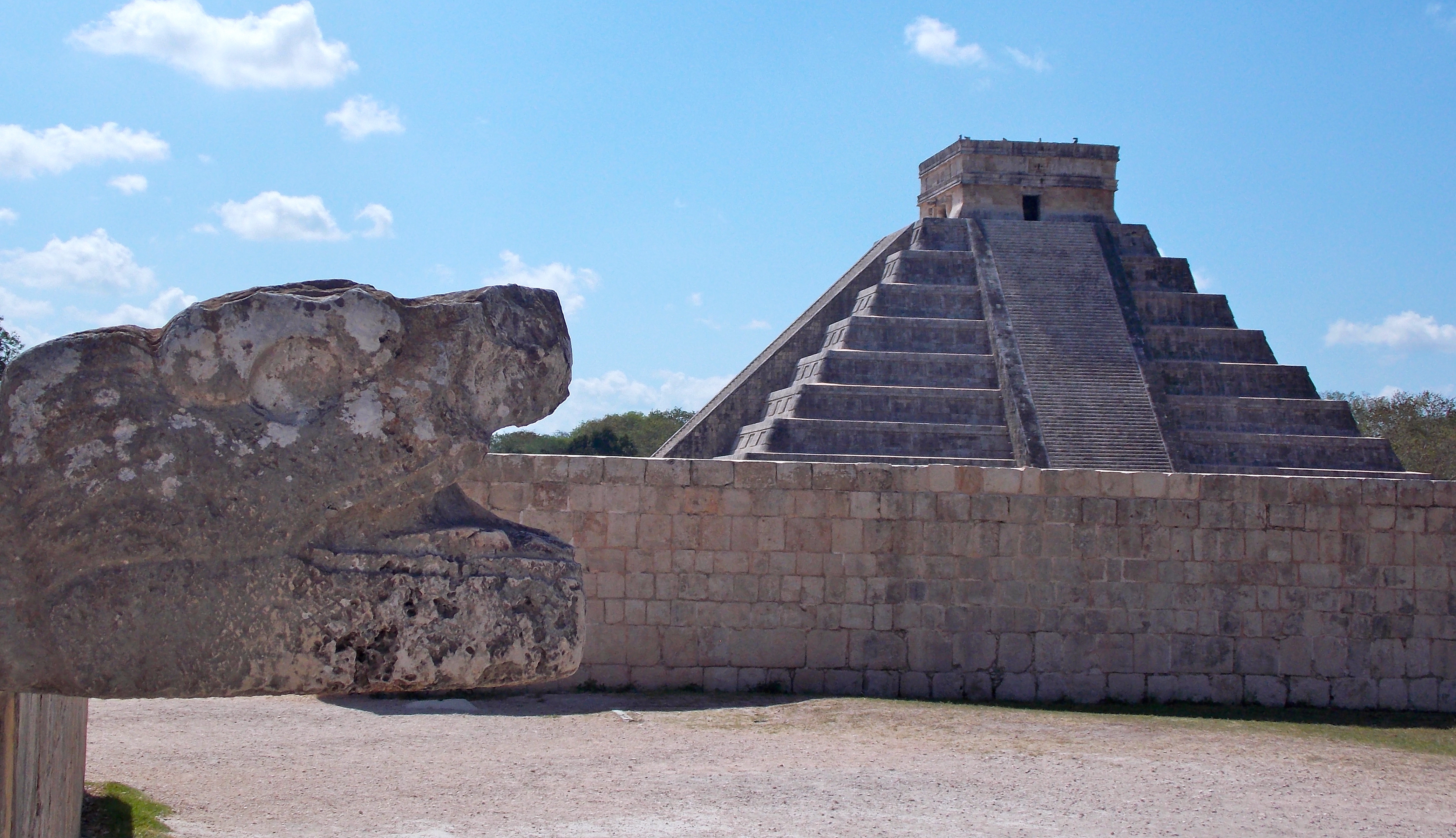
Finally we arrived at one of the most famous Mayan cities, the great Chichen Itza, far and away my least favorite of the places we visited, for three reasons. One, it was easily the most crowded because of its proximity to Cancun and the cruise ships that dock there. Two, the entire “campus” of ruins is lined with vendors hawking their wares, hundreds of them selling the same stuff. And three, it is incredibly restrictive in terms of where you can go; you can’t climb anything. Apparently five years ago or so a woman ascending the great pyramid of Kukulcan, perhaps the most visible and well-known of all remnants of the Mayan civilization, fainted and fell to her death, so now the limitations are excessive.

The iconic Pyramid of Kukulcan at Chichen Itza.
Despite these drawbacks Chichen Itza is impressive. The Kukulcan pyramid is in reality a huge calendar, and on the March and September equinox a shadow forms on the edge of the pyramid with triangles of light making it appear as if a serpent is slithering down from the top if the structure to a snake’s head carved at the bottom, and on into the underworld. The pyramid is the centerpiece of a core city two miles square, with residential buildings extending beyond that, one of the largest of all the Mayan cities.

Chichen Itza was actually owned by an American named Edward Herbert Thompson around 1900; after raiding it of its jade and gold (much of which he gave to Harvard University, which should give it back) he sold the site to a Mexican family, who sold it to the Mexican government five years ago for 20 million U.S. dollars.
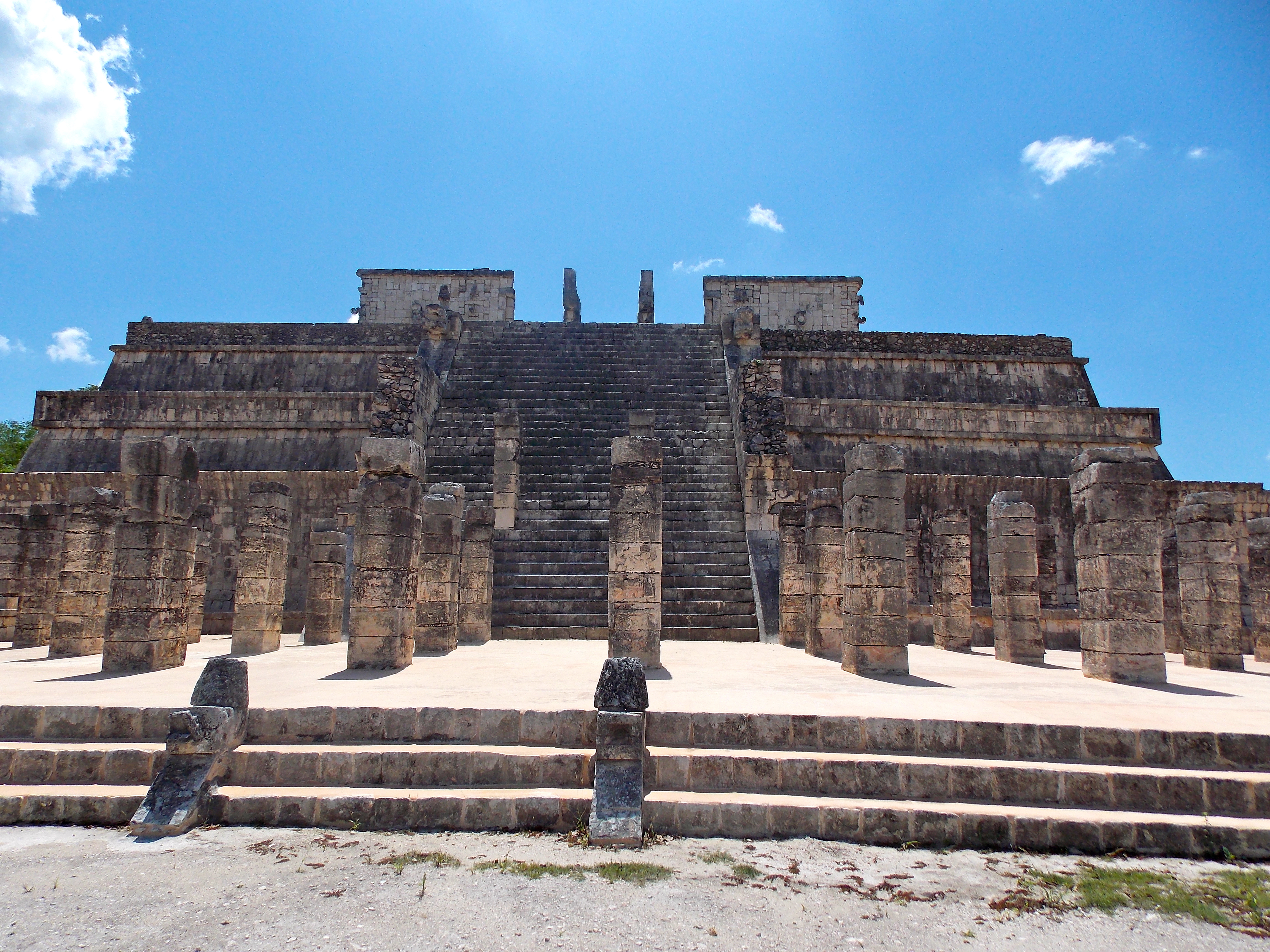
The Temple of the Warriors at Chichen Itza.
Chichen Itza features no fewer than 13 ball fields of various sizes, including the largest stadium in the Mayan kingdom for the playing of the Mesoamerican ballgame. Depending on the size of the field the game was played with between two and seven players per side, who could use only their hips, knees, shoulders and elbows to propel a rubber ball about the size of a volleyball and try to navigate it through a stone hoop jutting out from the side wall of the stadium, by all appearances an almost impossible task. Much like soccer today, many games ended in scoreless ties, in which case I suppose no one was beheaded.

So here’s the deal … get the ball through that ring using your hip or your knee or shoulder. No wonder games often ended in scoreless ties.
The Mayans were never wiped out as a people. Today, the Mexican states of Yucatan and Chaipas, as well as large sections of Guatemala and Belize, are populated with people of Mayan descent who still use the various dialects of the Mayan language. In the 1950s, a Dutch guy working for an American company in search of oil found a community of Mayans in the jungle who had never seen a non-Mayan. The leader of the tribe was 120 years old, and had fathered a child when he was 102.
My hope is that someday the Mexican government – if it can get financial support from the drug lords who really run the country – will pay for archeologists to uncover an entire Mayan city and then hire architects and artists to restore it and color it and return it to exactly as it was in its time of glory. It would be the most breathtaking and educational tourist attraction on the planet.

We saw much more than ruins, including this interesting church and graveyard, funeral in progress.
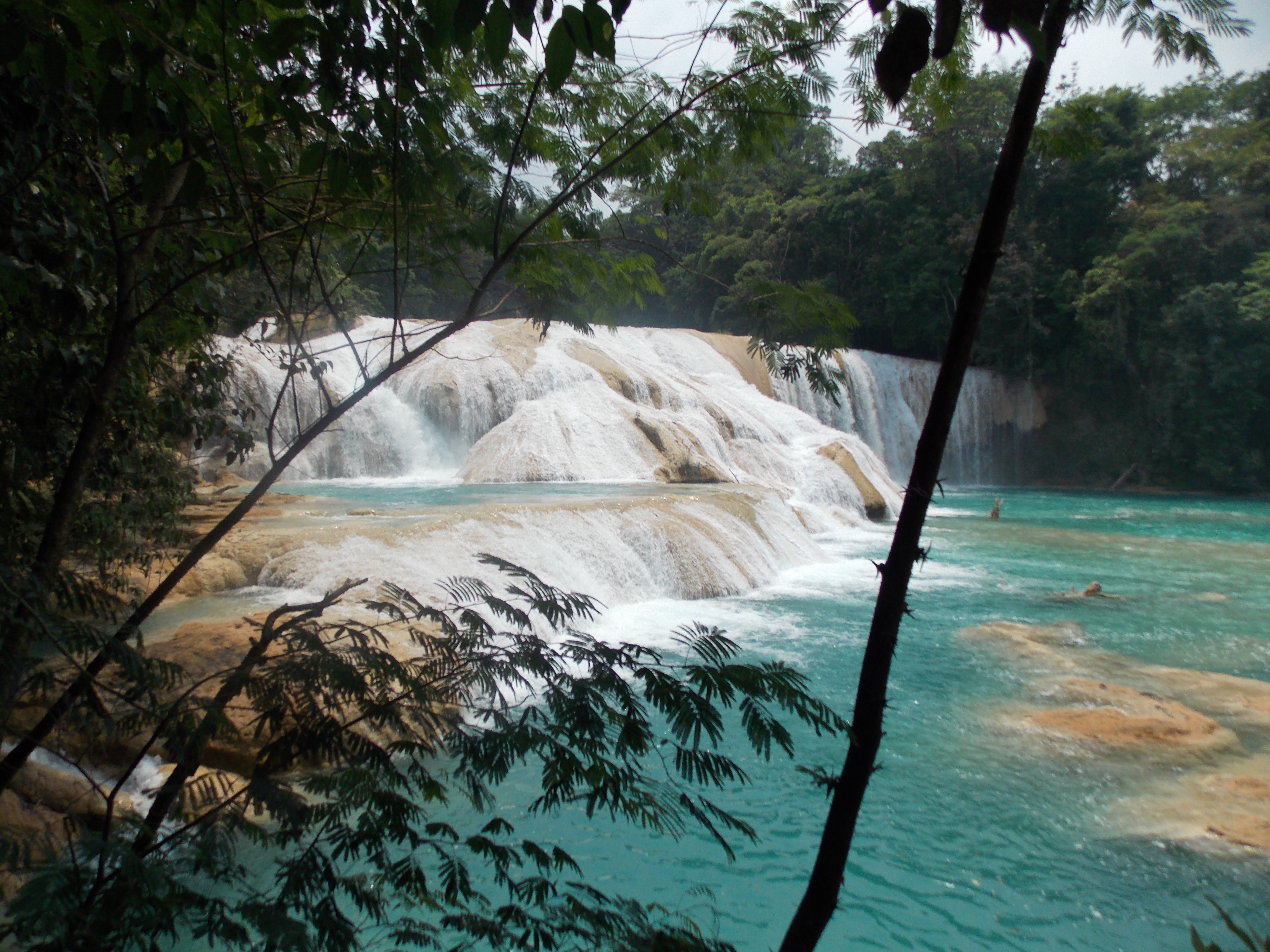
The falls at Agua Azul … a combination of the limestone and local vegetation color the water dramatically
Somebody got started just a liiiittle too early.

Kids. Love ’em.
Serpents and pyramids, big hits in the Mayan culture.

Adios!
Categories: Uncategorized
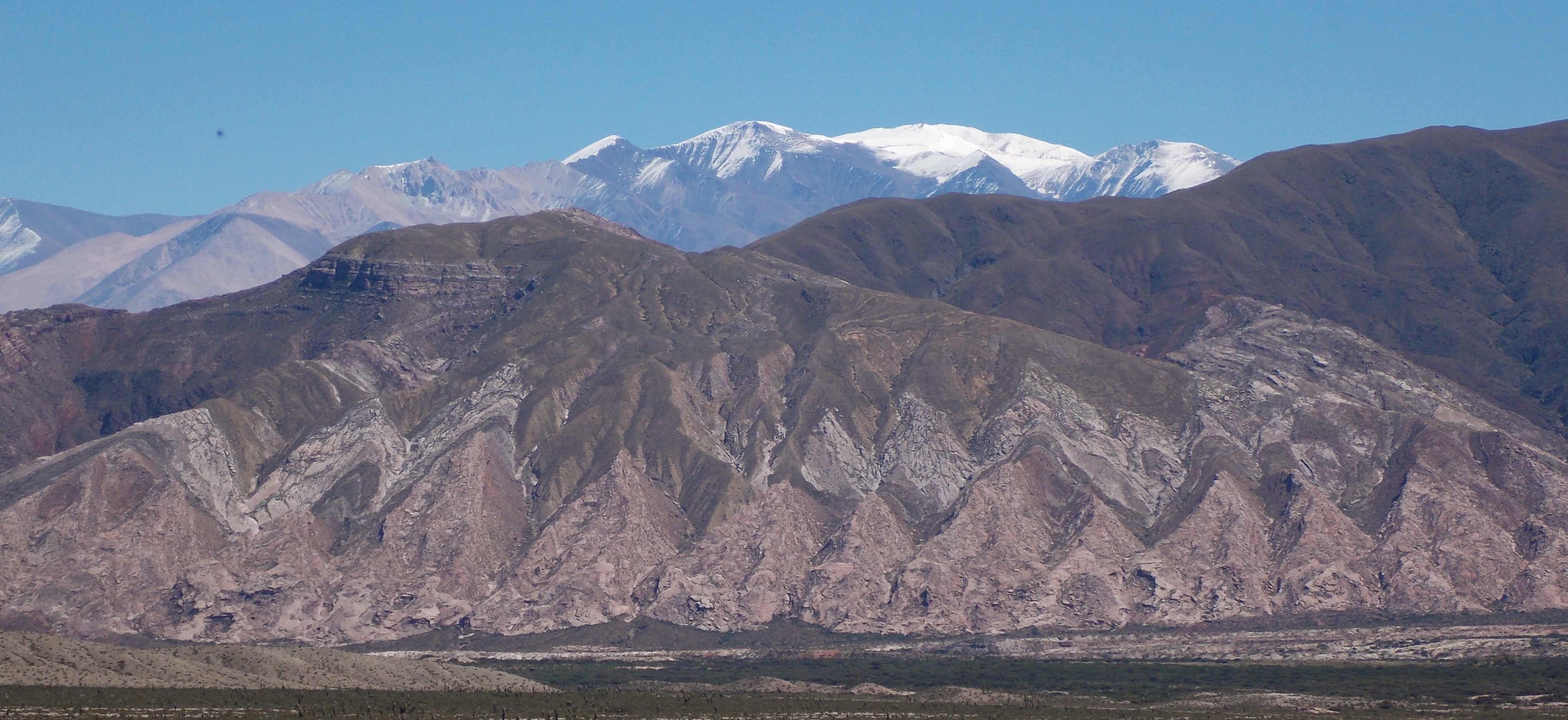
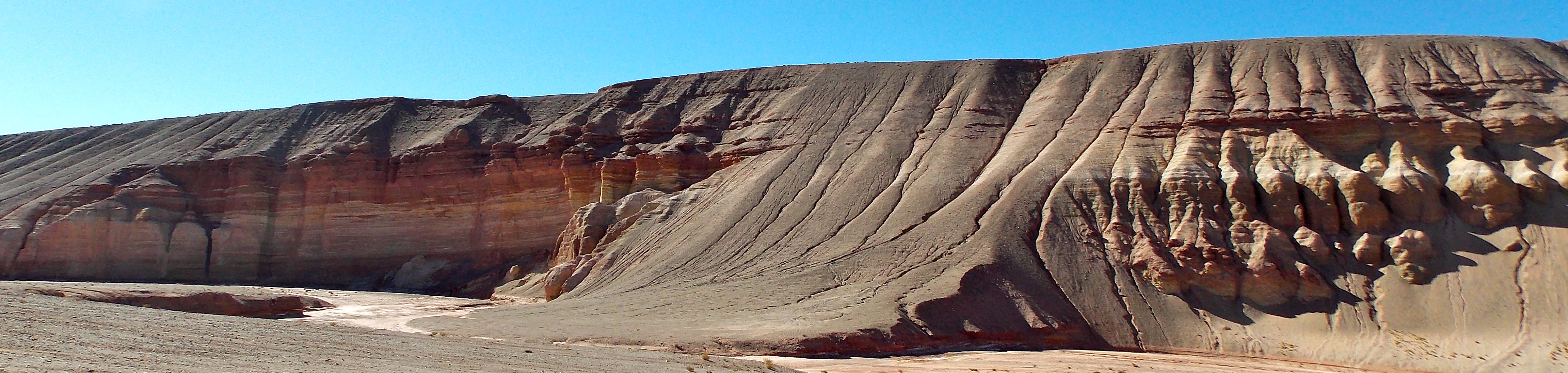
Pachamama and the Argentinian Puna
Pachamama. I love this word. It means Mother Earth; Pacha is Incan, and mama in this case is Spanish, but you can’t get more universal than mama. Over the past eight days of startling, ethereal landscapes I’ve seen a different and very special side of Pachamama.
My old friend Tony Roberts, an outstanding Arizona-based photographer who was trained by Ansel Adams, has an excellent photo-centric blog, and a short time ago he featured some images taken by a photographer from the New York area named Eric Meola of remote areas in Bolivia and Argentina. Especially compelling were his photos from the Puna, an Andean plateau at 11,300 feet that starts at Lake Titicaca on the border of Peru and Bolivia, and ends 1200 kilometers later in northwest Argentina. Friends had suggested going to Brazil, Patagonia or the Galapagos Islands for the South America segment of this trip, but more appealing to me was the fact that only about 150 people a year venture into the Puna. I found an excellent company called Socompa to handle the details, and made my way from Santiago, Chile to Salta, Argentina.
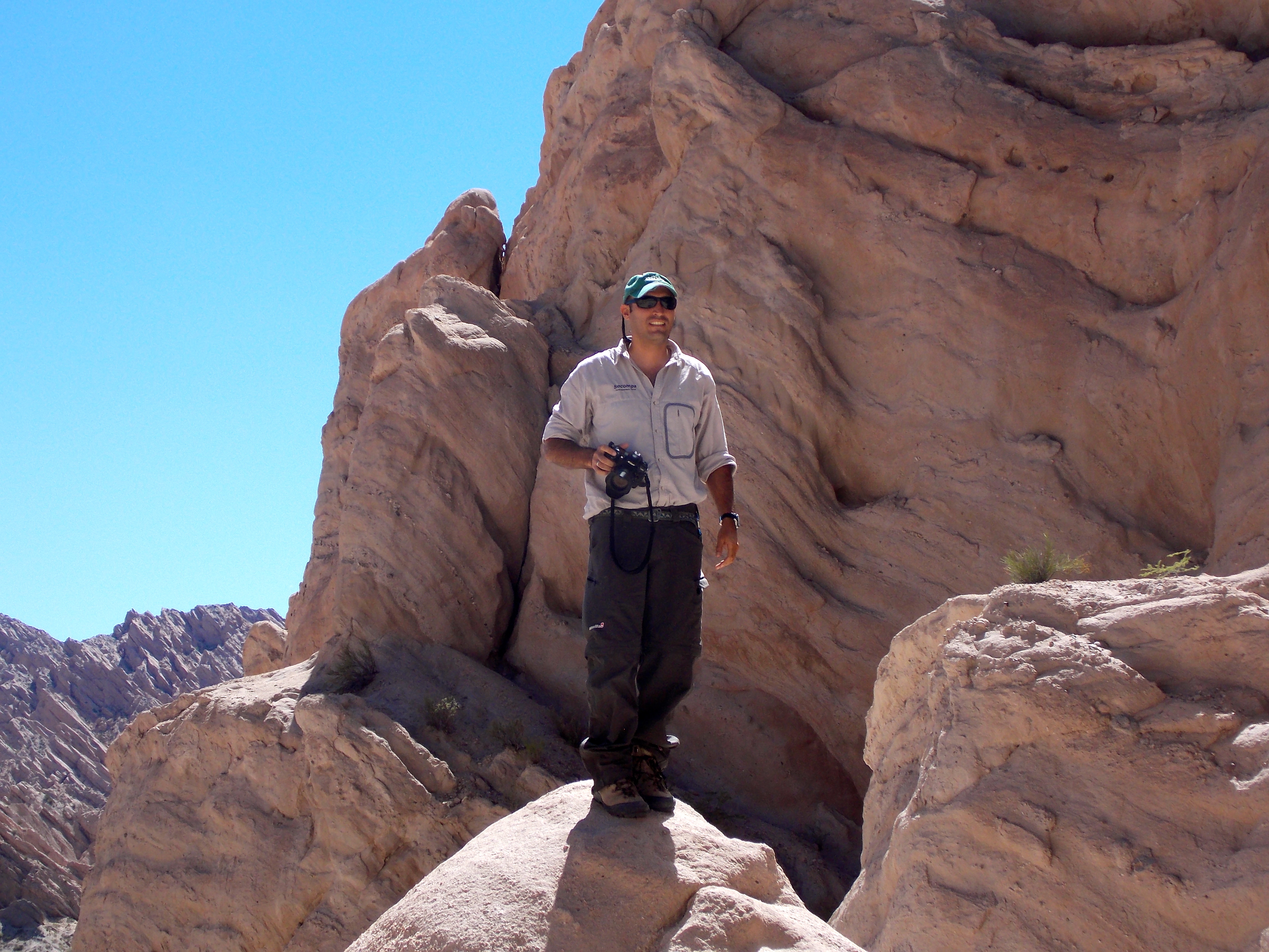
As my guide and traveling companion for the week, Socompa introduced me to Sebastian del Val, a 34-year-old new father from Salta who turned out to be the ideal partner for this trip. He studied to be a geologist and worked earlier in his career making geologic maps and charts, and then worked for a Canadian exploration company surveying for uranium, so his knowledge of the earth, and volcanic activity especially, is extensive. Unlike most guides Seba didn’t feel the need to talk all the time, which I appreciated; in this environment you wanted to spend a lot of time just letting the unique natural beauty wash over you. He is a passionate and accomplished photographer, and knew where to stop for the best shots. We had similar tastes in music and enjoyed departing on each cloudless morning to the strains of U2’s It’s a Beautiful Day. And he was an excellent driver; despite many opportunities to do so, not once did he drive us off a cliff.
Sebastian del Val
This week was all about trying to pay tribute to Pachamama through photography, appropriate since it was photography that led me here. Prior to arriving I’d averaged taking 170 pictures per week, and in one week in Argentina I took 940. Everywhere we went there was something interesting or incredibly beautiful, and it was fun not thinking of anything else, not taking many notes, just pretending I knew what I was doing with a camera in my hand. I wish I had better skills, and maybe a bit more sophisticated equipment than my little fixed-lens Nikon Coolpix, but hopefully these shots will to some extent convey the extraordinary raw beauty of this undiscovered part of the world.
Sebastian and I left Salta at 3900 feet, and headed up a dramatic and serpentine mountain road through four ecosystems on our way to 11,300 feet. On one curve we passed a well-maintained shrine where a bus had lost its brakes. Well up into the clouds we parked and walked along a path out onto a mountain ridge. Seba took this outstanding picture of me taking a picture.
And this is the picture I was taking; apparently I was fascinated by the road.

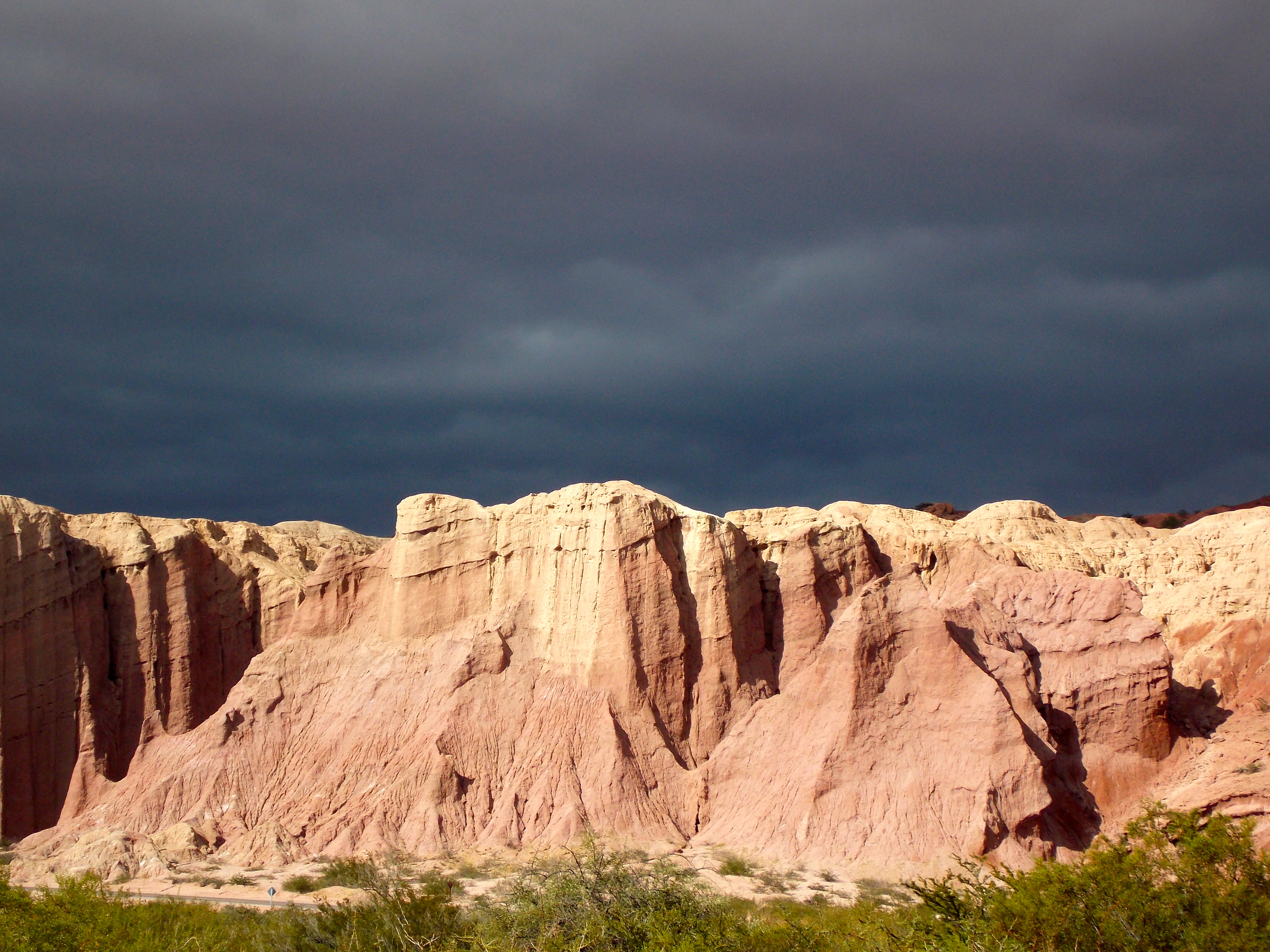
When we arrived at 11,000 feet I was surprised at the desert nature of the environment, especially all the cardones: cacti. We stopped in Los Colorados, a beautiful canyon of red rocks, spent some time in the town of Cachi, and the next day visited Molinos, where the home of the last Spanish governor of Argentina is now a hotel. Later in the day we toured through two stunning canyons: Quebrada de las Fleches (Arrows), and Quebrada de las Conchas (Shells). The cacti and the rock formations and colors were reminiscent of the American southwest, but I knew something very different was just ahead.
DIA UNO

There was a very small Church in the Clouds, at the top of the pass.
The size and Spanish architecture of the church in Cachi reminded me of the Alamo.
DIA DOS

Early morning desert scene at 11,000 … guess it’s what they call a high desert.

Mr. Guzman weaves the ponchos that the President of Argentina gives to visiting dignitaries.

It’s cool seeing mountains, then clouds, and then more mountains.

The town of Molinos. Building on the left is the home of the last Spanish governor of Argentina.
Courtyard of the former governor’s house.

We saw many motorcycles in the canyons of the second day.

The layers and colors of time.
Sun on the cliffs, ominous sky.
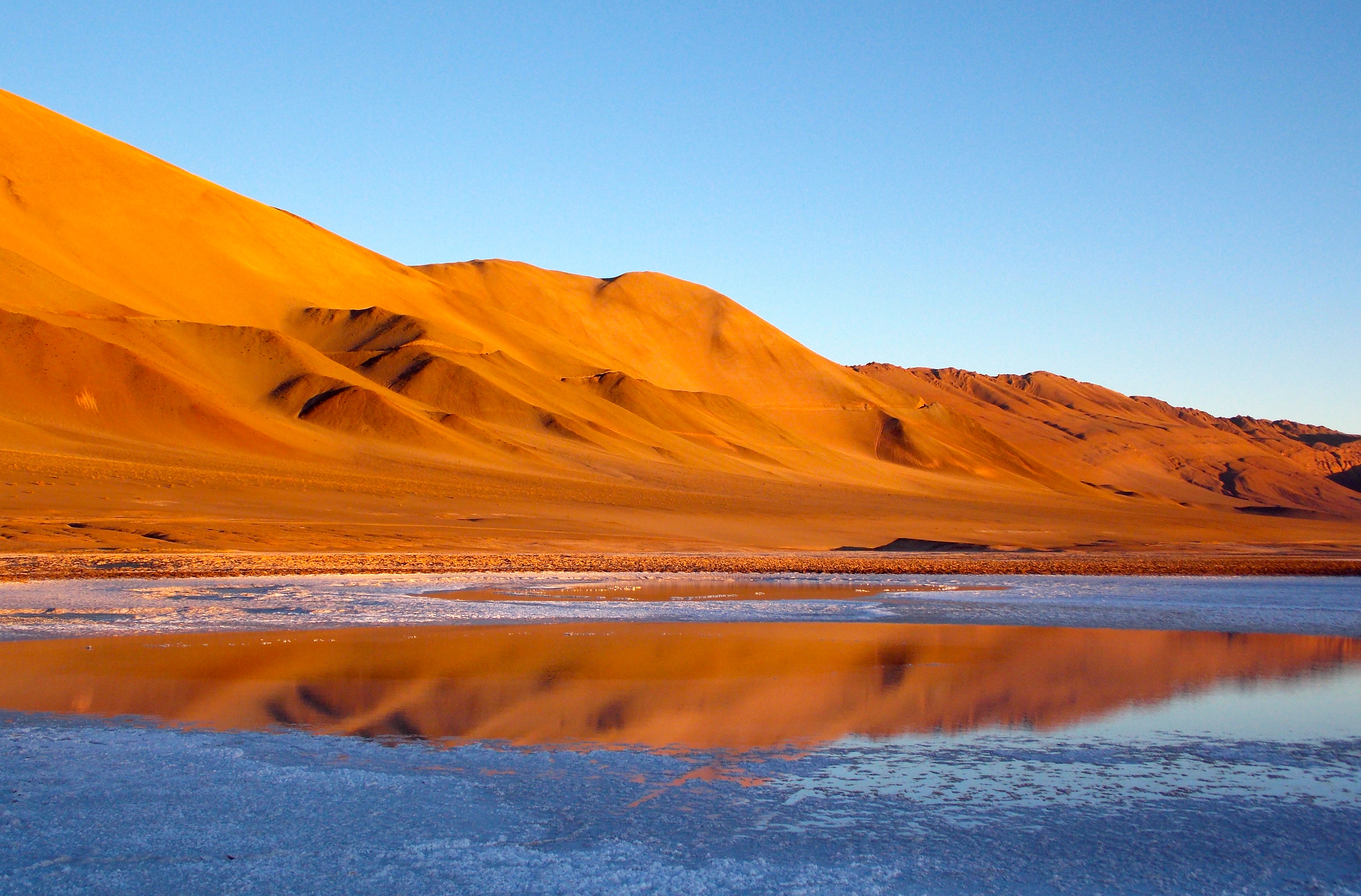
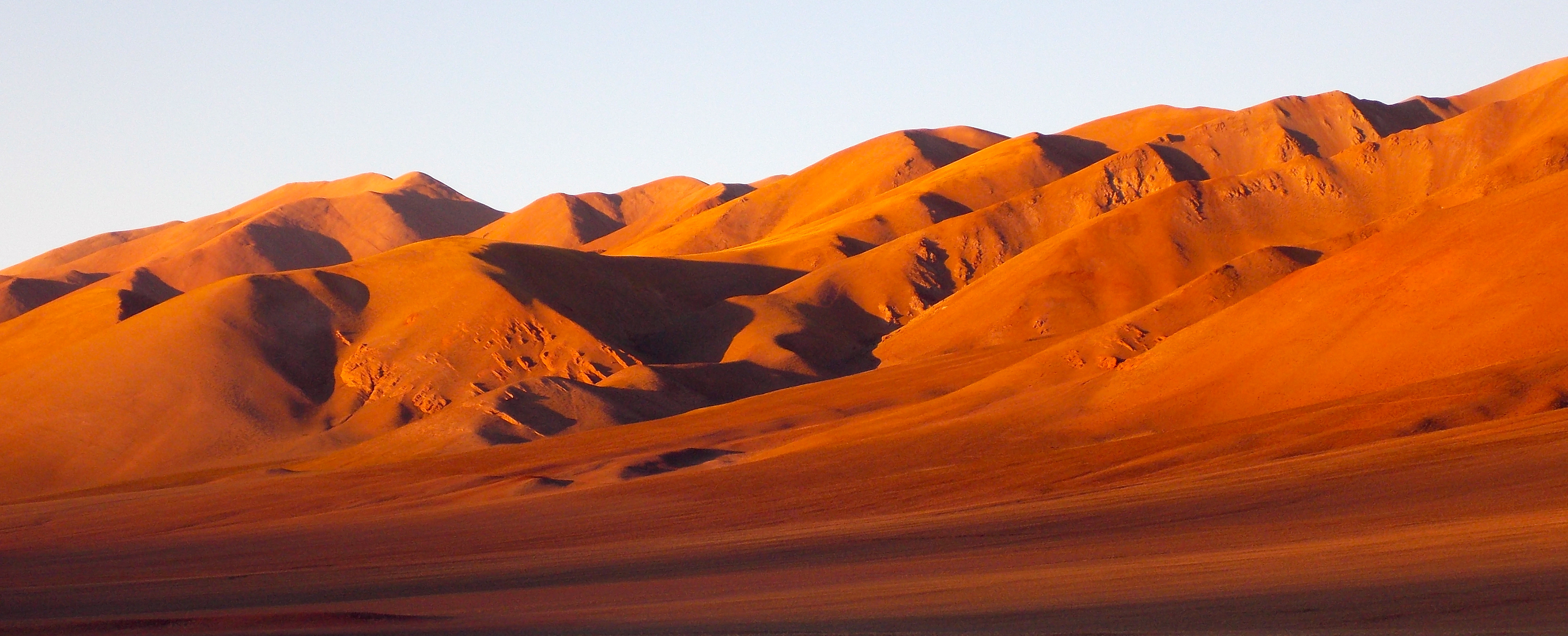
On the third day we drove around many volcanoes, through fields of bright yellow plants, past small groups of vicunas – a graceful animal known as the Andean gazelle – and ultimately into the Puna, the grassland plateau eco-region that extends from southern Peru, through Bolivia, and into northern Argentina. And the following day was the most memorable of the trip as we walked around massive dunes made from sand blown from the nearby pumice field, and then explored the pumice field itself, where you could lose yourself for days in the 1500 square kilometers of geologic wonder.
After a picnic lunch by the side of a road that no one else was traveling, we took an hour-long bumpy, cross-country ride to the far side of Carachi Pampa, the massive volcano that dominates the landscape, to a lake red from iron and just a multitude of photo opportunities. It was Sebastian, me and one lone burro, the only other breathing thing we saw between leaving and returning to the hotel. It was so blissfully serene.
DIA TRES
The road less traveled.


DIA QUATRO

The dunes of the Puna, from a distance.
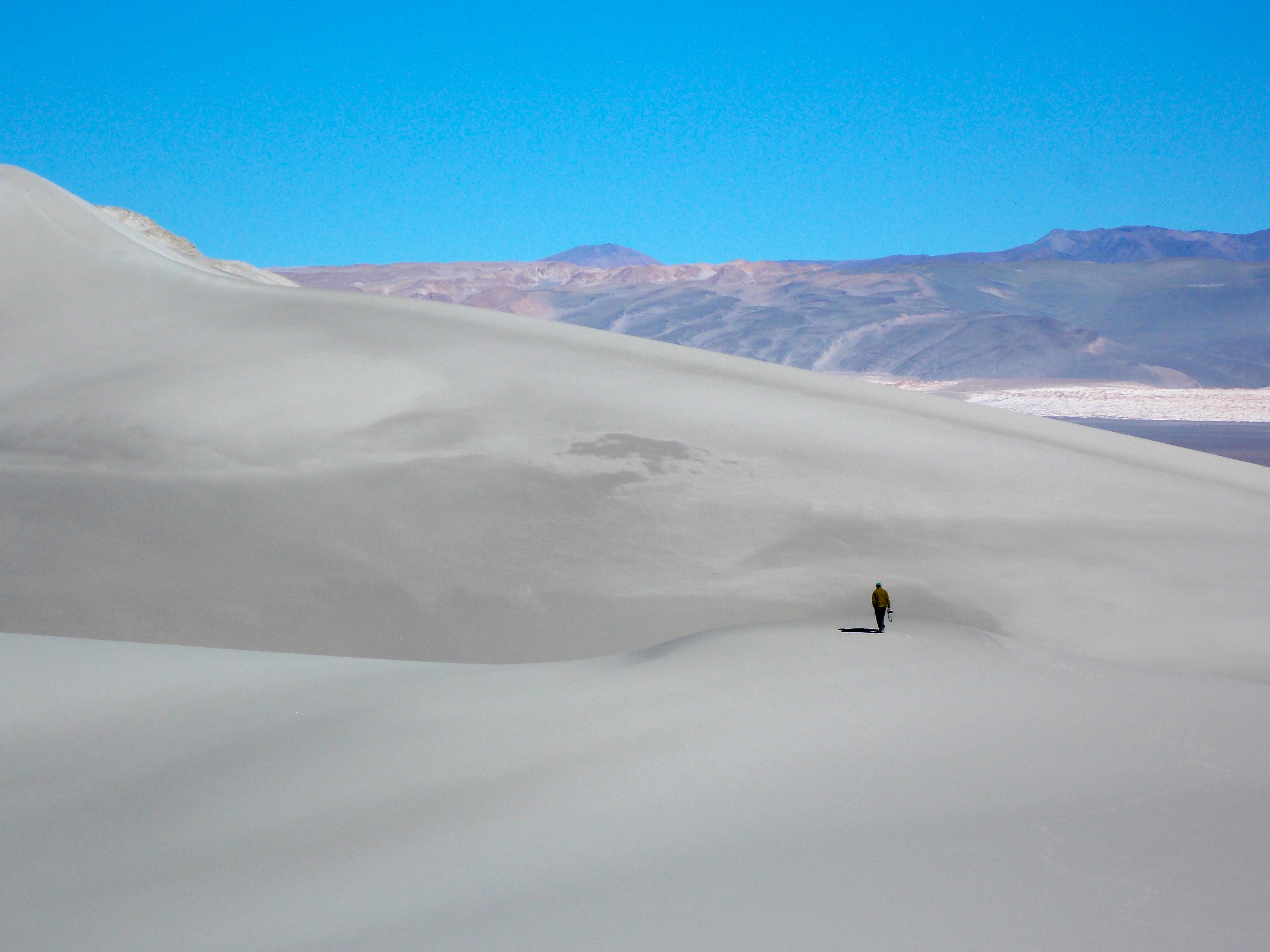
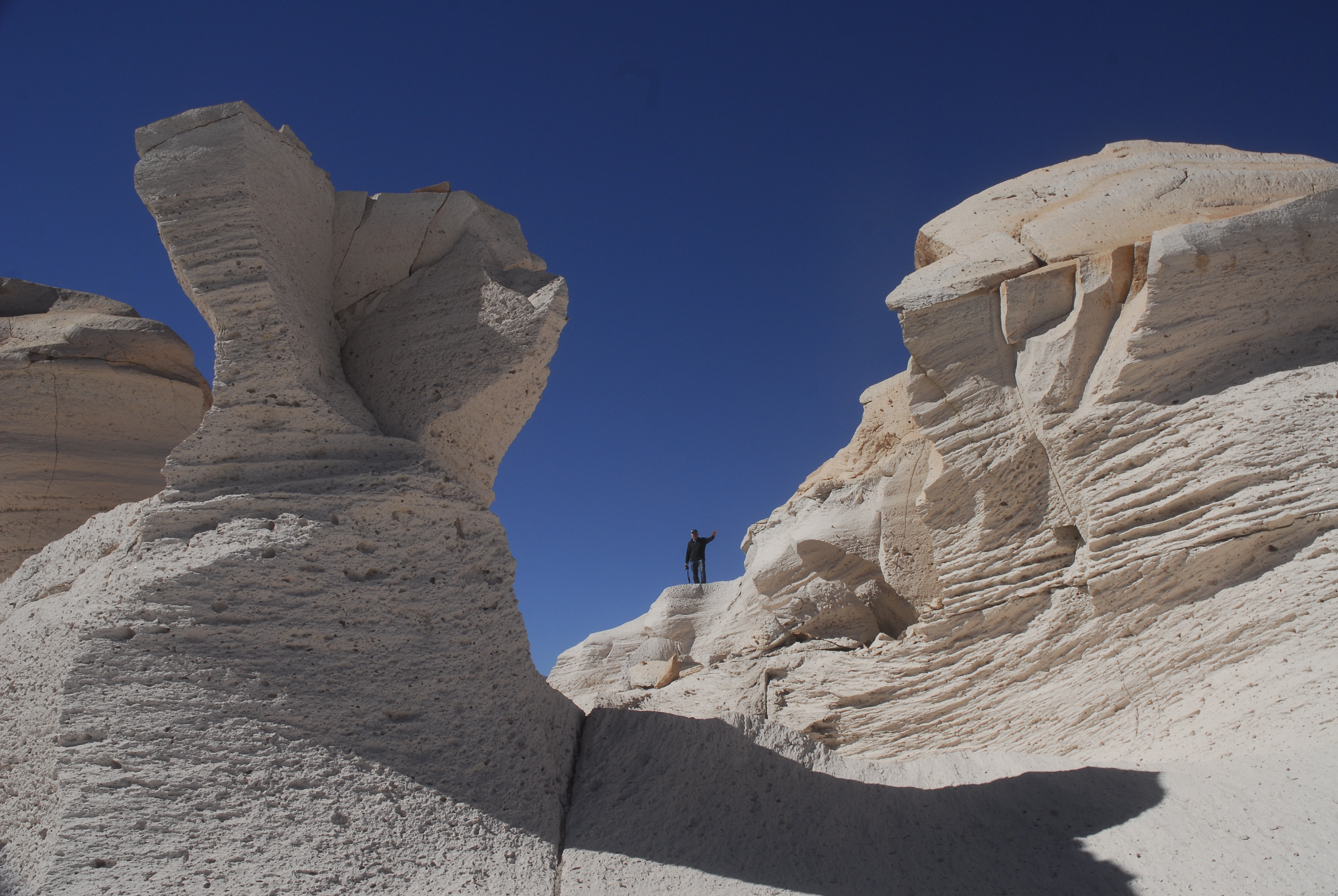
Sebastian provides some perspective on the dimensions of the dunes. The sand here is all blown over into this corner of the mountains from …
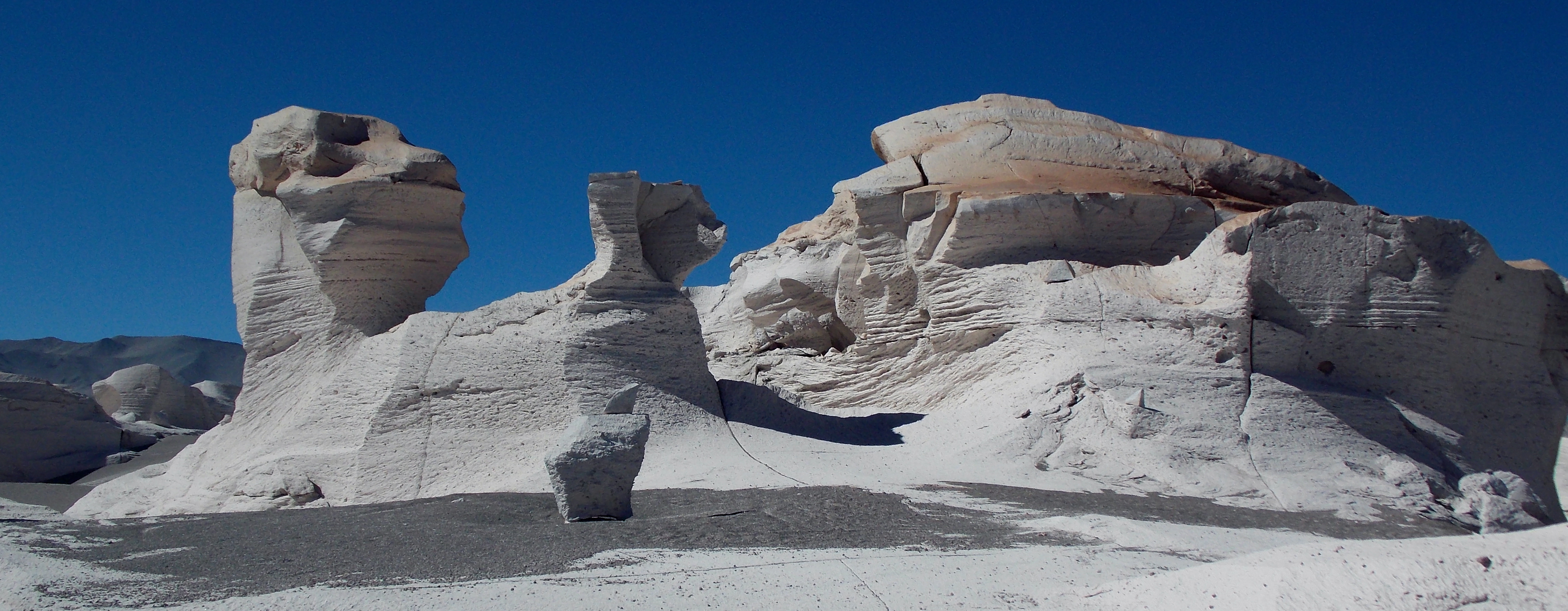
… the pumice field, probably the most unusual and dramatic place of the entire trip.

Did I mention that for five days on the Puna, we never saw a cloud?
Seba took this one.

How often can you get a volcano and a donkey carcass in the same picture?
Between the whiteness of the dunes and the black volcanic rock, the Puna offered so many colors and textures.

I thought flamingoes lived at sea level, but here they are at 11,300 feet. Sand and mud sifting down from the summit cake the crevasses of the mountain behind.

Sebastian removed his boots so he could take …
… this photograph.

Carachi Pampa, with a live donkey this time.
On day five we climbed from the Puna and twice hit 14000 feet. It was a good day for animals: sheep in the middle of a small salt flat, llama grazing in a foot of water, many vicunas. We had lunch at a private home in Antofalla, once a thriving mining town and now home to 15 families who raise a few animals and get support from the government.
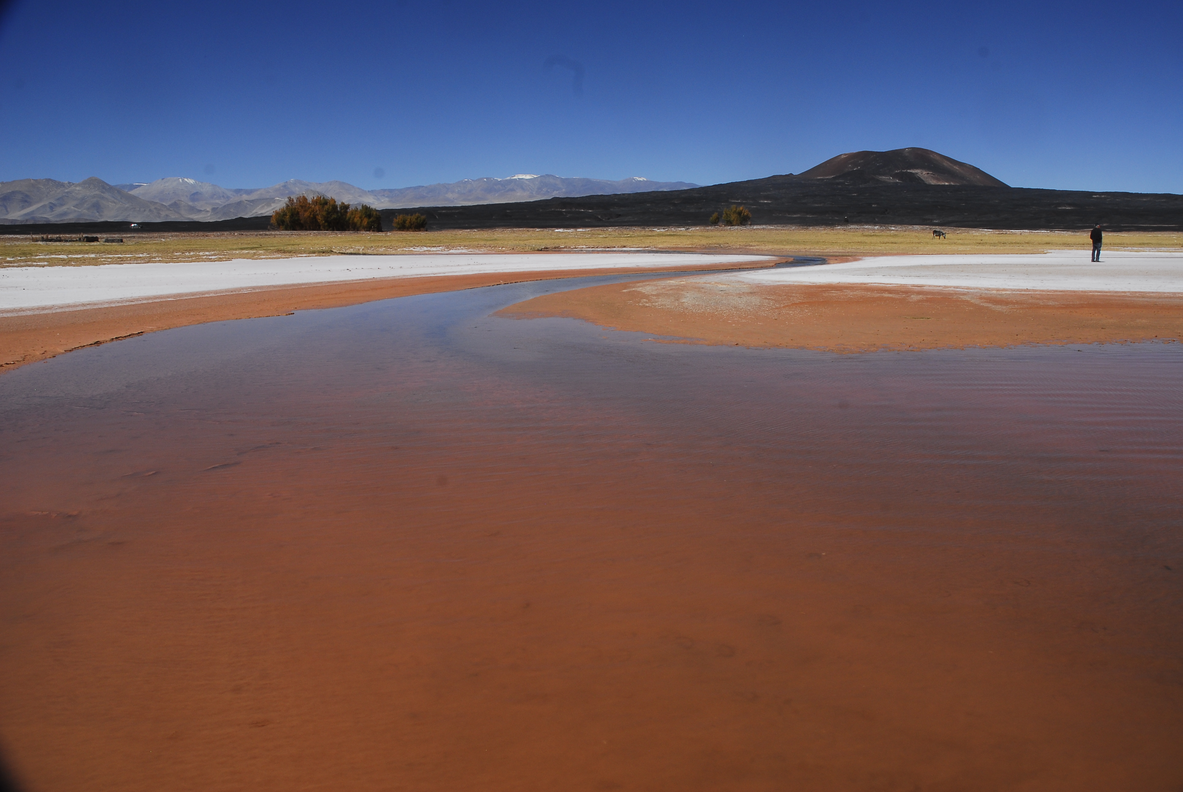
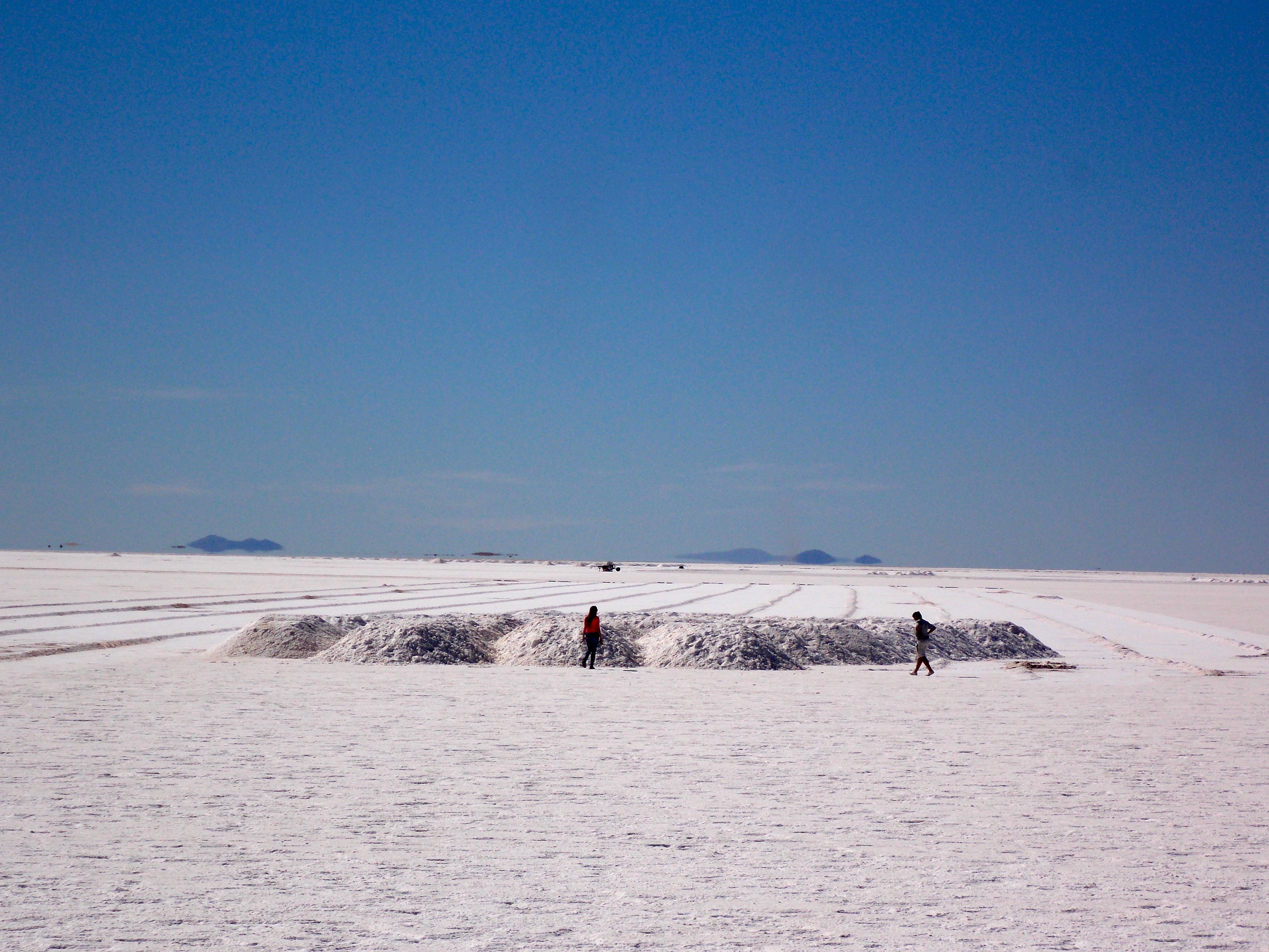
Toward the end of the day we came upon Salar de Arizaro, the third largest salt flat in the world (Bolivia and Chile have numbers one and two respectively) at 6,000 square kilometers; it was an ocean 600 million years ago, and these salt deposits remain. At one end of the flats is a huge cone the size of the Great Pyramid of Egypt. It’s called Cono de Arita, and Seba said it has been there 13 million years, likely the result of an aborted volcano, but “some people think it is from aliens.”
On the long drive across the salt flats to our hotel I started getting tired; the stark whiteness just went on for as far as we could see. “Man,” I said, “everything out here is just so big.” Yes,” laughed Seba. “Except the humans.”
On day six we crossed the flats again and stopped at the abandoned train station at Caipe, where minerals taken out of the mountains left to be transported to Salta; the trains stopped running in 1979. The station wasn’t totally uninhabited though; we were greeted and followed around by two curious foxes. Then we went along some very tough mountain roads to Mina Casualidad, a mining ghost town where 3000 people lived between 1939 and 1979. It was eerie and a little sad walking around this place, seeing pieces of people’s former lives, taking pictures of a place that not that long ago had been productive and vibrant.
We drove over the back of the mountain, and stumbled into a camp of workers who mine crystals of sodium sulfite for use in glass and medicines. They were just starting their day as they work until 3 a.m. It was Saturday, their big barbeque day, and they invited us for lunch; instead of a cold omelet picnic we had steak and salad and potatoes and fruit. We felt very lucky.
We got back to Tolar Grande about 4:30 and Sebastian said we’d leave at seven for some sunset shots at a lake just outside of town. We got some nice shots and it was amazing to watch in the colors and shadows change so quickly as the sun descended.
DIA CINCO

Llamas wading.
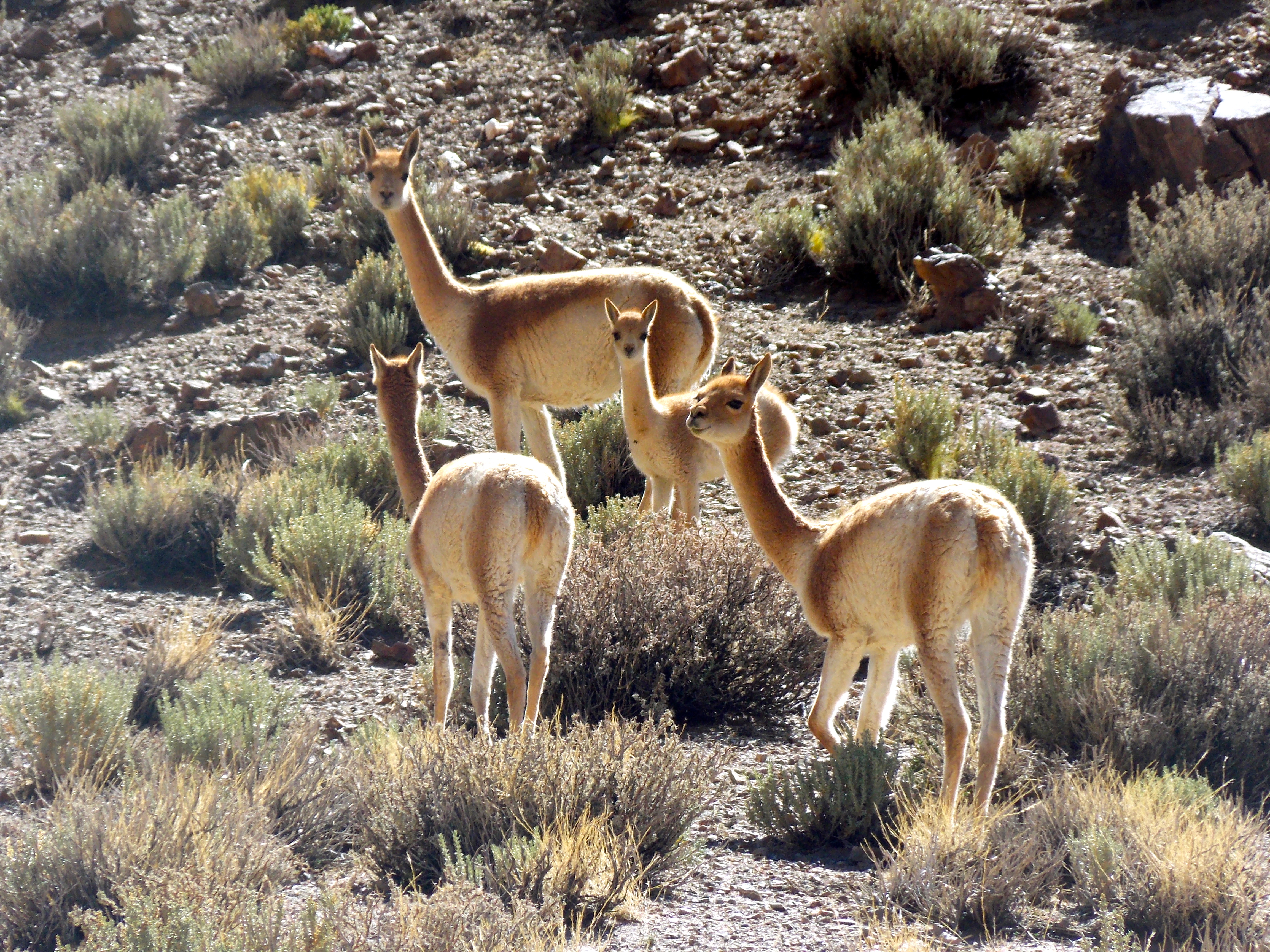
- Vicunas grazing.
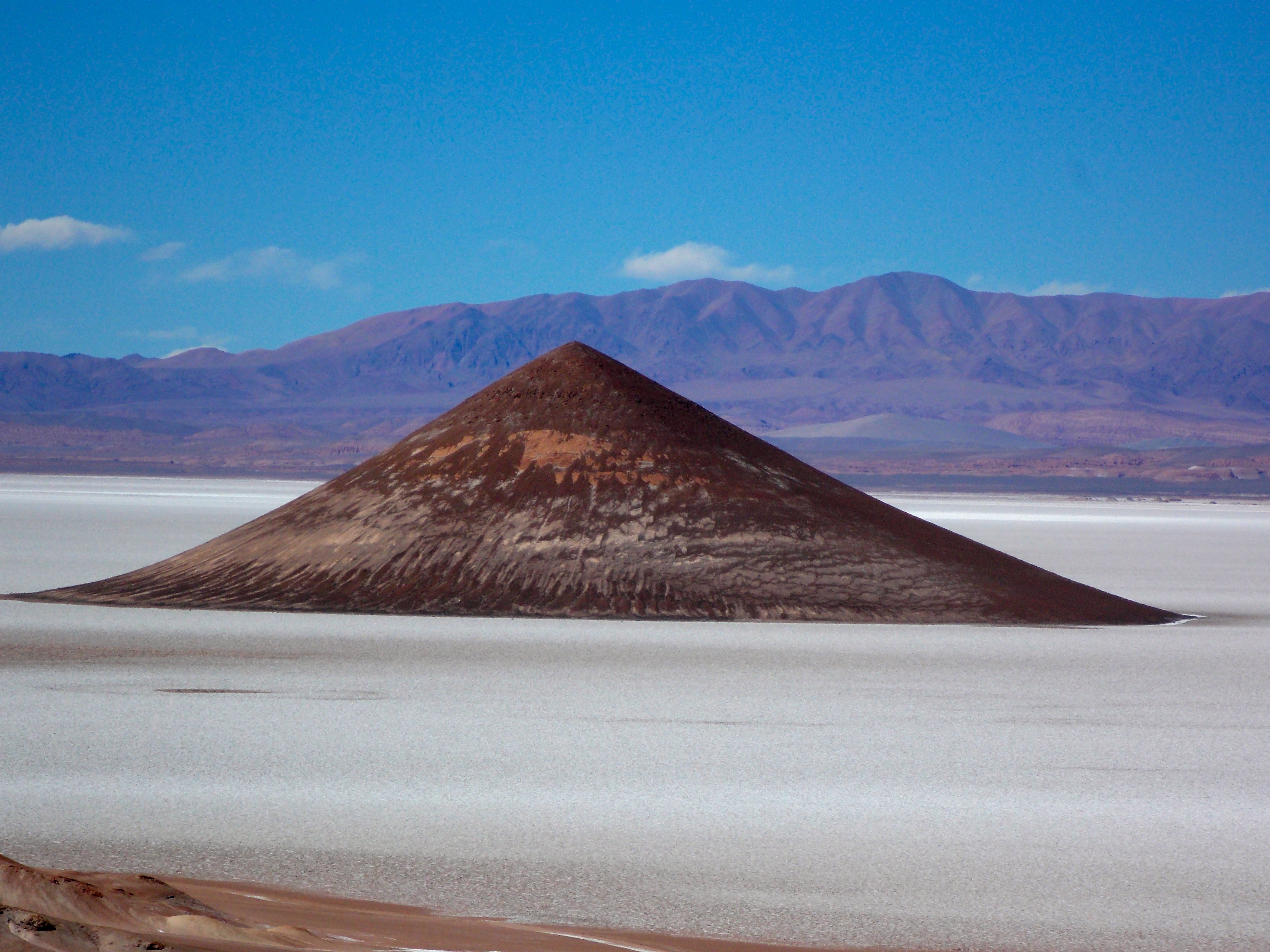
The mysterious Cono de Arita rises out of the Salar de Arizaro salt flats.

Another view of the Cono, across the salt.
DIA SEIS
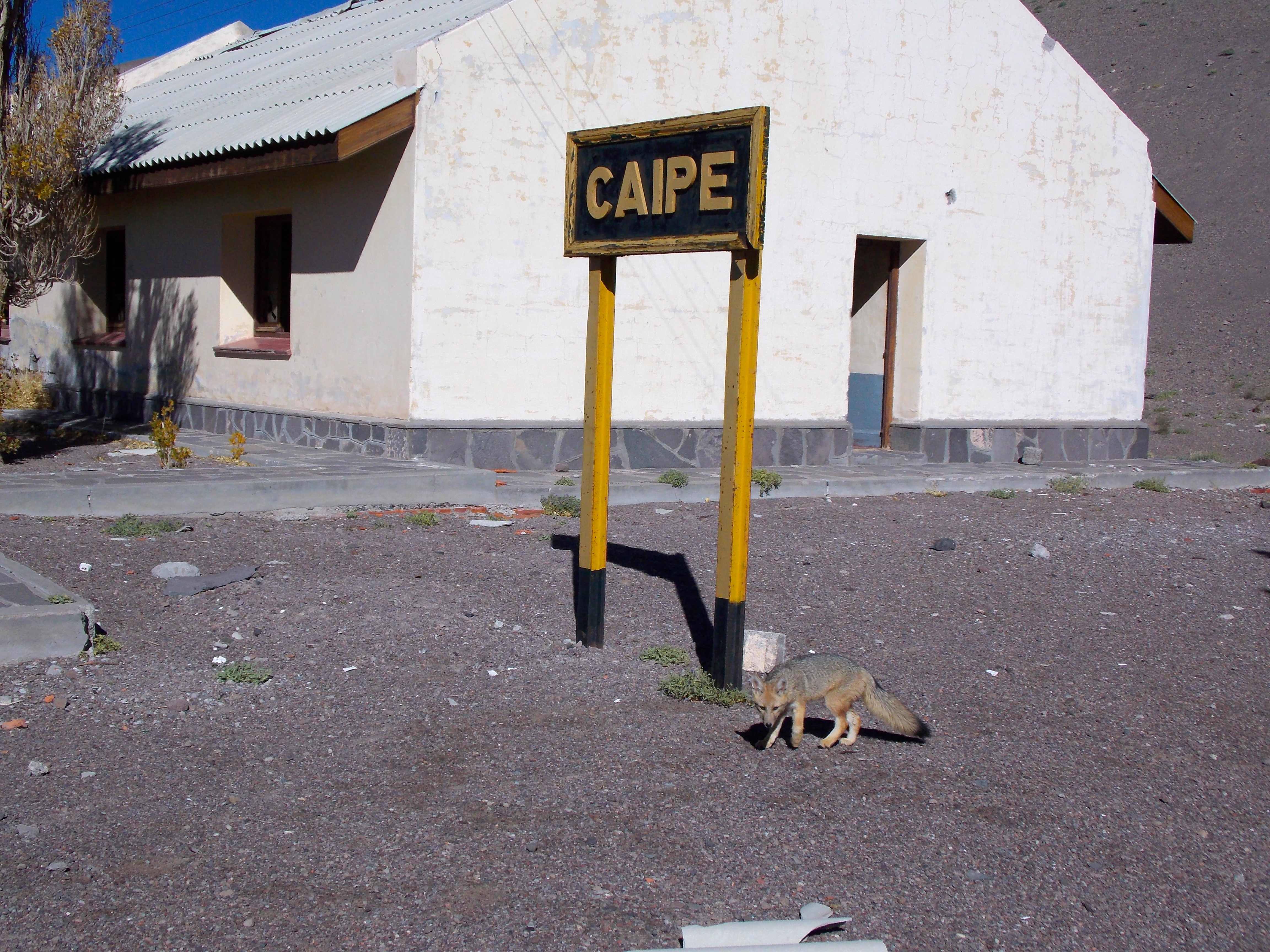
This fox and his buddy followed us around the old train station at Caipe.
View of the deserted mining town of Mina Casualidad.

The former nursery school and children’s park at Mina Casualidad.
Some of our lunch hosts, with Sebastian in the back.
At sunset, outside Tolar Grande.

We started out day seven by driving through the Labyrinth, a ten million year old fossil dune desert with many interesting geologic formations. We crossed a pass at 14,820 feet, the highest point of the trip, and started down toward Salinas Grande, another huge salt flat where they currently mine the salt by scraping the flat with heavy machines, trucking it to the nearby refinery, mixing it with some stuff and then sending it to a grocery store near you. The rest of the day was spent on a short climb and then a monster switchback descent off the Puna, another day at the office for Sebastian, ninety minutes of torture and sweaty palms for me.
On the final day of the trip we awoke to the news that there had been three minor earthquakes earlier in the morning close by, just over a nearby mountain range, and at lunch we learned a quake in Iran had killed some 50 people. “Pachamama is not happy,” Sebastian said. We hiked up and took some shots of The Mountain of Seven Colors, saw a very unique cemetery on the side of a small mountain, and walked to the top of the ruins of an Incan pukara, or fortress; we were on the Incan Trail, one of three paths the Incans had taken south from Peru, and this was a strategic point in the ultimately futile effort to withstand attacks from the Spanish.
In a town called Humahuaca we visited a monument to the native Indians; met a very attractive young woman who was working her way to Equador selling her ceramic wares; listened to a great Andean band in the town square; and finally, at the stroke of noon, witnessed a mechanical priest emerge from a second floor window in the local church and bless the throng below. Spiritually energized, we took off for the final stretch drive back to Salta.
DIA SIETE
A varied geological tapestry near the Labyrinth.

At 14,820 feet, the highest point of the trip.
A salt pile ready for transport on Salinas Grande.
DIA OCHO
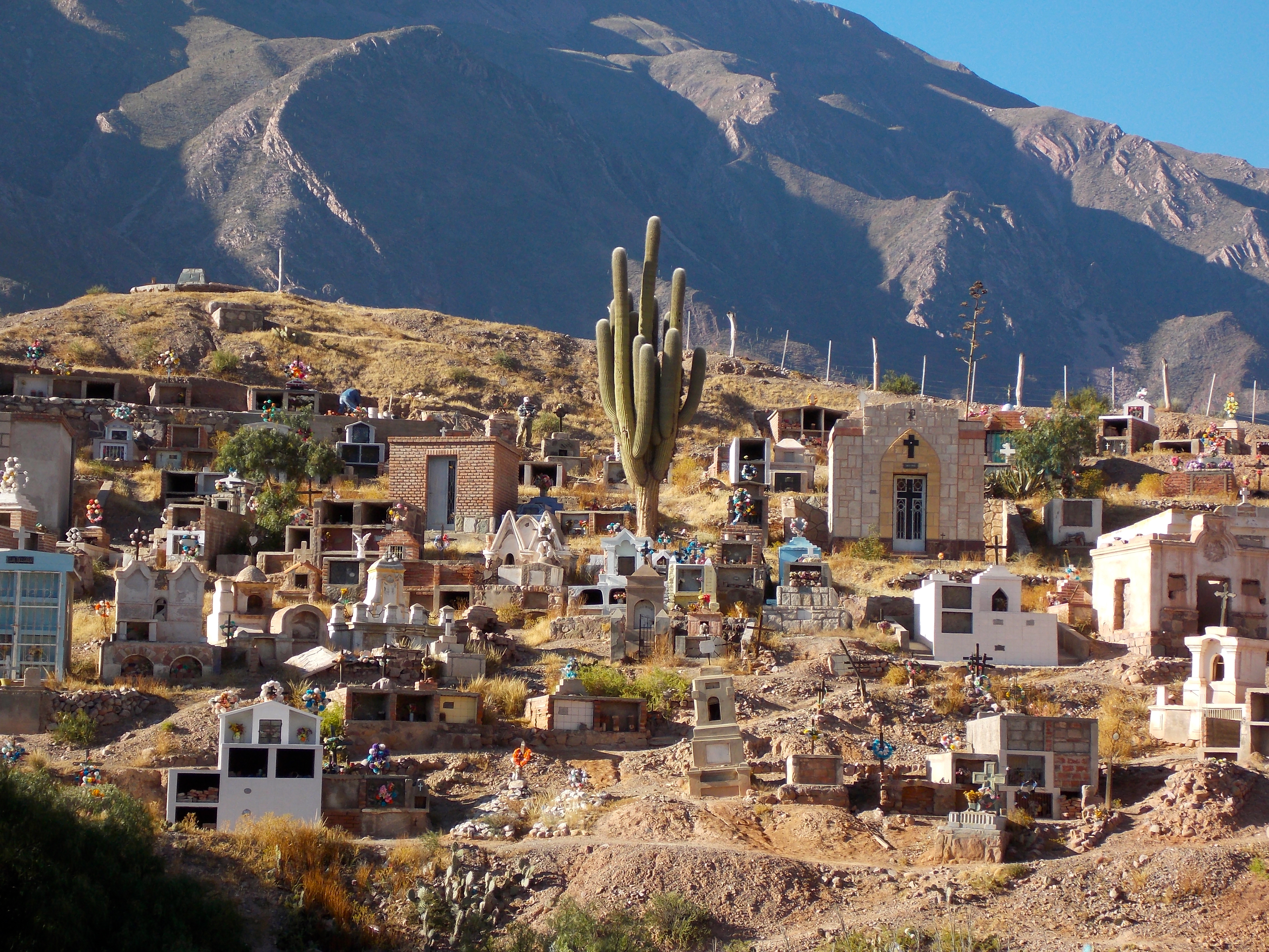
A different kind of cemetery
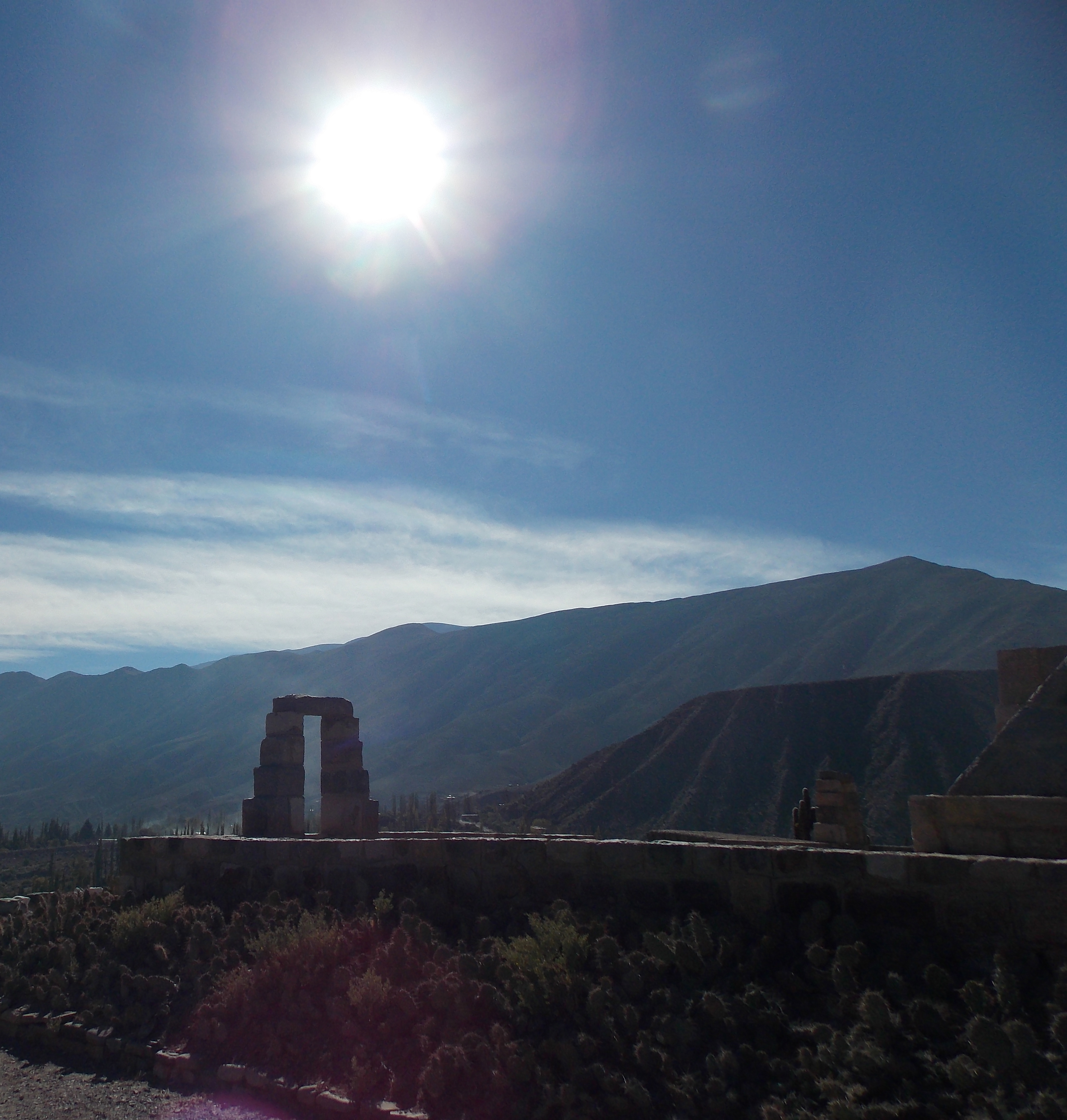
The ruins of the Incan fortress at Tilcara.

The monument to the native Indians in Humahuaca.

Pretty girl selling her ceramic pieces.
You had to admire the passion these guys brought to their Andean songs.

The mechanical priest blesses the crowd.
I know those other places in South America that were recommended are wonderful and I hope to see them one day, but this week in northwest Argentina was special on so many levels. The scenery was stunning, the opportunity to focus on photography a joy, and the incredible peace and solitude were therapeutic. An added bonus was to enjoy all of this in the company of a guy whose friendship and knowledge I appreciated . “You, my friend, are not a tourist,” Sebastian said as we shook hands at the Salta airport. “You are an explorer.” That’s a compliment I’ll cherish for a long time, along with the memory of my days seeing Pachamama in all her Argentinian splendor.

Categories: Uncategorized
The Mysteries of Easter Island
Is there a more unique and compelling place in the world than Easter Island? Most people are at least vaguely aware of the island and its mysterious Moai statues, but few have visited here because it is just so remote. The nearest inhabited island is 1,300 miles away (Pitcairn Island, with 50 residents) and the nearest continental point is almost 2,200 miles away in Chile. This time of year only one flight per day arrives to Easter Island, from either Santiago or Papeete; in the peak seasons it increases to 16 flights per week.
I arrived on the weekly red eye from Papeete and landed on the longest runway in either Chile or Polynesia, more than four kilometers in length. Some years back NASA paid to have it expanded to serve as an emergency landing spot if the space shuttle ever got into trouble out here in the middle of nowhere.

The island is triangular, and just 63 square miles. There are surprisingly few trees, and the coastline is rugged and very links-like; a golf course architect would see a myriad of possibilities here. It’s not nearly as mountainous as Tahiti, the elevation changes provided by the four large volcanoes and 70 smaller ones that punctuate the landscape. I visited the largest volcano, Rano Kau, the first day; it’s 1.5 kilometers in diameter and as perfect a volcano as you’ll ever see, although a big section of the crater rim to the east looks like someone took a bite out of the pie crust. Rano Kau last erupted 2.5 million years ago.

There are 7,000 inhabitants of Easter Island, 4,000 native Rapa Nui and 3,000 mainland Chileans who cannot own land but rent because there are jobs and no taxes. Like Tahiti, tourism is the primary industry, with 100,000 visitors per year; there is some fishing and a little bit of agriculture, but that’s about it. Everything the locals and hotels need is imported, a challenge because there is no port. Onions or autos, it is all offloaded onto barges and brought ashore. Hanga Roa, in the southwest corner next to the airport, is the island’s only real town.
In the Kuala Lumpur airport I met an adorable little Kiwi girl on her way home to Auckland who told me Easter Island got its name because the Easter bunny lives there. She was close. The first European visitor to the island was a Dutchman named Jacob Roggeveen who arrived on Easter Sunday in 1722, and so named it. Unfortunately when we were there the Easter bunny was in abstentia, gearing up for his big weekend. Or is it her big weekend?
The Polynesians who first arrived here around the year 400 called it Te Pito O Te Henua, “The Navel of the World,” (every island in Polynesia has a navel) and eventually Rapa Nui, “The Big Land.” All the indigenous people became known as Rapa Nui. The first to migrate here were the long ears, Polynesians who wore heavy jewelry in their ears to elongate their lobes. The second migration hundreds of years later brought the short ear people, who were welcomed by the long ears and then informed they would be doing the hard labor. Thus enslaved, it was the short ear people who not only carved but also transported the legendary statues, the Moai.

Between the years 800 and 1600 the Rapa Nui made or started to make 900 Moai to represent the incarnation of the spirit of their kings and chiefs, who were buried in the ahu, the elaborate stone altars on which the Moai were placed. In this way the Moai represented a resurrection of sorts for the chief: eternal life. The statues all stood along the coast and faced inland, toward the families they were there to protect.
The Rapa Nui had no metal and used the harder obsidian and basalt rock as tools to carve the statues out of the softer volcanic tuff. Each Moai included the head and torso, long ears, arms, and hands folded in front of the

“Topknots” provided the chiefs’ red hair.
belly, with long fingernails. In later years the chiefs started dying their long hair red and wearing it knotted on top of their head, so the newer Moai also featured a red “topknot” that was carved at a separate quarry where not long ago 700 topknots were found. Once the statues were solidly anchored on the ahu the eyes were added, usually made of white coral, and only when the eyes were in place was a Moai considered alive.
The individual statues averaged about 16 feet high but several have been found over 30, and they weigh between 40 and 80 tons. The Rapa Nui got more ambitious over the years and the larger statues represent later efforts, rather than more important chiefs.
How they were transported is one of the many Moai mysteries. Natives claim they walked to their respective ahu. Since the island was covered in thick Chilean palm trees, for a time it was believed the tree trunks were used to roll the statues to their location, but that has been disproved. Scientists now find evidence that the Moai did indeed walk, or rather were walked by the Rapa Nui, who picked up one side and then the other, moving it slowly forward as the statue was upright. As with the Great Pyramids or Stonehenge we’ll never know for sure, but what we do know is that 250 of the ahu platforms were constructed – you can see their ruins up and down the coast – and that 400 Moai eventually reached their positions on the ahu.
By 1600 the population of Easter Island had grown to an unmanageable 20,000 and all the natural resources had been depleted, including the trees. The working class short ears finally had enough and went to war with the long ears, in the process knocking over all of the 400 Moai that had been erected around the island. They were toppled face down so the eyes would fall out or be easily removed, rendering them good and truly dead. All of the 36 Moai standing today have been excavated, restored and replaced on their ahu since 1960.
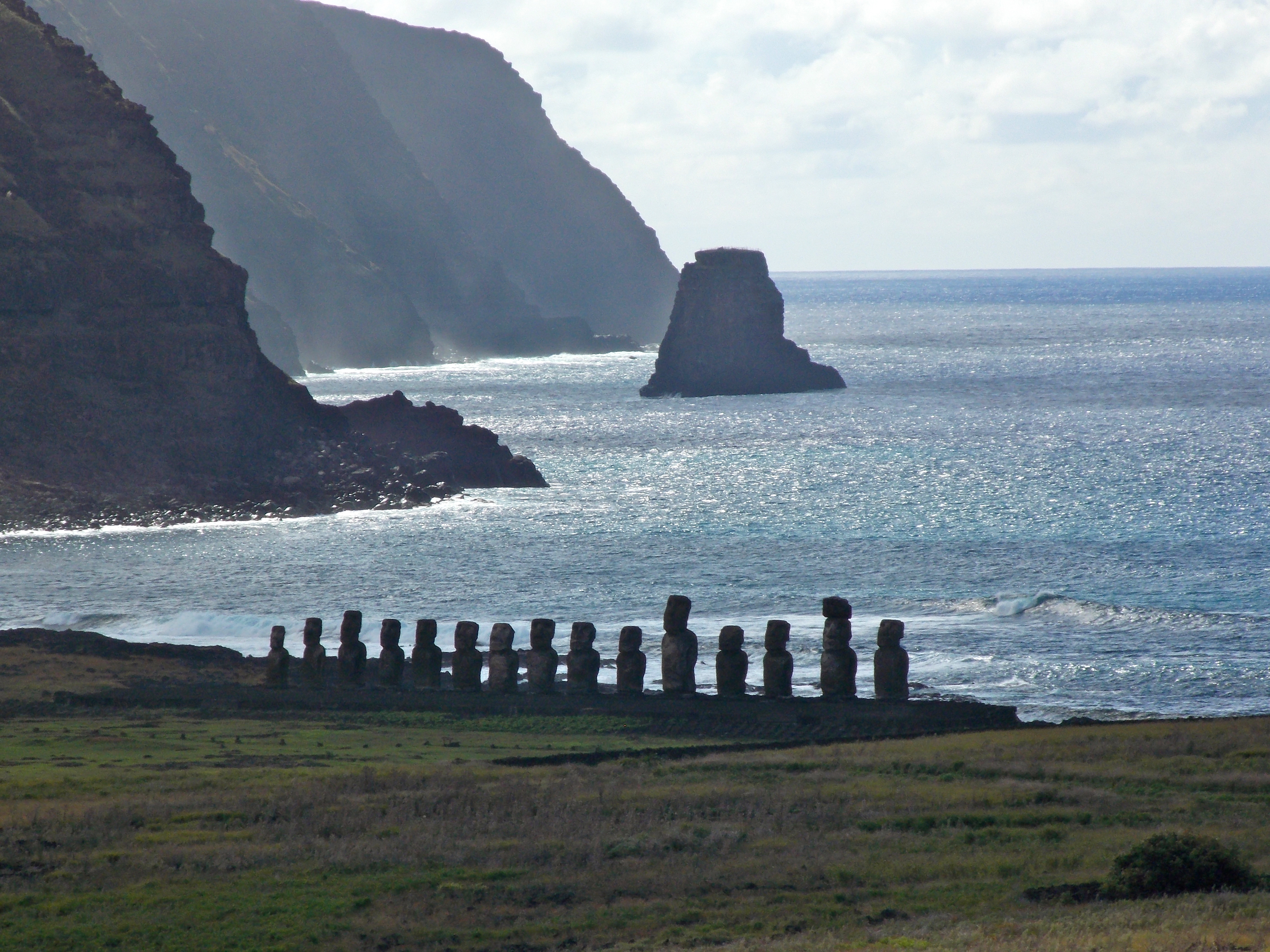
The Ahu Tongariki shrine, as seen from the quarry several miles away.
The most impressive array of Moai today is at Ahu Tongariki on a stunning piece of property on the northeast coast of the island. In 1960 the ruins of this shrine were devastated by a tidal wave, but in 1991 the Japanese company Tadano, which makes cranes and other large construction equipment, undertook a massive excavation project. The company’s motto is: “Tadano can even lift history,” and they proved it; Ahu Tongariki is the largest shrine on the island, and the 15 statues here lord over the plain to the west, impassive and yet fierce.

I should have included more people in these pictures for scale, but hopefully the guy in the green shirt provides some perspective.
We visited the only Moai not on the coast, the seven statues of the Ahu Akivi. They do not represent chiefs or kings, but rather explorers sent by an ancient king to find an island he saw in his dreams. They face “home” … west, to Polynesia.

The seven explorer Moai of Ahu Akivi, facing west to their Polynesian homeland.
Adjacent to Anakena, the best beach on the island, is Ahu Nau Nau, which features five full-sized Moai, four with topknots.
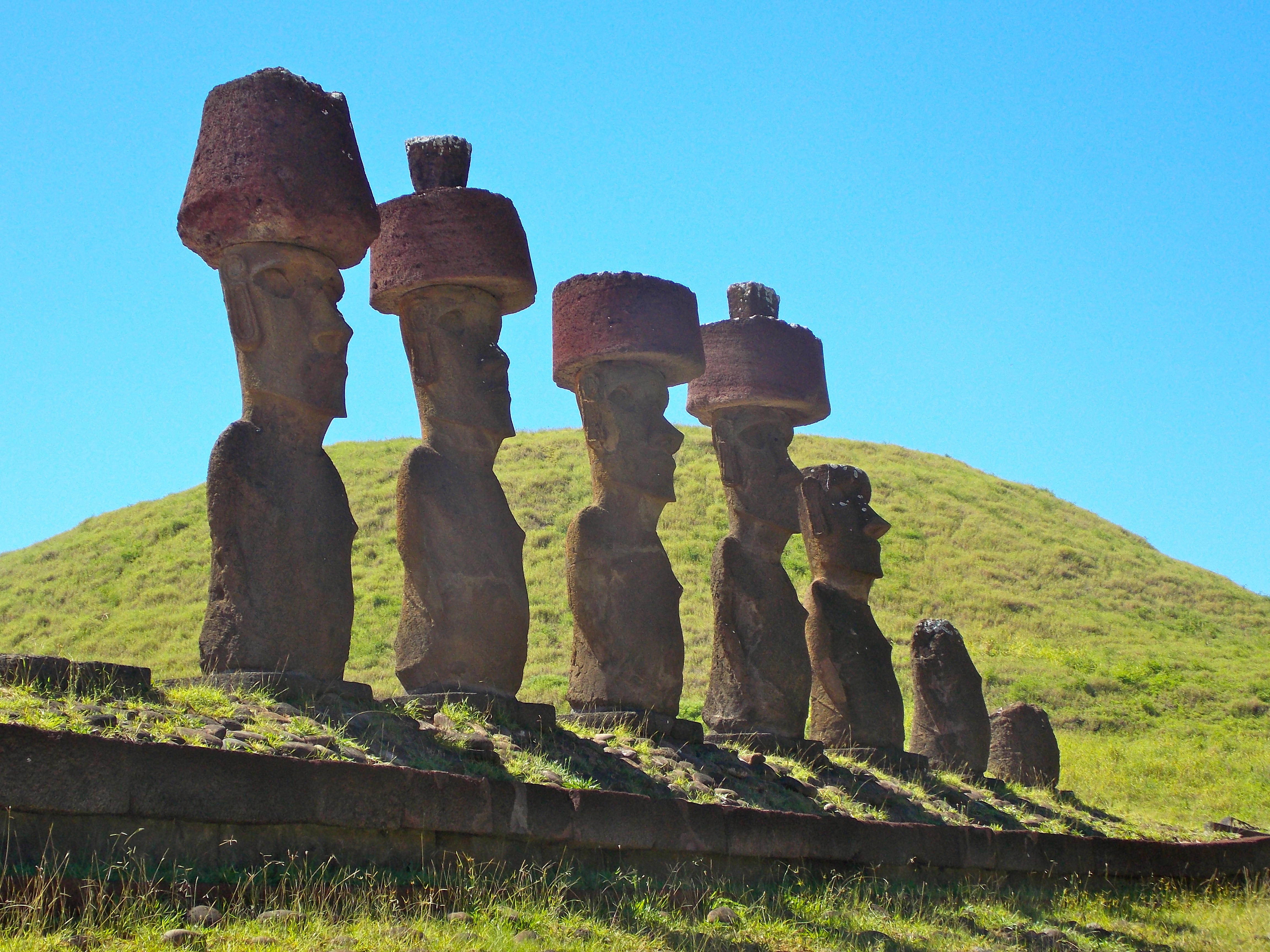
Ahu Nau Nau
And within walking distance from my hotel was Tahai, a complex of three small temples featuring Moai that draw a crowd every evening as the sun sets behind them.

The temple at Ahu Tahai is a popular spot at sunset.
But the coolest place of all is Rano Raraku, the volcano/quarry where most of the Moai were carved. Of the 900 discovered statues, 400 are still in the quarry, in various stages of completion. Some are just heads, some have been half buried over time, some are still embedded into rock on the side of the volcano. The Moai on the various ahu around the island have been excavated and restored over the past 50 years, but Rano Raraku seems so authentic, and provides insight into the remarkable effort that went into creating just one of these massive icons. Some of the completed Moai at the quarry were never toppled, left standing by the short ears because they hadn’t yet received their eyes.
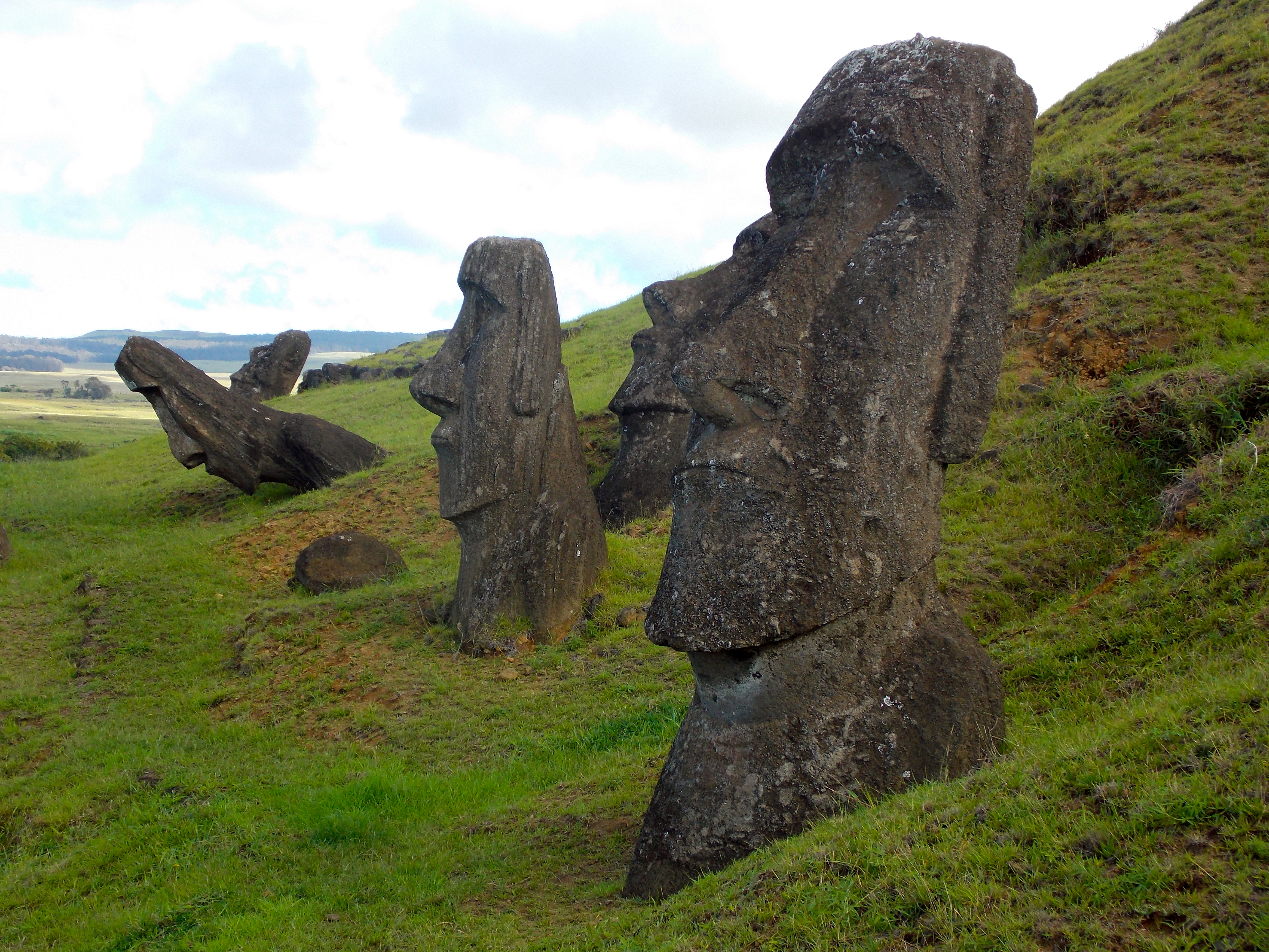
Heads of some of the 400 Moai at the main quarry site.
One quick story before leaving Easter Island. Around 1660, after the war had ended and the royal family had been killed, leaders of the island came together and decided they needed a democratic way to choose a new king. Each family, or tribe, sent a representative to an annual meeting at Orongo, on the rim of the Rano Kua volcano. Just

The far island is Motu Nui, where the frigate birds nested.
off the coast is an island called Motu Nui, where frigate birds nest in September. So they decided on a competition. Each family’s designee would descend the 300-meter cliff to the ocean, swim the kilometer and a half to the island, find the egg of a frigate bird, attach it to his head protected by moss and leaves, swim back to shore, climb the cliff and run to the finish. The first to cross the line with an unbroken egg was declared the winner, and his chief was crowned king for the following year. If we could only come up with a similar system in the U.S., we could eliminate campaign commercials.
The “birdman” competition continued for 200 years, until Christianity arrived around 1864. And now one airplane per day brings people to this remarkable place, to see the captivating remnants of one of the world’s most fascinating cultures.
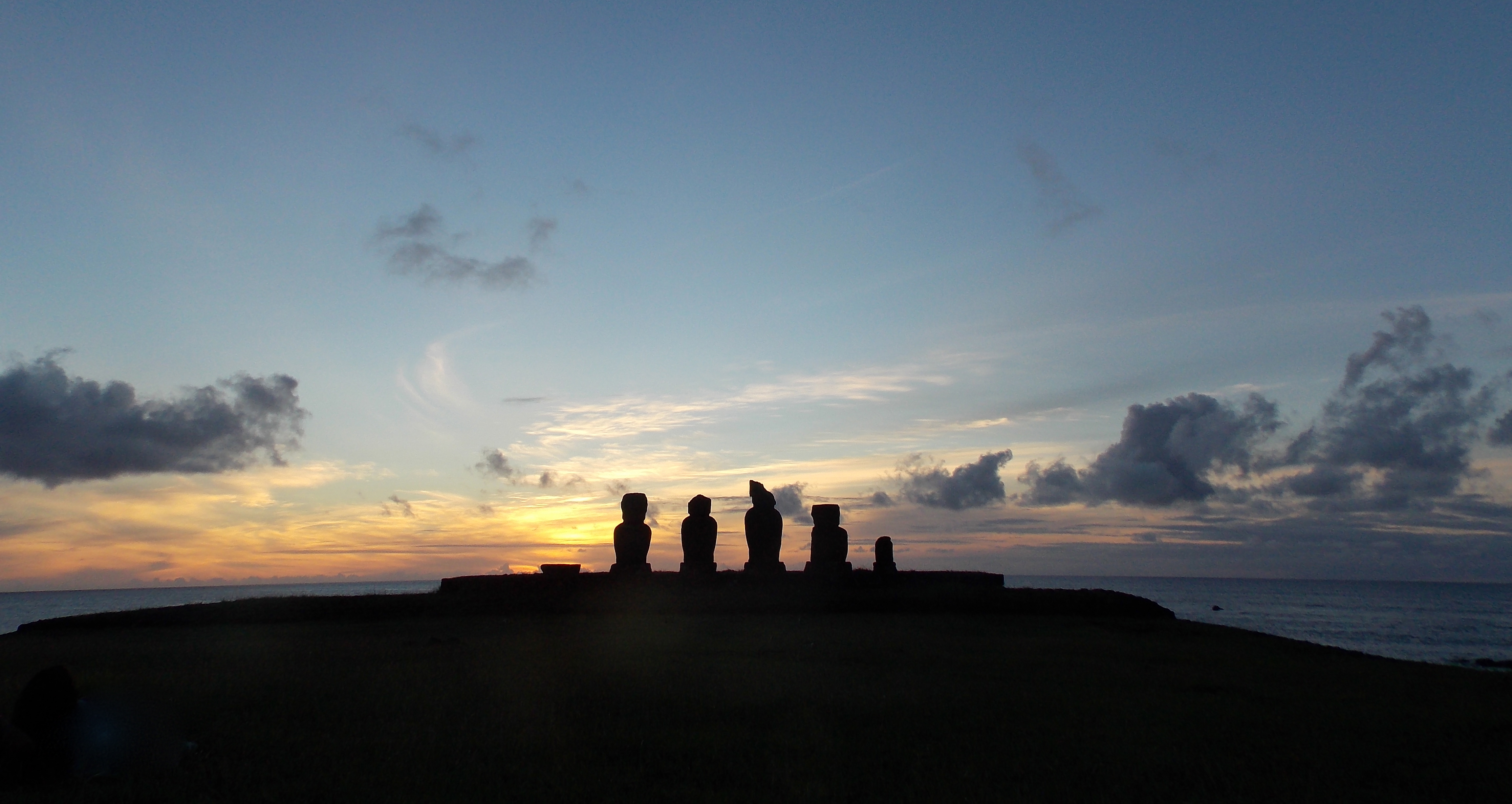
Probably my favorite picture from Easter Island

A group of very nice and fun Colombians pose at Ahu Akivi.
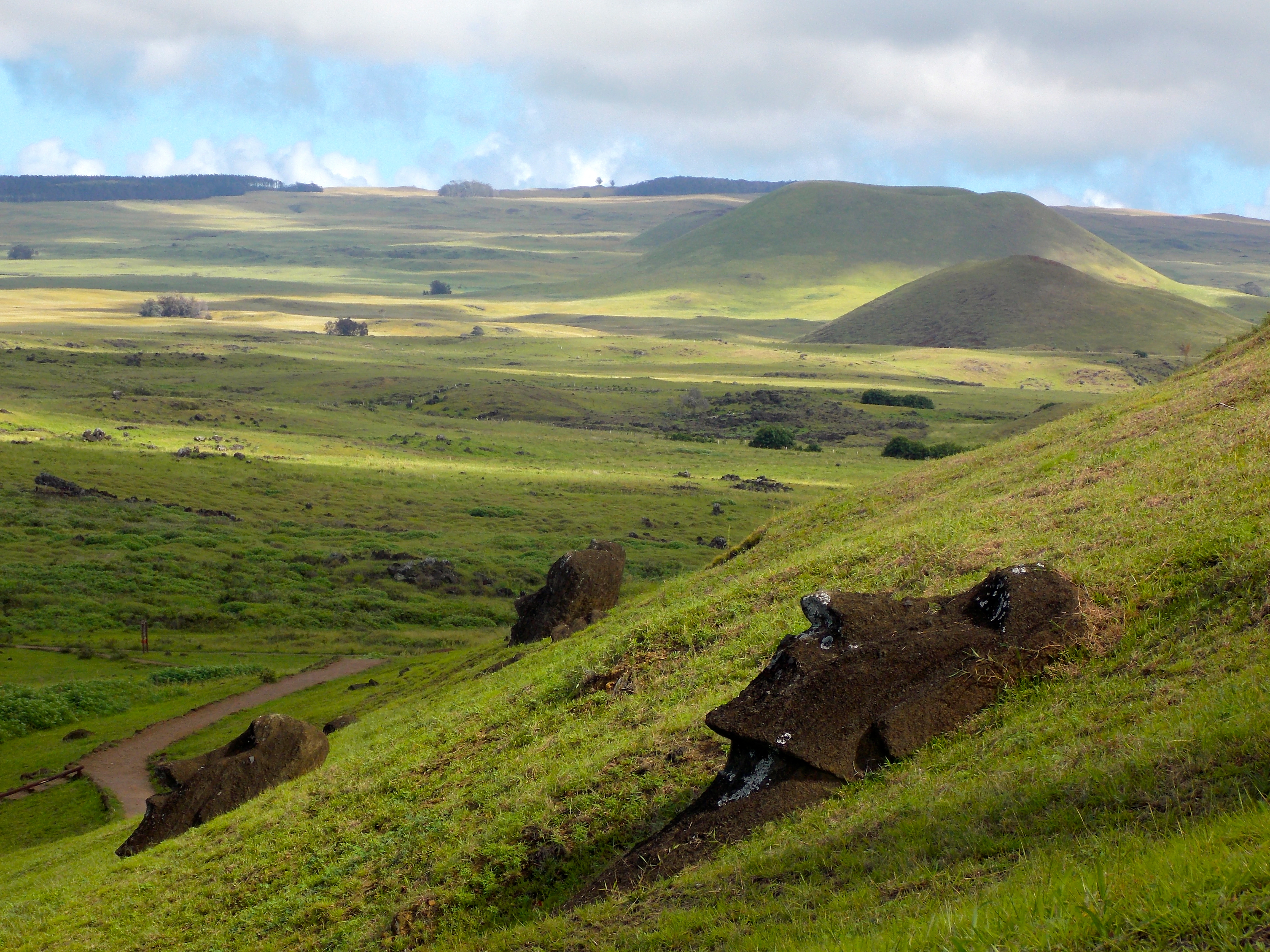
From the quarry a good look at the treeless terrain of Easter Island, and a few of the smaller volcanoes.
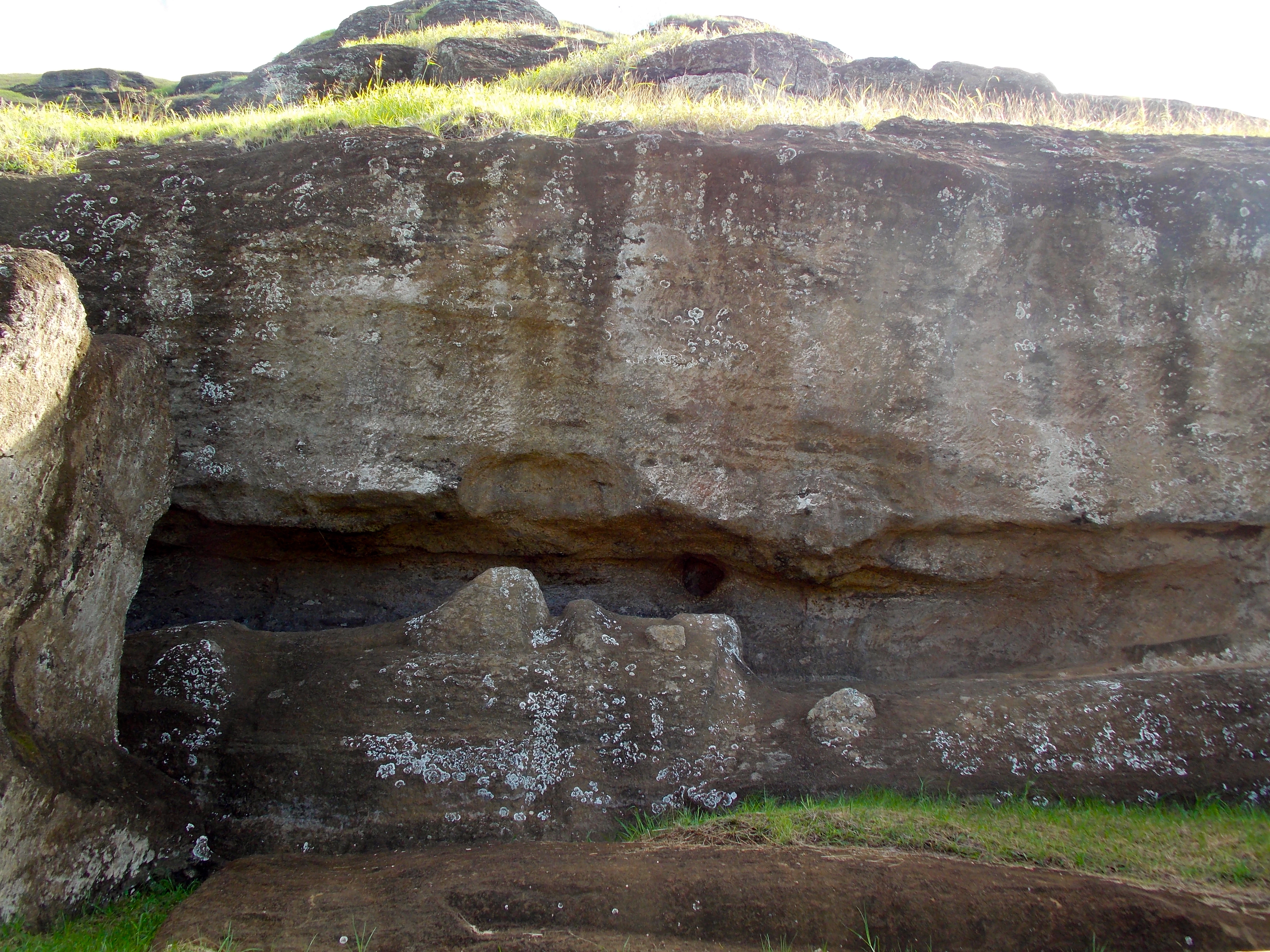
This poor guy never made it out of his volcanic womb.

The colors of the Pacific and the rocky coastline are a stunning combination.
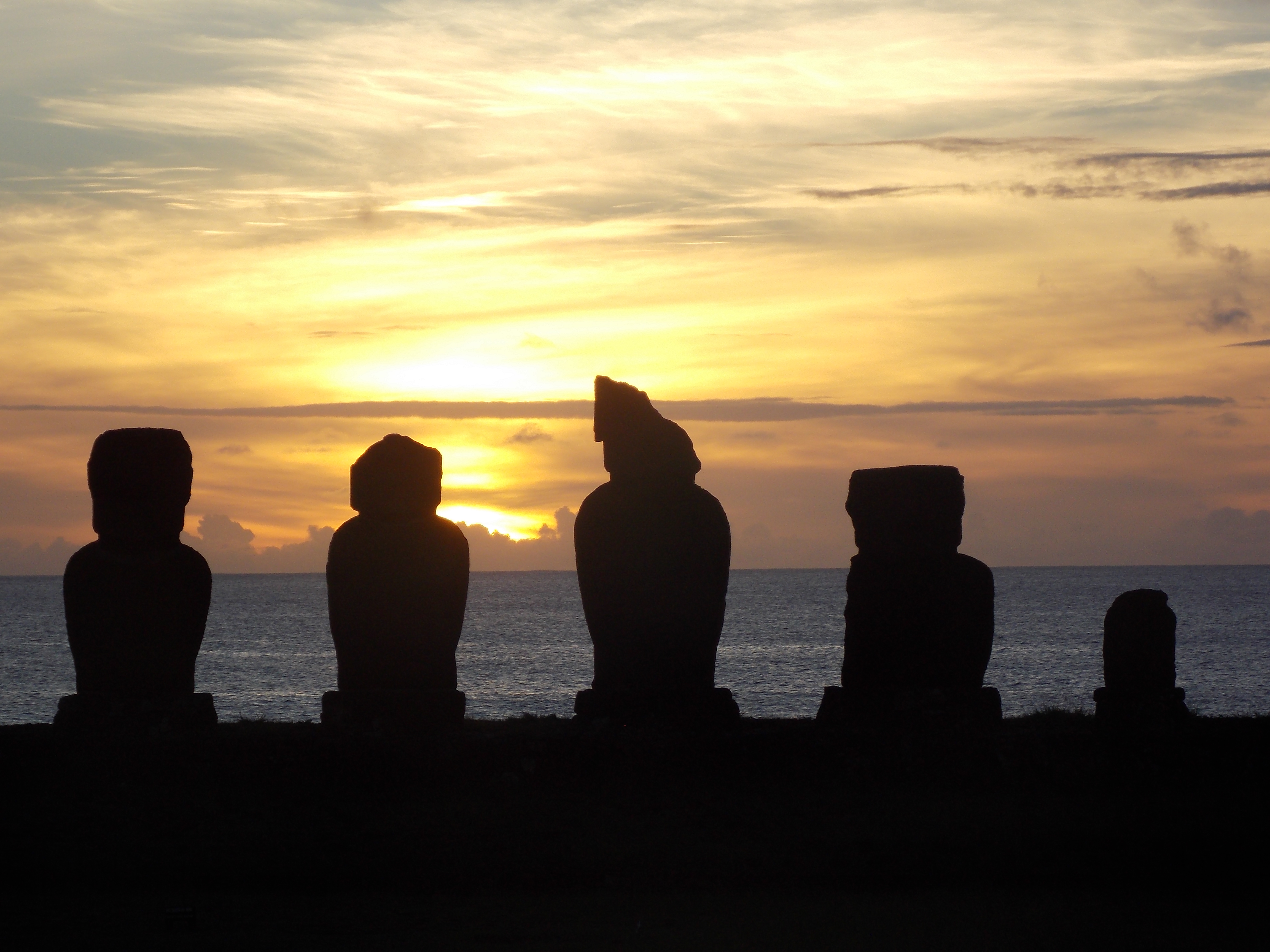
Recognize the fourth guy from the left? We didn’t realize that when he was phoning home, home was really Easter Island. Cheers!
Categories: Uncategorized
Tahiti
(NOTE: I just checked into my hotel in Santiago and figured I’d post Tahiti tonight and Easter Island tomorrow, on the day it is named after. I hope you all have a wonderful Easter Sunday!)
Like most people, I suppose, I’ve long harbored a romanticized image of Tahiti as the ultimate tropical paradise. Friends have told me that it’s crowded and crime-ridden, and that Moorea, Bora Bora and other islands are the places to go, but since I was coming this way I decided to stop for a few days and check it out for myself.
I’ve never flown across the Pacific Ocean before, always up and over Alaska, and it is just enormous, twice the size of the Atlantic. Kuala Lumpur to Auckland was a ten-hour flight, Auckland to Tahiti six, and it will be six from here to Easter Island and five to Santiago, Chile. That’s a lot of water, and within the waters of the Pacific are 30,000 islands, including Tahiti and its surrounding neighbors in French Polynesia.

I did a half-day tour of Tahiti Nui (“big island”) and Dave – a Hawaiian who came here 27 years ago to surf, fell in love and never left – gave us some of the history. Southeast Asians first populated Tahiti more than 1,000 years ago. That fact has been disputed over the years, and a Norwegian named Thor Heyerdahl built a raft he called Kon-Tiki, and sailed from Peru to show it could have been South American natives who first settled here. Despite the fact that Kon-Tiki had maneuverability issues and crashed on some rocks, Heyerdahl made it far enough to demonstrate he could have been correct. But he was ultimately overridden by the most modern of theory-busters, DNA testing, which proved that the blood of Tahitian natives is Taiwanese in origin, as is the language, which probably should have been a clue.
Dave told us that human sacrifice and cannibalism were part of the culture here for centuries, and it took a concerted effort on behalf of the Europeans to eventually wipe out those practices through the introduction of Catholicism. But though they were primitive, the natives here were also adventurous, and between the years 200 and 400 A.D. they explored the far corners of the Pacific and settled in many other places, including Hawaii.

The legendary Captain James Cook stumbled upon Tahiti in the mid 1700s, just prior to also discovering New Zealand and Australia. The natives had no metal, so Cook traded nails and uniform buttons for pigs and fruit. Of course the Europeans also introduced viruses and diseases for which the hearty Tahitians had no recourse, including tuberculosis, which at one point wiped out 60% of the indigenous population.
The British ruled for 75 years and got into a bit of a tussle with the French, but rather than go to war over it they negotiated (what a concept), and after being given some rights that it wanted elsewhere, England turned Tahiti over to France. The language of all the residents is French, and so are a vast majority of the visitors, which came as a surprise; I’m not sure you can get much further away from here than France.
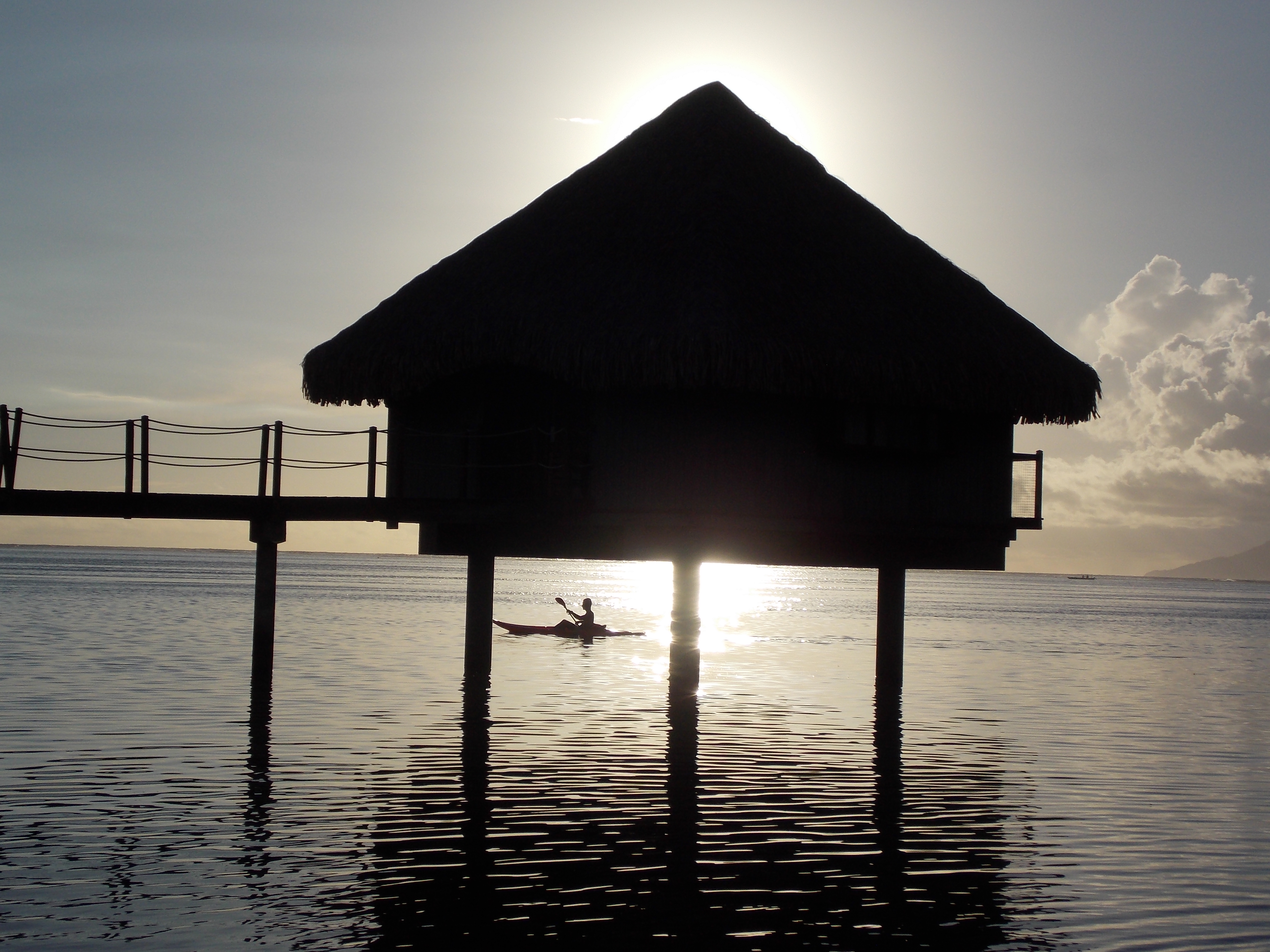
Two guys have probably had more to do with Tahiti’s exotic image than any others: the artist Paul Gauguin, and Marlon Brando. Gauguin left France for French Polynesia in 1895 to escape “everything that is artificial and conventional”, and he never returned. He took a 13-year-old wife, had trysts with several other pre-pubescent girls given to him by their parents – along with pigs and other food – and these girls were featured in many of his paintings. He contracted syphilis and believed the spring waters in a cave we visited could cure him, and it was decades before natives ever swam in that cave again. Gauguin ran into some legal problems and was sentenced to a month in jail, but died before he could serve any time.
Brando fell in love with Tahiti while filming “The Mutiny on the Bounty” here in the early 1960s. Dave showed us  the beach of black, volcanic sand where Brando demanded they import white sand to better contrast with his dark blue officer’s uniform. He married his Tahitian co-star and bought a near-by island called Tetiaroa, where he built a rustic village that he visited often over the next 30 years. But in 1991 his son Christian confessed to killing the Tahitian boyfriend of his half-sister Cheyenne, and Cheyenne later killed herself at her mother’s home in Tahiti, and Brando never returned. A resort called “The Brando” is supposed to open on Tetiaroa later this year.
Today, Tahiti is struggling. Tourism is vital, its number one industry, and the weak global economy is taking a toll; many large resort hotels are dark. The production of black pearls is the number two industry – they are carefully cultivated over many years – but that requires tourists to buy them. Much of the French population is leaving because the government has rescinded some excessive retirement benefits and the French military presence has been cut in half. But Tahitians are still thinking creatively and with optimism; Papeete, the capital, is congested with traffic, so they are developing a second major city up the coast to reduce the pressure, and industrial shipping will be relocated there so Papeete can cater only to cruise ships.
My visit to Tahiti was extremely relaxing, thanks in part to absolutely perfect tropical weather. I worked a lot on arrangements for the final two months of this trip (Cuba is looking good). I got a bit too much sun. Being less than three months from my 65th birthday I registered for social security and Medicare, mildly depressing but curable with two rum punches. I followed the NCAA basketball tournament … Duke is through to the Sweet 16, North Carolina lost and there is a great Cinderella story in Florida Gulf Coast, so all is right in that world. I went into Papeete once to do some Western Union transmissions and visit a couple of real estate offices. And I had a few drinks one evening with two engaging American women who have been friends since high school, and had stopped here on the way back from their vacation in New Zealand.
And on the day of my red eye departure I rented a kayak and cruised the half-mile or so out to the barrier reef that encircles 75% of Tahiti. The water in the lagoon created by the reef was crystal clear; where it looked to be a foot deep I knew it was ten. From out by the reef I could look back and see how mountainous Tahiti really is, and the darker clouds ensheathed the higher peaks as if protecting the secrets of the gods. It was beautiful and so unbelievably tranquil, as being on the water always seems to be.
In truth, I found Tahiti to be just the island paradise I’d always envisioned; a lot like Hawaii, just further away and so very … comment le dites-vous? … French. I doubt I’ll be back this way again, but I’m glad I was here once.
Categories: Uncategorized
Due to circumstances beyond our control …
I had a post ready to go from Tahiti but the signal in the hotel was too weak to download photos, and Tahiti without pictures didn’t make much sense. The Internet situation is even worse here on Easter Island, so I’ll be combining them into one post when I get to Santiago this weekend. But all is well out here in the middle of the Pacific.
I hope everyone has a great Easter weekend!
Categories: Uncategorized

You must be logged in to post a comment.